Property Record
187 Northpointe Blvd, Freeport, PA 16229
Current Lease Availabilities
NEARBY LISTINGS FOR SALE OR LEASE
-
-
View all Freeport listings for lease on LoopNet.com
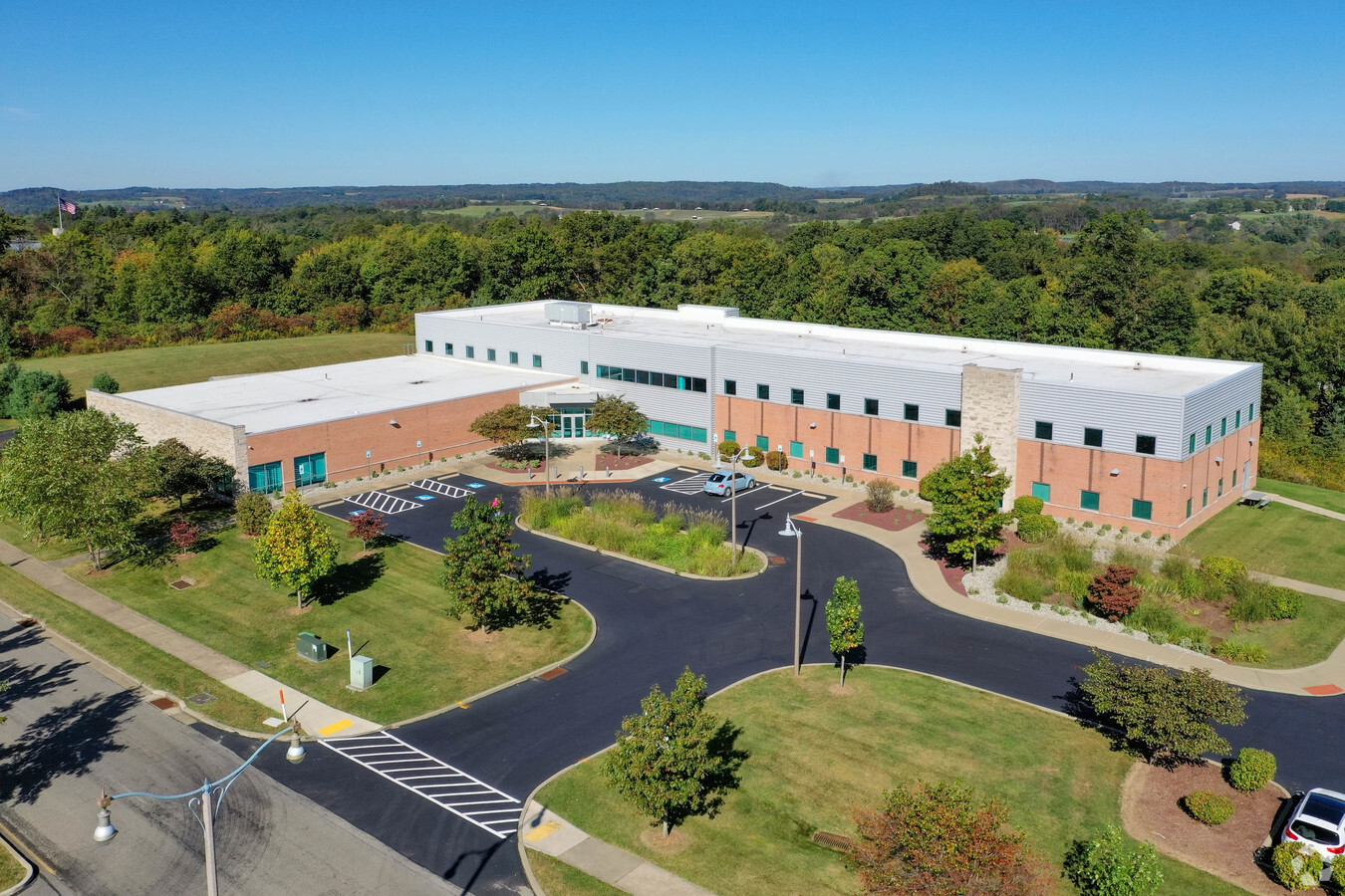
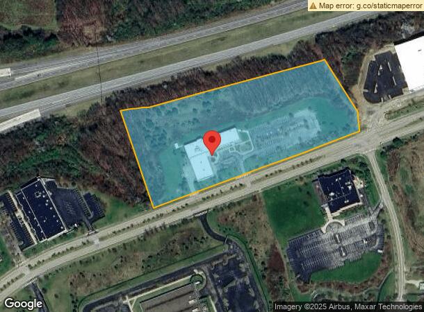
Property Detail
187 Northpointe Blvd
Pittsburgh, PA
Northpointe No 2
44-0-069026
LOT 18-19 & 21A PB6 PG178-179 / PB7 PG53 SL689
Industrialgeneral
Armstrong
X
Pennsylvania
42019C0470D
18-19
2024
8.54 AC
2024
Armstrong County
951200
Pittsburgh
34,415 SF
DEMOGRAPHICS near 187 Northpointe Blvd
1 Mile
3 Mile
5 Mile
2024 Total Population
415
2,912
6,840
2029 Population
407
2,855
6,753
Pop Growth 2024-2029
(1.93%)
(1.96%)
(1.27%)
Average Age
43
45
46
2024 Total Households
158
1,185
2,775
HH Growth 2024-2029
(1.90%)
(2.03%)
(1.37%)
Median Household Inc
$81,481
$74,861
$75,256
Avg Household Size
2.60
2.40
2.40
2024 Avg HH Vehicles
2.00
2.00
2.00
Median Home Value
$244,047
$199,853
$204,056
Median Year Built
1968
1968
1970
Nearby Places
- Restaurants
- Banks
- Shops
- Fitness
- Groceries
Nearby Properties
Address
Land Use
TOTAL SIZE
Lot Size
Zoning
Address
Land Use
TOTAL SIZE
Lot Size
Zoning
44,000 SF
37.30 AC
Address
Land Use
TOTAL SIZE
Lot Size
Zoning
23,999 SF
5.43 AC
Address
Land Use
TOTAL SIZE
Lot Size
Zoning
45,373 SF
5.36 AC
Address
Land Use
TOTAL SIZE
Lot Size
Zoning
20,000 SF
3.95 AC
Address
Land Use
TOTAL SIZE
Lot Size
Zoning
30,038 SF
5.82 AC
Address
Land Use
TOTAL SIZE
Lot Size
Zoning
34,290 SF
2.82 AC
Address
Land Use
TOTAL SIZE
Lot Size
Zoning
23,400 SF
3.85 AC
Address
Land Use
TOTAL SIZE
Lot Size
Zoning
14,960 SF
19 AC
RESIDENTIA
Address
Land Use
TOTAL SIZE
Lot Size
Zoning
16,843 SF
2.82 AC
Address
Land Use
TOTAL SIZE
Lot Size
Zoning
10,350 SF
2.22 AC
BUSINESS
Address
Land Use
TOTAL SIZE
Lot Size
Zoning
9,000 SF
2.68 AC
Address
Land Use
TOTAL SIZE
Lot Size
Zoning
12,636 SF
1 AC
BUSINESS
Address
Land Use
TOTAL SIZE
Lot Size
Zoning
28,191 SF
35 AC
RESIDENTIA
Address
Land Use
TOTAL SIZE
Lot Size
Zoning
113.66 AC
RESIDENTIA
Address
Land Use
TOTAL SIZE
Lot Size
Zoning
45,913 SF
2 AC
Address
Land Use
TOTAL SIZE
Lot Size
Zoning
6,000 SF
1.07 AC
RESIDENTIA
Address
Land Use
TOTAL SIZE
Lot Size
Zoning
4,800 SF
12.14 AC
AGRICULTUR
Address
Land Use
TOTAL SIZE
Lot Size
Zoning
10,444 SF
2.11 AC
Address
Land Use
TOTAL SIZE
Lot Size
Zoning
10,260 SF
9.17 AC
Address
Land Use
TOTAL SIZE
Lot Size
Zoning
4,302 SF
2.23 AC
AGRICULTUR
Address
Land Use
TOTAL SIZE
Lot Size
Zoning
7,252 SF
0.12 AC
Address
Land Use
TOTAL SIZE
Lot Size
Zoning
72.82 AC
Address
Land Use
TOTAL SIZE
Lot Size
Zoning
10,040 SF
1.74 AC
RESIDENTIA
Address
Land Use
TOTAL SIZE
Lot Size
Zoning
12,032 SF
1.35 AC
AGRICULTUR
Address
Land Use
TOTAL SIZE
Lot Size
Zoning
21,513 SF
6.88 AC
Address
Land Use
TOTAL SIZE
Lot Size
Zoning
250.64 AC
Address
Land Use
TOTAL SIZE
Lot Size
Zoning
145.50 AC
AGRICULTUR
Address
Land Use
TOTAL SIZE
Lot Size
Zoning
7,480 SF
13.33 AC
Address
Land Use
TOTAL SIZE
Lot Size
Zoning
4,160 SF
5 AC
The World's #1 Commercial Real Estate Marketplace
Connect with us
© 2025 CoStar Group
The information above has been obtained from sources believed reliable. While we do not doubt its accuracy we have not verified it and make no guarantee, warranty or representation about it. It is your responsibility to independently confirm its accuracy and completeness. Any projections, opinions, assumptions, or estimates used are for example only and do not represent the current or future performance of the property. The value of this transaction to you depends on tax and other factors which should be evaluated by your tax, financial, and legal advisors. You and your advisors should conduct a careful, independent investigation of the property to determine to your satisfaction the suitability of the property for your needs.