Property Record
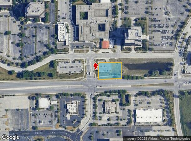
1800 E Golf Rd, Schaumburg, IL 60173


Current Lease Availabilities
NEARBY LISTINGS FOR SALE OR LEASE
Property Detail
1800 E Golf Rd
07-12-402-021-0000
Cook
Commercialnec
Illinois
X
0.75 AC
17031C0191J
Schaumburg Area
2022
Chicago
2024
Chicago-Naperville-Elgin, IL-IN-WI
804603
DEMOGRAPHICS near 1800 E Golf Rd
1 Mile
3 Mile
5 Mile
2024 Total Population
3,191
78,074
274,573
2029 Population
3,103
75,775
266,098
Pop Growth 2024-2029
(2.76%)
(2.94%)
(3.09%)
Average Age
38
41
42
2024 Total Households
1,545
31,703
107,413
HH Growth 2024-2029
(2.72%)
(3.25%)
(3.41%)
Median Household Inc
$67,604
$88,474
$93,385
Avg Household Size
2.10
2.40
2.50
2024 Avg HH Vehicles
2.00
2.00
2.00
Median Home Value
$197,441
$311,924
$331,757
Median Year Built
1974
1975
1973
Nearby Places
- Restaurants
- Banks
- Shops
- Fitness
- Groceries
PUBLIC TRANSPORTATION
COMMUTER RAIL
Arlington Heights Station (Union Pacific Northwest Line - Northeast Illinois Regional Commuter Railroad (Metra))
DRIVE
WALK
Distance
Arlington Heights Station (Union Pacific Northwest Line - Northeast Illinois Regional Commuter Railroad (Metra))
11 min
5.2 mi
Arlington Park Station (Union Pacific Northwest Line - Northeast Illinois Regional Commuter Railroad (Metra))
DRIVE
WALK
Distance
Arlington Park Station (Union Pacific Northwest Line - Northeast Illinois Regional Commuter Railroad (Metra))
10 min
6.0 mi
AIRPORT
Chicago O'Hare International
DRIVE
WALK
Distance
Chicago O'Hare International
20 min
13.0 mi
Chicago Midway International
DRIVE
WALK
Distance
Chicago Midway International
40 min
28.4 mi
Freight Ports
Port Milwaukee
DRIVE
WALK
Distance
Port Milwaukee
97 min
79.5 mi
Nearby Properties
Address
Land Use
TOTAL SIZE
Lot Size
Zoning
Address
Land Use
TOTAL SIZE
Lot Size
Zoning
42.14 AC
Address
Land Use
TOTAL SIZE
Lot Size
Zoning
800,552 SF
38.86 AC
Address
Land Use
TOTAL SIZE
Lot Size
Zoning
32.56 AC
Address
Land Use
TOTAL SIZE
Lot Size
Zoning
782,746 SF
12.44 AC
Address
Land Use
TOTAL SIZE
Lot Size
Zoning
Address
Land Use
TOTAL SIZE
Lot Size
Zoning
Address
Land Use
TOTAL SIZE
Lot Size
Zoning
Address
Land Use
TOTAL SIZE
Lot Size
Zoning
300,000 SF
9.29 AC
Address
Land Use
TOTAL SIZE
Lot Size
Zoning
875,776 SF
8.73 AC
Address
Land Use
TOTAL SIZE
Lot Size
Zoning
961,890 SF
42.21 AC
Address
Land Use
TOTAL SIZE
Lot Size
Zoning
369,303 SF
29.96 AC
Address
Land Use
TOTAL SIZE
Lot Size
Zoning
12.66 AC
Address
Land Use
TOTAL SIZE
Lot Size
Zoning
510,788 SF
39.93 AC
Address
Land Use
TOTAL SIZE
Lot Size
Zoning
748,059 SF
7.36 AC
Address
Land Use
TOTAL SIZE
Lot Size
Zoning
338,694 SF
12.18 AC
Address
Land Use
TOTAL SIZE
Lot Size
Zoning
303,671 SF
10.94 AC
Address
Land Use
TOTAL SIZE
Lot Size
Zoning
427,761 SF
30.41 AC
Address
Land Use
TOTAL SIZE
Lot Size
Zoning
13.33 AC
Address
Land Use
TOTAL SIZE
Lot Size
Zoning
388,080 SF
12.64 AC
Address
Land Use
TOTAL SIZE
Lot Size
Zoning
Address
Land Use
TOTAL SIZE
Lot Size
Zoning
24.55 AC
Address
Land Use
TOTAL SIZE
Lot Size
Zoning
229,083 SF
6.43 AC
Address
Land Use
TOTAL SIZE
Lot Size
Zoning
286,720 SF
9.77 AC
Address
Land Use
TOTAL SIZE
Lot Size
Zoning
298,493 SF
9.76 AC
Address
Land Use
TOTAL SIZE
Lot Size
Zoning
239,700 SF
Address
Land Use
TOTAL SIZE
Lot Size
Zoning
490,458 SF
13.52 AC
Address
Land Use
TOTAL SIZE
Lot Size
Zoning
544,744 SF
14.87 AC
Address
Land Use
TOTAL SIZE
Lot Size
Zoning
290,000 SF
9.08 AC
Address
Land Use
TOTAL SIZE
Lot Size
Zoning
117,825 SF
4.49 AC
Address
Land Use
TOTAL SIZE
Lot Size
Zoning
365,253 SF
31.07 AC
The World's #1 Commercial Real Estate Marketplace
Connect with us
© 2025 CoStar Group
The information above has been obtained from sources believed reliable. While we do not doubt its accuracy we have not verified it and make no guarantee, warranty or representation about it. It is your responsibility to independently confirm its accuracy and completeness. Any projections, opinions, assumptions, or estimates used are for example only and do not represent the current or future performance of the property. The value of this transaction to you depends on tax and other factors which should be evaluated by your tax, financial, and legal advisors. You and your advisors should conduct a careful, independent investigation of the property to determine to your satisfaction the suitability of the property for your needs.