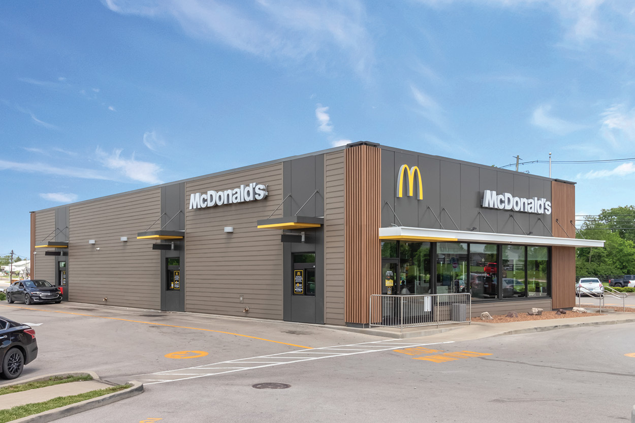
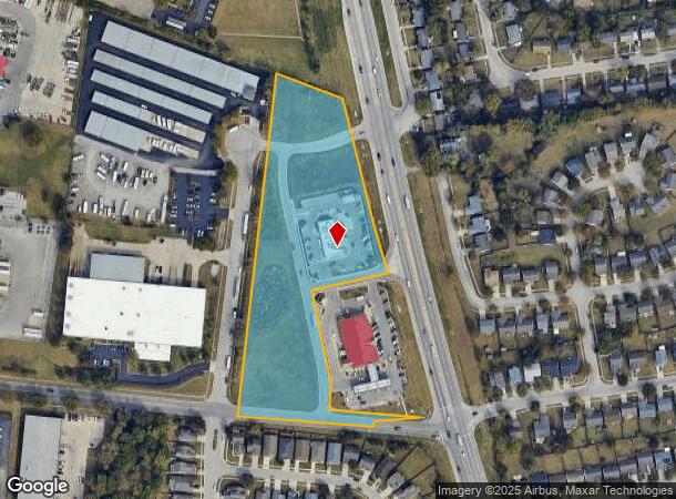
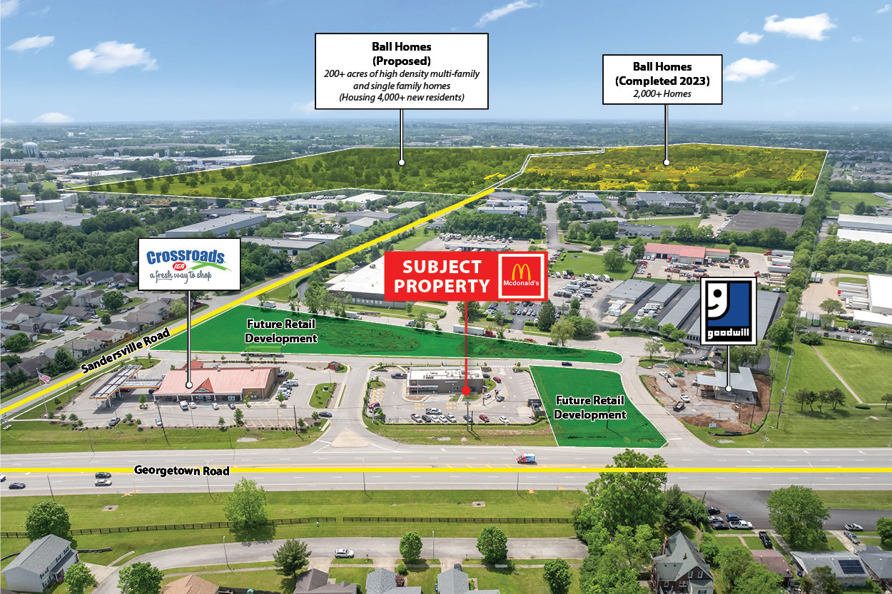
Property Record
1845 Georgetown Rd, Lexington, KY 40511
NEARBY LISTINGS FOR SALE OR LEASE
Property Detail
1845 Georgetown Rd
Lexington-Fayette, KY
Burke Hockensmith & Maggard
38281500
BOOK: 3434 PAGE: 546
Restaurantdrivein
Fayette
X
Kentucky
2100670109E
3
2024
1.24 AC
2024
West Lexington/Fayette
003704
Lexington/Fayette
DEMOGRAPHICS near 1845 Georgetown Rd
1 Mile
3 Mile
5 Mile
2024 Total Population
3,929
58,526
139,935
2029 Population
3,946
59,127
140,665
Pop Growth 2024-2029
+ 0.43%
+ 1.03%
+ 0.52%
Average Age
38
37
37
2024 Total Households
1,581
23,890
57,601
HH Growth 2024-2029
+ 0.38%
+ 1.03%
+ 0.56%
Median Household Inc
$76,356
$56,524
$50,911
Avg Household Size
2.40
2.30
2.20
2024 Avg HH Vehicles
2.00
2.00
2.00
Median Home Value
$176,257
$189,905
$204,856
Median Year Built
2001
1990
1970
Nearby Places
- Restaurants
- Banks
- Shops
- Fitness
- Groceries
PUBLIC TRANSPORTATION
AIRPORT
Blue Grass
DRIVE
WALK
Distance
Blue Grass
17 min
9.5 mi
Freight Ports
Port of Toledo
DRIVE
WALK
Distance
Port of Toledo
331 min
283.9 mi
SALE & LEASE HISTORY
LISTING DATE
SALE/LEASE

Jun 05, 2024
For Sale
Nearby Properties
Address
Land Use
TOTAL SIZE
Lot Size
Zoning
Address
Land Use
TOTAL SIZE
Lot Size
Zoning
14.90 AC
B-2B
Address
Land Use
TOTAL SIZE
Lot Size
Zoning
Address
Land Use
TOTAL SIZE
Lot Size
Zoning
87 SF
R-4
Address
Land Use
TOTAL SIZE
Lot Size
Zoning
Address
Land Use
TOTAL SIZE
Lot Size
Zoning
6,173 SF
301.57 AC
A-R
Address
Land Use
TOTAL SIZE
Lot Size
Zoning
1,344 SF
150.76 AC
A-U
Address
Land Use
TOTAL SIZE
Lot Size
Zoning
1.25 AC
B-2B
Address
Land Use
TOTAL SIZE
Lot Size
Zoning
163,536 SF
117.26 AC
I-1
Address
Land Use
TOTAL SIZE
Lot Size
Zoning
292,191 SF
19.74 AC
B-5P
Address
Land Use
TOTAL SIZE
Lot Size
Zoning
29,480 SF
4.60 AC
MU-3
Address
Land Use
TOTAL SIZE
Lot Size
Zoning
61,965 SF
46.96 AC
A-U
Address
Land Use
TOTAL SIZE
Lot Size
Zoning
6,462 SF
332.36 AC
I-1
Address
Land Use
TOTAL SIZE
Lot Size
Zoning
278,944 SF
0.75 AC
B-2B
Address
Land Use
TOTAL SIZE
Lot Size
Zoning
340,698 SF
B-2B
Address
Land Use
TOTAL SIZE
Lot Size
Zoning
Address
Land Use
TOTAL SIZE
Lot Size
Zoning
0.42 AC
B-2B
Address
Land Use
TOTAL SIZE
Lot Size
Zoning
70.44 AC
I-1
Address
Land Use
TOTAL SIZE
Lot Size
Zoning
357,373 SF
2.43 AC
B-2B
Address
Land Use
TOTAL SIZE
Lot Size
Zoning
374,910 SF
0.78 AC
B-2B
Address
Land Use
TOTAL SIZE
Lot Size
Zoning
210 SF
46.68 AC
M-1P
Address
Land Use
TOTAL SIZE
Lot Size
Zoning
107,473 SF
17 AC
A-U
Address
Land Use
TOTAL SIZE
Lot Size
Zoning
16.93 AC
R-3
Address
Land Use
TOTAL SIZE
Lot Size
Zoning
133,750 SF
1.13 AC
B-2B
Address
Land Use
TOTAL SIZE
Lot Size
Zoning
441,100 SF
30 AC
I-1
Address
Land Use
TOTAL SIZE
Lot Size
Zoning
94,835 SF
21.09 AC
A-U
Address
Land Use
TOTAL SIZE
Lot Size
Zoning
Address
Land Use
TOTAL SIZE
Lot Size
Zoning
54,525 SF
25.78 AC
P-2
Address
Land Use
TOTAL SIZE
Lot Size
Zoning
255,490 SF
55.45 AC
I-1
Address
Land Use
TOTAL SIZE
Lot Size
Zoning
164,858 SF
0.18 AC
B-2B
Address
Land Use
TOTAL SIZE
Lot Size
Zoning
407,736 SF
29.54 AC
P-1
The World's #1 Commercial Real Estate Marketplace
Connect with us
© 2025 CoStar Group
The information above has been obtained from sources believed reliable. While we do not doubt its accuracy we have not verified it and make no guarantee, warranty or representation about it. It is your responsibility to independently confirm its accuracy and completeness. Any projections, opinions, assumptions, or estimates used are for example only and do not represent the current or future performance of the property. The value of this transaction to you depends on tax and other factors which should be evaluated by your tax, financial, and legal advisors. You and your advisors should conduct a careful, independent investigation of the property to determine to your satisfaction the suitability of the property for your needs.