Property Record
1885 Swarthmore Ave, Lakewood, NJ 08701


NEARBY LISTINGS FOR SALE OR LEASE
Property Detail
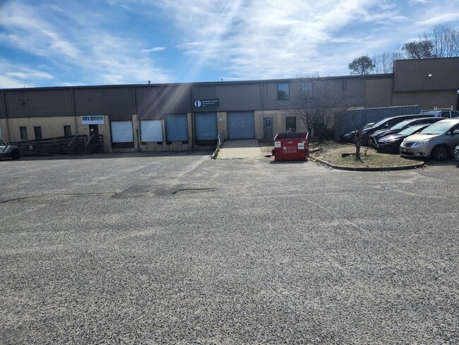
1885 Swarthmore Ave
New York-Jersey City-White Plains, NY-NJ
Lakewood Indust Campus
15-01609-0000-00012
3.006AC DISPERSION STICKEL CO.
Industrialgeneral
Ocean
X
New Jersey
34025C0435F
12
2024
3.01 AC
2025
Ocean County
715001
Northern New Jersey
24,000 SF
DEMOGRAPHICS near 1885 Swarthmore Ave
1 Mile
3 Mile
5 Mile
2024 Total Population
5,175
107,177
227,123
2029 Population
5,367
110,990
236,456
Pop Growth 2024-2029
+ 3.71%
+ 3.56%
+ 4.11%
Average Age
24
30
34
2024 Total Households
1,192
29,188
68,493
HH Growth 2024-2029
+ 3.02%
+ 2.91%
+ 3.67%
Median Household Inc
$65,785
$60,757
$70,638
Avg Household Size
4.00
3.30
3.00
2024 Avg HH Vehicles
1.00
2.00
2.00
Median Home Value
$392,335
$331,857
$348,605
Median Year Built
1983
1984
1981
Nearby Places
Map Layers
Map Styles
 Street
 Aerial
- Restaurants
- Banks
- Shops
- Fitness
- Groceries
PUBLIC TRANSPORTATION
COMMUTER RAIL
Bay Head (North Jersey Coast Line - NJ Transit Commuter Rail (NJ Transit))
DRIVE
WALK
Distance
Bay Head (North Jersey Coast Line - NJ Transit Commuter Rail (NJ Transit))
18 min
8.6 mi
Point Pleasant Beach (North Jersey Coast Line - NJ Transit Commuter Rail (NJ Transit))
DRIVE
WALK
Distance
Point Pleasant Beach (North Jersey Coast Line - NJ Transit Commuter Rail (NJ Transit))
17 min
9.1 mi
Freight Ports
New York Container Terminal
DRIVE
WALK
Distance
New York Container Terminal
68 min
48.0 mi
SALE & LEASE HISTORY
LISTING DATE
SALE/LEASE

May 20, 2024
For Sale
Mar 26, 2024
For Sale
Feb 24, 2025
For Sale
Nearby Properties
Address
Land Use
TOTAL SIZE
Lot Size
Zoning
Address
Land Use
TOTAL SIZE
Lot Size
Zoning
12.43 AC
HD7
Address
Land Use
TOTAL SIZE
Lot Size
Zoning
45.53 AC
B3
Address
Land Use
TOTAL SIZE
Lot Size
Zoning
22.88 AC
HS
Address
Land Use
TOTAL SIZE
Lot Size
Zoning
338.52 AC
OSP
Address
Land Use
TOTAL SIZE
Lot Size
Zoning
105.04 AC
SED
Address
Land Use
TOTAL SIZE
Lot Size
Zoning
2,382 SF
341 AC
OSP
Address
Land Use
TOTAL SIZE
Lot Size
Zoning
56.58 AC
DA-1
Address
Land Use
TOTAL SIZE
Lot Size
Zoning
29.34 AC
B4
Address
Land Use
TOTAL SIZE
Lot Size
Zoning
23,843 SF
37.83 AC
B5
Address
Land Use
TOTAL SIZE
Lot Size
Zoning
272,500 SF
17.88 AC
M1
Address
Land Use
TOTAL SIZE
Lot Size
Zoning
25.22 AC
B3
Address
Land Use
TOTAL SIZE
Lot Size
Zoning
36.25 AC
R12
Address
Land Use
TOTAL SIZE
Lot Size
Zoning
23,391 SF
19.32 AC
RM
Address
Land Use
TOTAL SIZE
Lot Size
Zoning
49.57 AC
RR1
Address
Land Use
TOTAL SIZE
Lot Size
Zoning
1.80 AC
B5
Address
Land Use
TOTAL SIZE
Lot Size
Zoning
22.34 AC
ABC
Address
Land Use
TOTAL SIZE
Lot Size
Zoning
50,125 SF
19.18 AC
M1
Address
Land Use
TOTAL SIZE
Lot Size
Zoning
12,269 SF
14.92 AC
R40C
Address
Land Use
TOTAL SIZE
Lot Size
Zoning
26.37 AC
R75
Address
Land Use
TOTAL SIZE
Lot Size
Zoning
5,826 SF
15.35 AC
RM
Address
Land Use
TOTAL SIZE
Lot Size
Zoning
30 AC
RR1
Address
Land Use
TOTAL SIZE
Lot Size
Zoning
39.84 AC
OPT
Address
Land Use
TOTAL SIZE
Lot Size
Zoning
94,380 SF
8.71 AC
B4
Address
Land Use
TOTAL SIZE
Lot Size
Zoning
39,777 SF
3.50 AC
M1
Address
Land Use
TOTAL SIZE
Lot Size
Zoning
26.43 AC
B3
Address
Land Use
TOTAL SIZE
Lot Size
Zoning
39.28 AC
R12
Address
Land Use
TOTAL SIZE
Lot Size
Zoning
162,000 SF
34.35 AC
ARE2
Address
Land Use
TOTAL SIZE
Lot Size
Zoning
5,290 SF
12.95 AC
LP
Address
Land Use
TOTAL SIZE
Lot Size
Zoning
17.08 AC
R15
Address
Land Use
TOTAL SIZE
Lot Size
Zoning
38,920 SF
9.70 AC
M1
The World's #1 Commercial Real Estate Marketplace
Connect with us
© 2026 CoStar Group
The information above has been obtained from sources believed reliable. While we do not doubt its accuracy we have not verified it and make no guarantee, warranty or representation about it. It is your responsibility to independently confirm its accuracy and completeness. Any projections, opinions, assumptions, or estimates used are for example only and do not represent the current or future performance of the property. The value of this transaction to you depends on tax and other factors which should be evaluated by your tax, financial, and legal advisors. You and your advisors should conduct a careful, independent investigation of the property to determine to your satisfaction the suitability of the property for your needs.