Property Record
1900 Veterans Memorial Blvd Nw, Andover, MN 55304
NEARBY LISTINGS FOR SALE OR LEASE
-
-
View all Andover listings for sale on LoopNet.com
Property Detail
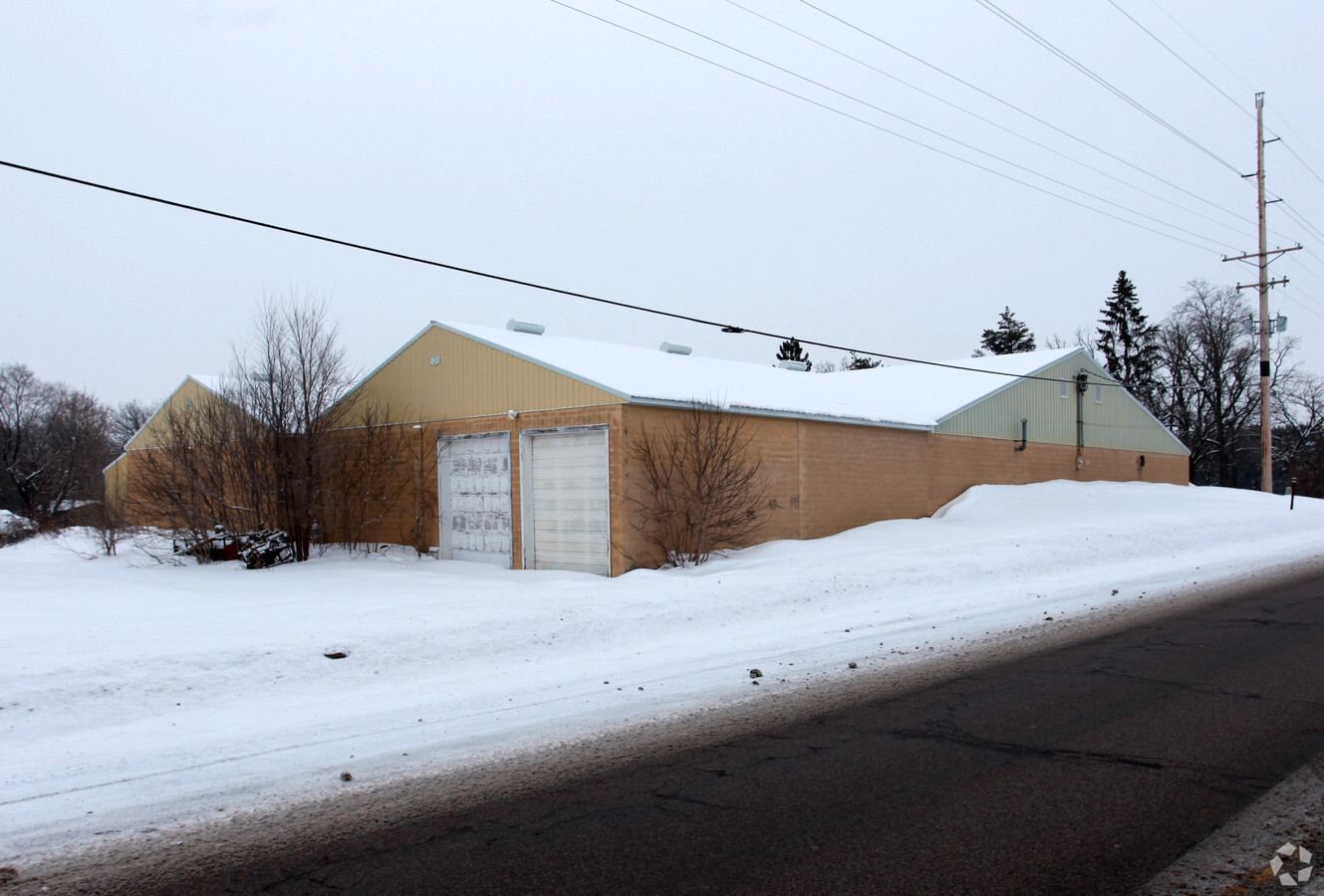
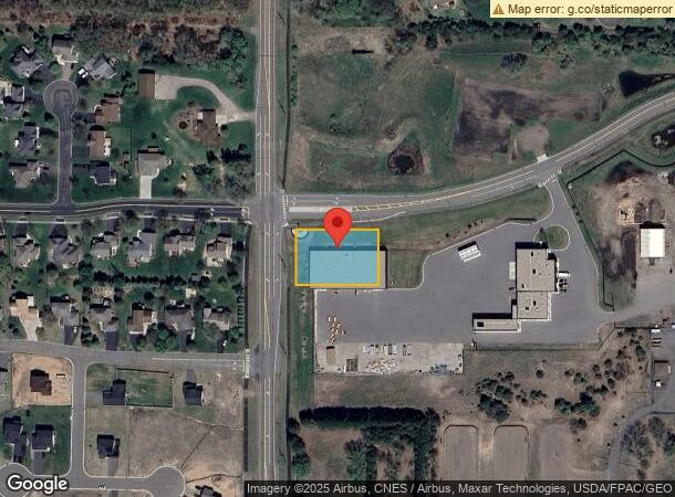
1900 Veterans Memorial Blvd Nw
22-32-24-42-0001
THAT PRT OF NW1/4 OF SE1/4 SEC 22 TWP 32 RGE 24 DESC AS FOL: BEG AT PT ON W LINE OF SD 1/4 1/4, 835 FT N OF SW COR THEREOF; T
Taxexempt
Anoka
X
Minnesota
27053C0100F
0.78 AC
0
North Central
2024
Minneapolis/St Paul
050238
Minneapolis-St. Paul-Bloomington, MN-WI
18,240 SF
DEMOGRAPHICS near 1900 Veterans Memorial Blvd Nw
1 Mile
3 Mile
5 Mile
2024 Total Population
5,924
33,716
99,531
2029 Population
6,161
34,946
103,071
Pop Growth 2024-2029
+ 4.00%
+ 3.65%
+ 3.56%
Average Age
39
40
40
2024 Total Households
1,922
11,238
35,769
HH Growth 2024-2029
+ 4.06%
+ 3.67%
+ 3.56%
Median Household Inc
$154,112
$122,787
$99,311
Avg Household Size
3.00
2.90
2.70
2024 Avg HH Vehicles
2.00
2.00
2.00
Median Home Value
$386,318
$357,137
$314,801
Median Year Built
2001
1993
1988
Nearby Places
- Restaurants
- Banks
- Shops
- Fitness
- Groceries
PUBLIC TRANSPORTATION
COMMUTER RAIL
Coon Rapids-Riverdale Station (Northstar Corridor - Northstar Commuter Rail)
DRIVE
WALK
Distance
Coon Rapids-Riverdale Station (Northstar Corridor - Northstar Commuter Rail)
11 min
5.2 mi
Anoka Station (Northstar Corridor - Northstar Commuter Rail)
DRIVE
WALK
Distance
Anoka Station (Northstar Corridor - Northstar Commuter Rail)
12 min
5.8 mi
AIRPORT
Minneapolis-St Paul International/Wold-Chamberlain
DRIVE
WALK
Distance
Minneapolis-St Paul International/Wold-Chamberlain
50 min
33.7 mi
Freight Ports
Port Milwaukee
DRIVE
WALK
Distance
Port Milwaukee
395 min
355.9 mi
Nearby Properties
Address
Land Use
TOTAL SIZE
Lot Size
Zoning
Address
Land Use
TOTAL SIZE
Lot Size
Zoning
225,748 SF
Address
Land Use
TOTAL SIZE
Lot Size
Zoning
447,671 SF
78.33 AC
Address
Land Use
TOTAL SIZE
Lot Size
Zoning
168,887 SF
7.01 AC
Address
Land Use
TOTAL SIZE
Lot Size
Zoning
133,906 SF
34.37 AC
Address
Land Use
TOTAL SIZE
Lot Size
Zoning
164,472 SF
10.95 AC
Address
Land Use
TOTAL SIZE
Lot Size
Zoning
7,888 SF
40 AC
Address
Land Use
TOTAL SIZE
Lot Size
Zoning
84,924 SF
12.49 AC
Address
Land Use
TOTAL SIZE
Lot Size
Zoning
172,335 SF
13.41 AC
Address
Land Use
TOTAL SIZE
Lot Size
Zoning
124,951 SF
12.67 AC
Address
Land Use
TOTAL SIZE
Lot Size
Zoning
152,040 SF
20.71 AC
Address
Land Use
TOTAL SIZE
Lot Size
Zoning
129,726 SF
40 AC
Address
Land Use
TOTAL SIZE
Lot Size
Zoning
73,862 SF
2.86 AC
Address
Land Use
TOTAL SIZE
Lot Size
Zoning
109,305 SF
9.15 AC
Address
Land Use
TOTAL SIZE
Lot Size
Zoning
49,646 SF
9.40 AC
Address
Land Use
TOTAL SIZE
Lot Size
Zoning
Address
Land Use
TOTAL SIZE
Lot Size
Zoning
76,013 SF
19.28 AC
Address
Land Use
TOTAL SIZE
Lot Size
Zoning
51,200 SF
6.85 AC
Address
Land Use
TOTAL SIZE
Lot Size
Zoning
82,494 SF
6.81 AC
Address
Land Use
TOTAL SIZE
Lot Size
Zoning
29,785 SF
4.45 AC
Address
Land Use
TOTAL SIZE
Lot Size
Zoning
1,056 SF
13.91 AC
Address
Land Use
TOTAL SIZE
Lot Size
Zoning
4,686 SF
40 AC
Address
Land Use
TOTAL SIZE
Lot Size
Zoning
38,177 SF
4.90 AC
Address
Land Use
TOTAL SIZE
Lot Size
Zoning
39,090 SF
1.59 AC
Address
Land Use
TOTAL SIZE
Lot Size
Zoning
20,430 SF
2.28 AC
Address
Land Use
TOTAL SIZE
Lot Size
Zoning
1,100 SF
41.96 AC
Address
Land Use
TOTAL SIZE
Lot Size
Zoning
25,851 SF
3.42 AC
Address
Land Use
TOTAL SIZE
Lot Size
Zoning
40,074 SF
24.27 AC
Address
Land Use
TOTAL SIZE
Lot Size
Zoning
2,760 SF
42.37 AC
Address
Land Use
TOTAL SIZE
Lot Size
Zoning
24,557 SF
2.12 AC
The World's #1 Commercial Real Estate Marketplace
Connect with us
© 2025 CoStar Group
The information above has been obtained from sources believed reliable. While we do not doubt its accuracy we have not verified it and make no guarantee, warranty or representation about it. It is your responsibility to independently confirm its accuracy and completeness. Any projections, opinions, assumptions, or estimates used are for example only and do not represent the current or future performance of the property. The value of this transaction to you depends on tax and other factors which should be evaluated by your tax, financial, and legal advisors. You and your advisors should conduct a careful, independent investigation of the property to determine to your satisfaction the suitability of the property for your needs.