Property Record
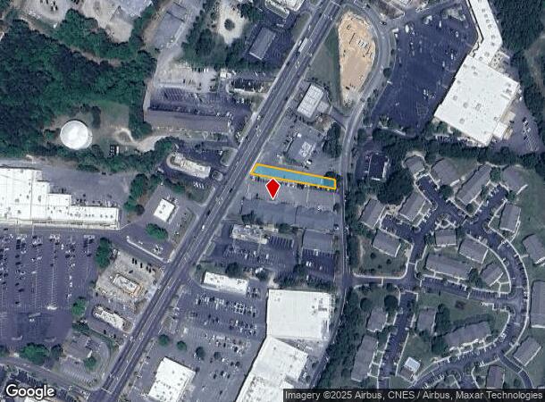
1902 N Sandhills Blvd, Aberdeen, NC 28315
NEARBY LISTINGS FOR SALE OR LEASE
Property Detail
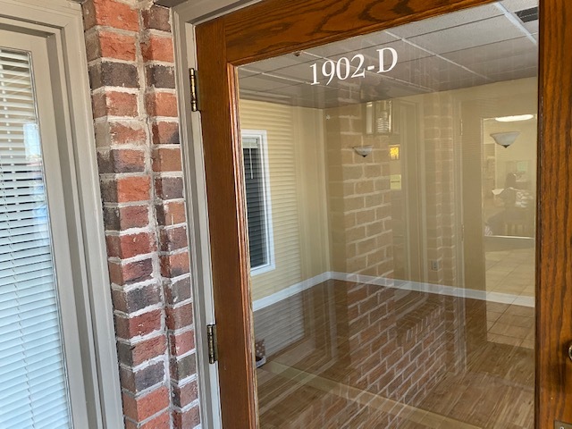
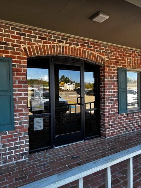
1902 N Sandhills Blvd
8571-19-62-4039
Sandhills
Medicalbuilding
QUALITY OIL LAND
X
Moore
3710857100J
North Carolina
2024
0.84 AC
2024
North Carolina Southeast Area
950900
Other Market Areas
36,452 SF
Pinehurst-Southern Pines, NC
DEMOGRAPHICS near 1902 N Sandhills Blvd
1 Mile
3 Mile
5 Mile
2024 Total Population
4,691
27,162
49,905
2029 Population
5,393
31,434
57,741
Pop Growth 2024-2029
+ 14.96%
+ 15.73%
+ 15.70%
Average Age
39
42
44
2024 Total Households
2,178
12,293
22,340
HH Growth 2024-2029
+ 15.20%
+ 15.98%
+ 15.98%
Median Household Inc
$50,645
$66,506
$71,071
Avg Household Size
2.10
2.10
2.20
2024 Avg HH Vehicles
2.00
2.00
2.00
Median Home Value
$295,516
$348,113
$343,131
Median Year Built
1995
1993
1994
Nearby Places
- Restaurants
- Banks
- Shops
- Fitness
- Groceries
PUBLIC TRANSPORTATION
COMMUTER RAIL
Southern Pines Amtrak Station (Silver Star - Amtrak)
DRIVE
WALK
Distance
Southern Pines Amtrak Station (Silver Star - Amtrak)
4 min
2.1 mi
Freight Ports
Port of Wilmington
DRIVE
WALK
Distance
Port of Wilmington
166 min
132.8 mi
SALE & LEASE HISTORY
LISTING DATE
SALE/LEASE

Jun 02, 2022
For Lease
Feb 28, 2020
For Lease
Nearby Properties
Address
Land Use
TOTAL SIZE
Lot Size
Zoning
Address
Land Use
TOTAL SIZE
Lot Size
Zoning
2,264 SF
36 AC
PPC
Address
Land Use
TOTAL SIZE
Lot Size
Zoning
20,091 SF
12 AC
PPC
Address
Land Use
TOTAL SIZE
Lot Size
Zoning
18.49 AC
Address
Land Use
TOTAL SIZE
Lot Size
Zoning
7,024 SF
9.05 AC
Address
Land Use
TOTAL SIZE
Lot Size
Zoning
Address
Land Use
TOTAL SIZE
Lot Size
Zoning
21,138 SF
473.33 AC
RD
Address
Land Use
TOTAL SIZE
Lot Size
Zoning
22,772 SF
12.46 AC
HC
Address
Land Use
TOTAL SIZE
Lot Size
Zoning
51,552 SF
33.02 AC
GBCD
Address
Land Use
TOTAL SIZE
Lot Size
Zoning
4,184 SF
13.85 AC
R6
Address
Land Use
TOTAL SIZE
Lot Size
Zoning
83,896 SF
66.98 AC
R20
Address
Land Use
TOTAL SIZE
Lot Size
Zoning
44.59 AC
MULTI
Address
Land Use
TOTAL SIZE
Lot Size
Zoning
4,992 SF
14.75 AC
PD
Address
Land Use
TOTAL SIZE
Lot Size
Zoning
12.78 AC
Address
Land Use
TOTAL SIZE
Lot Size
Zoning
39,490 SF
5.16 AC
GBCD
Address
Land Use
TOTAL SIZE
Lot Size
Zoning
4,710 SF
6.95 AC
R6
Address
Land Use
TOTAL SIZE
Lot Size
Zoning
199,100 SF
24.89 AC
HC
Address
Land Use
TOTAL SIZE
Lot Size
Zoning
8.15 AC
GC
Address
Land Use
TOTAL SIZE
Lot Size
Zoning
11.16 AC
Address
Land Use
TOTAL SIZE
Lot Size
Zoning
33,296 SF
11.23 AC
HC
Address
Land Use
TOTAL SIZE
Lot Size
Zoning
24,802 SF
3.92 AC
OS
Address
Land Use
TOTAL SIZE
Lot Size
Zoning
2,450 SF
2.96 AC
Address
Land Use
TOTAL SIZE
Lot Size
Zoning
57,109 SF
4.08 AC
GBSD
Address
Land Use
TOTAL SIZE
Lot Size
Zoning
Address
Land Use
TOTAL SIZE
Lot Size
Zoning
9,690 SF
19.96 AC
HC
Address
Land Use
TOTAL SIZE
Lot Size
Zoning
47,273 SF
11.25 AC
NC
Address
Land Use
TOTAL SIZE
Lot Size
Zoning
37,261 SF
7 AC
OI
Address
Land Use
TOTAL SIZE
Lot Size
Zoning
23,472 SF
3.49 AC
GC
Address
Land Use
TOTAL SIZE
Lot Size
Zoning
Address
Land Use
TOTAL SIZE
Lot Size
Zoning
1,034 SF
12.10 AC
RM1
Address
Land Use
TOTAL SIZE
Lot Size
Zoning
5,090 SF
99.55 AC
RD
The World's #1 Commercial Real Estate Marketplace
Connect with us
© 2025 CoStar Group
The information above has been obtained from sources believed reliable. While we do not doubt its accuracy we have not verified it and make no guarantee, warranty or representation about it. It is your responsibility to independently confirm its accuracy and completeness. Any projections, opinions, assumptions, or estimates used are for example only and do not represent the current or future performance of the property. The value of this transaction to you depends on tax and other factors which should be evaluated by your tax, financial, and legal advisors. You and your advisors should conduct a careful, independent investigation of the property to determine to your satisfaction the suitability of the property for your needs.