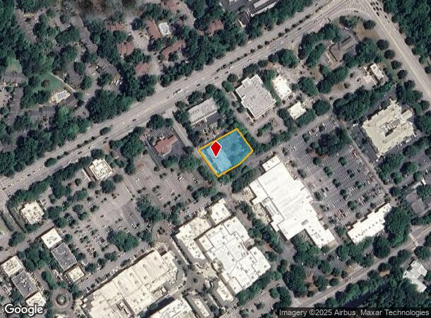
Property Record
1903 N Highway 17, Mount Pleasant, SC 29464
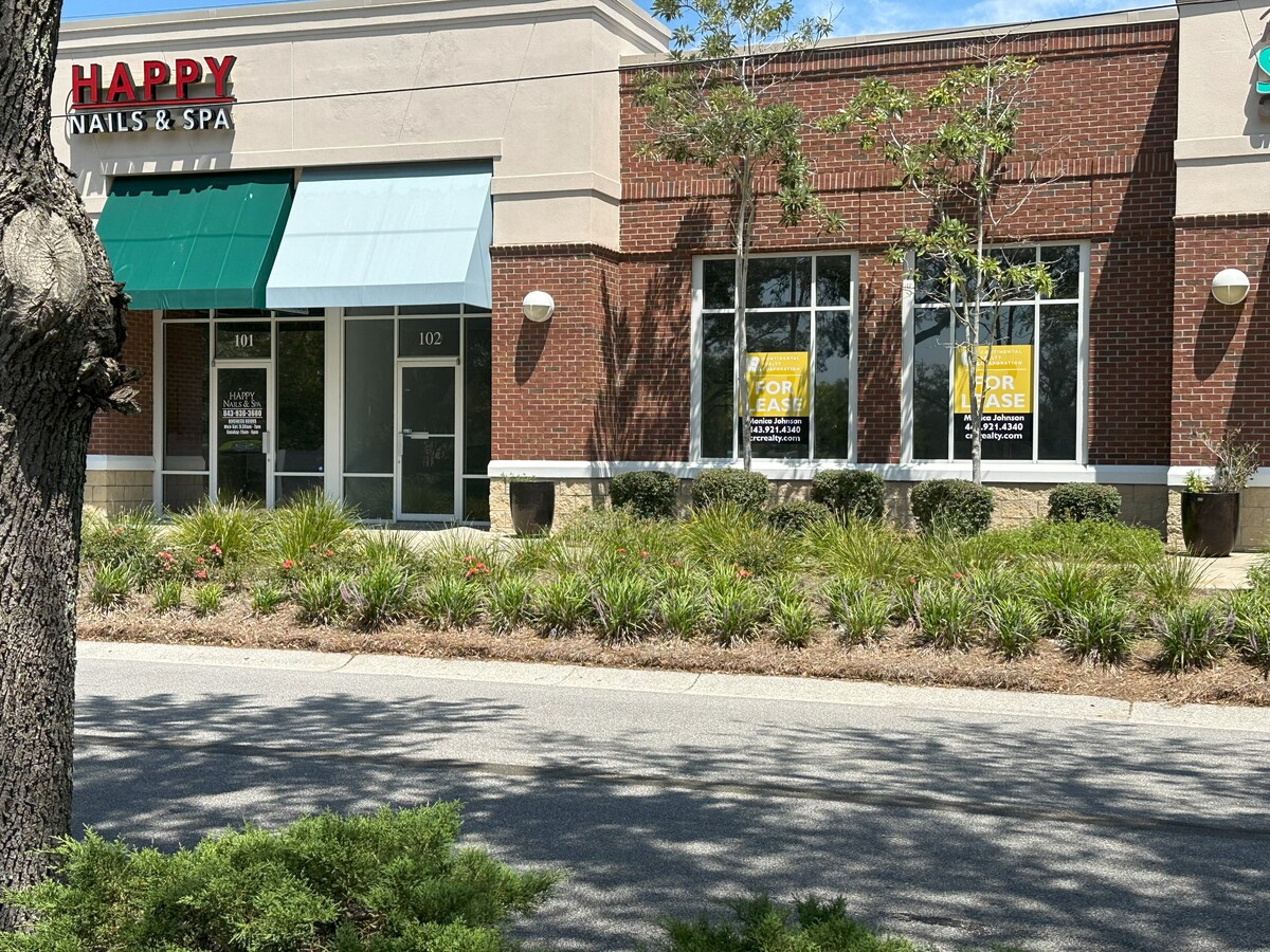
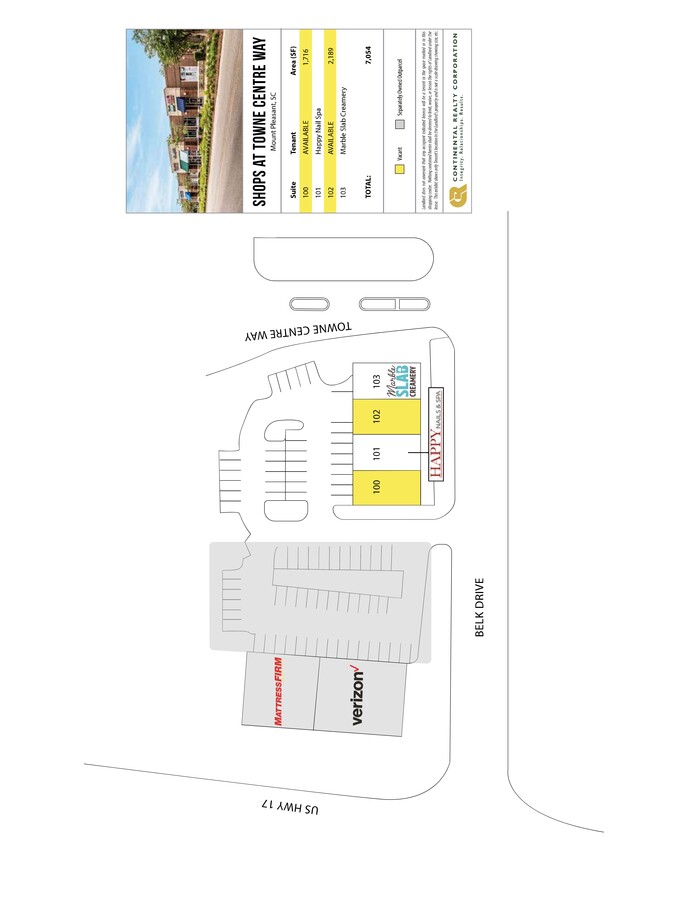
Current Lease Availabilities
NEARBY LISTINGS FOR SALE OR LEASE
Property Detail
1903 N Highway 17
Charleston-North Charleston, SC
Part Snee Farm
558-00-00-348
LEGAL DESCRIPTION SUBDIVISION NAME -PART SNEE FARM DESCRIPTION -LOT L-2 PART PARCEL B-1 SITE NAME -03-CHURCH PARSONAGE CEMETA
Commercialnec
Charleston
X
South Carolina
45019C0529K
l-2
2024
0.75 AC
2023
East Islands/Mt Pleasant
004619
Charleston/N Charleston
6,974 SF
DEMOGRAPHICS near 1903 N Highway 17
1 Mile
3 Mile
5 Mile
2024 Total Population
8,160
42,553
89,639
2029 Population
8,594
45,245
96,417
Pop Growth 2024-2029
+ 5.32%
+ 6.33%
+ 7.56%
Average Age
42
42
42
2024 Total Households
3,755
17,917
37,523
HH Growth 2024-2029
+ 5.01%
+ 6.27%
+ 7.53%
Median Household Inc
$91,288
$96,629
$101,566
Avg Household Size
2.10
2.30
2.30
2024 Avg HH Vehicles
2.00
2.00
2.00
Median Home Value
$468,707
$499,467
$579,369
Median Year Built
1989
1993
1996
Nearby Places
- Restaurants
- Banks
- Shops
- Fitness
- Groceries
PUBLIC TRANSPORTATION
AIRPORT
Charleston AFB/International
DRIVE
WALK
Distance
Charleston AFB/International
29 min
19.6 mi
Freight Ports
Wando Welch Terminal
DRIVE
WALK
Distance
Wando Welch Terminal
8 min
4.3 mi
Nearby Properties
Address
Land Use
TOTAL SIZE
Lot Size
Zoning
Address
Land Use
TOTAL SIZE
Lot Size
Zoning
18,316 SF
14.16 AC
Address
Land Use
TOTAL SIZE
Lot Size
Zoning
15,957 SF
3.80 AC
Address
Land Use
TOTAL SIZE
Lot Size
Zoning
6,572 SF
23.28 AC
Address
Land Use
TOTAL SIZE
Lot Size
Zoning
Address
Land Use
TOTAL SIZE
Lot Size
Zoning
37,472 SF
9.04 AC
Address
Land Use
TOTAL SIZE
Lot Size
Zoning
9,993 SF
0.15 AC
LAR3
Address
Land Use
TOTAL SIZE
Lot Size
Zoning
1,064 SF
20.39 AC
Address
Land Use
TOTAL SIZE
Lot Size
Zoning
70,052 SF
14.67 AC
Address
Land Use
TOTAL SIZE
Lot Size
Zoning
11.29 AC
Address
Land Use
TOTAL SIZE
Lot Size
Zoning
9,148 SF
2.01 AC
Address
Land Use
TOTAL SIZE
Lot Size
Zoning
24,836 SF
10.63 AC
Address
Land Use
TOTAL SIZE
Lot Size
Zoning
10,165 SF
1.38 AC
Address
Land Use
TOTAL SIZE
Lot Size
Zoning
Address
Land Use
TOTAL SIZE
Lot Size
Zoning
Address
Land Use
TOTAL SIZE
Lot Size
Zoning
1,898 SF
11.80 AC
Address
Land Use
TOTAL SIZE
Lot Size
Zoning
648 SF
19.68 AC
Address
Land Use
TOTAL SIZE
Lot Size
Zoning
4,351 SF
29.03 AC
Address
Land Use
TOTAL SIZE
Lot Size
Zoning
63,836 SF
2.76 AC
Address
Land Use
TOTAL SIZE
Lot Size
Zoning
Address
Land Use
TOTAL SIZE
Lot Size
Zoning
10.05 AC
Address
Land Use
TOTAL SIZE
Lot Size
Zoning
8,388 SF
2.01 AC
Address
Land Use
TOTAL SIZE
Lot Size
Zoning
Address
Land Use
TOTAL SIZE
Lot Size
Zoning
6.54 AC
Address
Land Use
TOTAL SIZE
Lot Size
Zoning
92,236 SF
14.46 AC
Address
Land Use
TOTAL SIZE
Lot Size
Zoning
Address
Land Use
TOTAL SIZE
Lot Size
Zoning
80,395 SF
15.24 AC
Address
Land Use
TOTAL SIZE
Lot Size
Zoning
179,279 SF
6.85 AC
Address
Land Use
TOTAL SIZE
Lot Size
Zoning
Address
Land Use
TOTAL SIZE
Lot Size
Zoning
87,543 SF
8.60 AC
Address
Land Use
TOTAL SIZE
Lot Size
Zoning
The World's #1 Commercial Real Estate Marketplace
Connect with us
© 2025 CoStar Group
The information above has been obtained from sources believed reliable. While we do not doubt its accuracy we have not verified it and make no guarantee, warranty or representation about it. It is your responsibility to independently confirm its accuracy and completeness. Any projections, opinions, assumptions, or estimates used are for example only and do not represent the current or future performance of the property. The value of this transaction to you depends on tax and other factors which should be evaluated by your tax, financial, and legal advisors. You and your advisors should conduct a careful, independent investigation of the property to determine to your satisfaction the suitability of the property for your needs.