Property Record
84 San Filippo Dr Se, Palm Bay, FL 32909

NEARBY LISTINGS FOR SALE OR LEASE
Property Detail
84 San Filippo Dr Se
Palm Bay-Melbourne-Titusville, FL
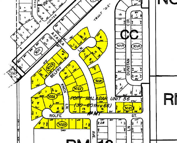
Port Malabar Unit Fifty Six
29-37-04-00-00510.0-0000.00
PART OF W 1/2 OF SW 1/4 AS DESC IN ORB 5862 PG 4436 & ORB 7552 PG 1199
Multifamilyacreage
Brevard
A
Florida
12009C0660G
18.94 AC
2024
Brevard County
2025
Orlando
071339
DEMOGRAPHICS near 84 San Filippo Dr Se
1 Mile
3 Mile
5 Mile
2024 Total Population
5,790
55,797
137,688
2029 Population
6,460
61,352
151,665
Pop Growth 2024-2029
+ 11.57%
+ 9.96%
+ 10.15%
Average Age
40
42
42
2024 Total Households
2,116
21,373
54,143
HH Growth 2024-2029
+ 11.39%
+ 9.75%
+ 9.94%
Median Household Inc
$44,631
$55,238
$57,277
Avg Household Size
2.60
2.50
2.50
2024 Avg HH Vehicles
2.00
2.00
2.00
Median Home Value
$210,852
$219,169
$221,652
Median Year Built
1995
1990
1992
Nearby Places
Map Layers
Map Styles
 Street
 Aerial
- Restaurants
- Banks
- Shops
- Fitness
- Groceries
PUBLIC TRANSPORTATION
AIRPORT
Melbourne Orlando International
DRIVE
WALK
Distance
Melbourne Orlando International
21 min
9.8 mi
Freight Ports
Port Canaveral
DRIVE
WALK
Distance
Port Canaveral
53 min
42.9 mi
Nearby Properties
Address
Land Use
TOTAL SIZE
Lot Size
Zoning
Address
Land Use
TOTAL SIZE
Lot Size
Zoning
282,680 SF
16 AC
IU
Address
Land Use
TOTAL SIZE
Lot Size
Zoning
294,170 SF
70.66 AC
IU
Address
Land Use
TOTAL SIZE
Lot Size
Zoning
307,849 SF
39.14 AC
IU
Address
Land Use
TOTAL SIZE
Lot Size
Zoning
257,044 SF
14.99 AC
Address
Land Use
TOTAL SIZE
Lot Size
Zoning
276,936 SF
18.44 AC
RM20
Address
Land Use
TOTAL SIZE
Lot Size
Zoning
260,331 SF
9.90 AC
RM10
Address
Land Use
TOTAL SIZE
Lot Size
Zoning
267,548 SF
23.10 AC
RM10
Address
Land Use
TOTAL SIZE
Lot Size
Zoning
97,093 SF
20.87 AC
Address
Land Use
TOTAL SIZE
Lot Size
Zoning
290,105 SF
30.94 AC
CC
Address
Land Use
TOTAL SIZE
Lot Size
Zoning
121,353 SF
24.37 AC
RS2
Address
Land Use
TOTAL SIZE
Lot Size
Zoning
143,529 SF
7.76 AC
RM20
Address
Land Use
TOTAL SIZE
Lot Size
Zoning
216,692 SF
28.97 AC
CC
Address
Land Use
TOTAL SIZE
Lot Size
Zoning
117,568 SF
28.97 AC
IU
Address
Land Use
TOTAL SIZE
Lot Size
Zoning
195,032 SF
13.26 AC
RM15
Address
Land Use
TOTAL SIZE
Lot Size
Zoning
118,747 SF
11.43 AC
RM10
Address
Land Use
TOTAL SIZE
Lot Size
Zoning
104,620 SF
12.82 AC
IU
Address
Land Use
TOTAL SIZE
Lot Size
Zoning
106,915 SF
11.01 AC
IU
Address
Land Use
TOTAL SIZE
Lot Size
Zoning
105,976 SF
18.95 AC
IU
Address
Land Use
TOTAL SIZE
Lot Size
Zoning
86,968 SF
9.86 AC
IU
Address
Land Use
TOTAL SIZE
Lot Size
Zoning
103,507 SF
24.90 AC
IU
Address
Land Use
TOTAL SIZE
Lot Size
Zoning
69,508 SF
12.66 AC
PUD
Address
Land Use
TOTAL SIZE
Lot Size
Zoning
135,860 SF
15.46 AC
CC
Address
Land Use
TOTAL SIZE
Lot Size
Zoning
48,492 SF
17.45 AC
OI
Address
Land Use
TOTAL SIZE
Lot Size
Zoning
123,275 SF
13.22 AC
IU
Address
Land Use
TOTAL SIZE
Lot Size
Zoning
150,810 SF
15.11 AC
CC
Address
Land Use
TOTAL SIZE
Lot Size
Zoning
79,677 SF
13.90 AC
IU
Address
Land Use
TOTAL SIZE
Lot Size
Zoning
108,024 SF
15.15 AC
CC
Address
Land Use
TOTAL SIZE
Lot Size
Zoning
171,010 SF
16.35 AC
CC
Address
Land Use
TOTAL SIZE
Lot Size
Zoning
75,599 SF
11.06 AC
PUD
Address
Land Use
TOTAL SIZE
Lot Size
Zoning
108,360 SF
18.48 AC
CC
The World's #1 Commercial Real Estate Marketplace
Connect with us
© 2026 CoStar Group
The information above has been obtained from sources believed reliable. While we do not doubt its accuracy we have not verified it and make no guarantee, warranty or representation about it. It is your responsibility to independently confirm its accuracy and completeness. Any projections, opinions, assumptions, or estimates used are for example only and do not represent the current or future performance of the property. The value of this transaction to you depends on tax and other factors which should be evaluated by your tax, financial, and legal advisors. You and your advisors should conduct a careful, independent investigation of the property to determine to your satisfaction the suitability of the property for your needs.