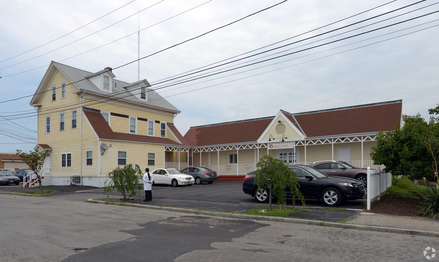
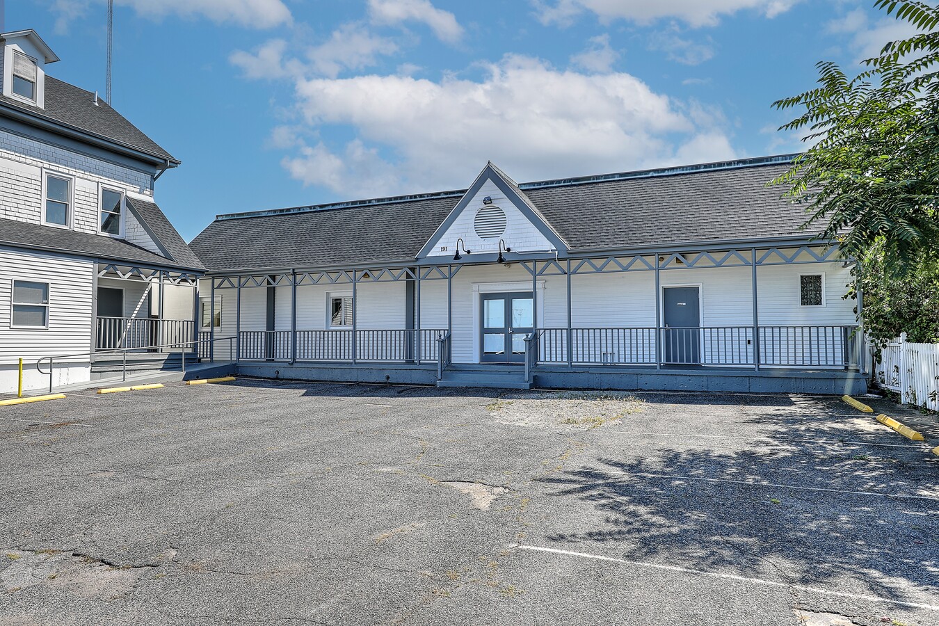
Property Record
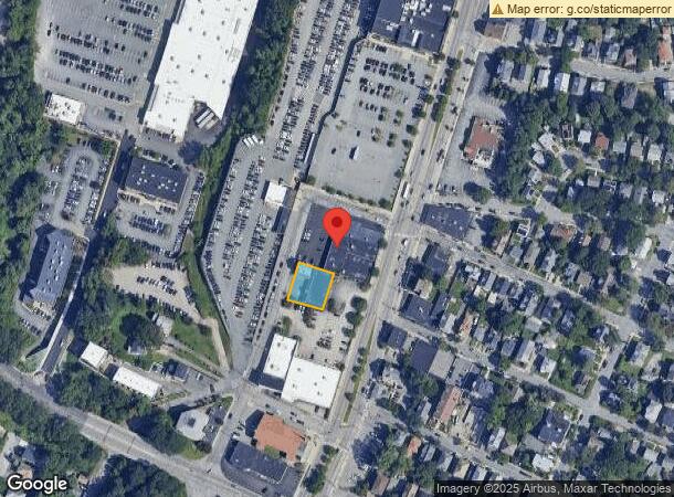
191 Nashua St, Providence, RI 02904
Current Lease Availabilities
NEARBY LISTINGS FOR SALE OR LEASE
Property Detail
191 Nashua St
PROV-750155-000000-000000
Providence
Commercialofficeresidentialmixeduse
Rhode Island
X
155
44007C0307J
0.23 AC
0
Providence
2024
Providence
003300
Providence-Warwick, RI-MA
7,176 SF
DEMOGRAPHICS near 191 Nashua St
1 Mile
3 Mile
5 Mile
2024 Total Population
21,849
209,577
404,820
2029 Population
21,655
207,727
400,379
Pop Growth 2024-2029
(0.89%)
(0.88%)
(1.10%)
Average Age
39
38
38
2024 Total Households
9,285
85,597
159,498
HH Growth 2024-2029
(1.06%)
(0.82%)
(1.06%)
Median Household Inc
$74,830
$62,236
$62,364
Avg Household Size
2.20
2.30
2.40
2024 Avg HH Vehicles
1.00
1.00
2.00
Median Home Value
$354,733
$293,814
$294,233
Median Year Built
1947
1948
1950
Nearby Places
- Restaurants
- Banks
- Shops
- Fitness
- Groceries
PUBLIC TRANSPORTATION
COMMUTER RAIL
Pawtucket/Central Falls (Foxboro Event Service - MBTA, Providence/Stoughton Line - MBTA)
DRIVE
WALK
Distance
Pawtucket/Central Falls (Foxboro Event Service - MBTA, Providence/Stoughton Line - MBTA)
4 min
2.1 mi
Providence (Providence/Stoughton Line - Massachusetts Bay Transportation Authority Commuter Rail (Purple Line))
DRIVE
WALK
Distance
Providence (Providence/Stoughton Line - Massachusetts Bay Transportation Authority Commuter Rail (Purple Line))
6 min
3.5 mi
AIRPORT
Rhode Island Tf Green International
DRIVE
WALK
Distance
Rhode Island Tf Green International
22 min
11.7 mi
Freight Ports
Port of Davisville, RI
DRIVE
WALK
Distance
Port of Davisville, RI
38 min
24.0 mi
Nearby Properties
Address
Land Use
TOTAL SIZE
Lot Size
Zoning
Address
Land Use
TOTAL SIZE
Lot Size
Zoning
15.88 AC
D-1-75
Address
Land Use
TOTAL SIZE
Lot Size
Zoning
2.25 AC
I-2
Address
Land Use
TOTAL SIZE
Lot Size
Zoning
199.13 AC
OS
Address
Land Use
TOTAL SIZE
Lot Size
Zoning
37.67 AC
R-3
Address
Land Use
TOTAL SIZE
Lot Size
Zoning
64.44 AC
I-1-75
Address
Land Use
TOTAL SIZE
Lot Size
Zoning
162,816 SF
16.52 AC
D-1-10
Address
Land Use
TOTAL SIZE
Lot Size
Zoning
4.14 AC
D-1-30
Address
Land Use
TOTAL SIZE
Lot Size
Zoning
13.84 AC
I-2
Address
Land Use
TOTAL SIZE
Lot Size
Zoning
5.05 AC
I-1-75
Address
Land Use
TOTAL SIZE
Lot Size
Zoning
45,407 SF
38.03 AC
I-2
Address
Land Use
TOTAL SIZE
Lot Size
Zoning
32.48 AC
I-2
Address
Land Use
TOTAL SIZE
Lot Size
Zoning
12.41 AC
D-1-10
Address
Land Use
TOTAL SIZE
Lot Size
Zoning
20.04 AC
I-2
Address
Land Use
TOTAL SIZE
Lot Size
Zoning
2.74 AC
I-2
Address
Land Use
TOTAL SIZE
Lot Size
Zoning
280,000 SF
0.75 AC
I-2
Address
Land Use
TOTAL SIZE
Lot Size
Zoning
8.93 AC
OS
Address
Land Use
TOTAL SIZE
Lot Size
Zoning
268,679 SF
8.64 AC
I-1-75
Address
Land Use
TOTAL SIZE
Lot Size
Zoning
20.05 AC
I-2
Address
Land Use
TOTAL SIZE
Lot Size
Zoning
79.57 AC
O1
Address
Land Use
TOTAL SIZE
Lot Size
Zoning
19.69 AC
R-1
Address
Land Use
TOTAL SIZE
Lot Size
Zoning
314,273 SF
D-1-20
Address
Land Use
TOTAL SIZE
Lot Size
Zoning
205,551 SF
1.38 AC
C-2
Address
Land Use
TOTAL SIZE
Lot Size
Zoning
26.08 AC
PS
Address
Land Use
TOTAL SIZE
Lot Size
Zoning
6.39 AC
I-2
Address
Land Use
TOTAL SIZE
Lot Size
Zoning
Address
Land Use
TOTAL SIZE
Lot Size
Zoning
18.51 AC
PS
Address
Land Use
TOTAL SIZE
Lot Size
Zoning
4.21 AC
I-2
Address
Land Use
TOTAL SIZE
Lot Size
Zoning
170,531 SF
3 AC
M-2
Address
Land Use
TOTAL SIZE
Lot Size
Zoning
202,461 SF
1.64 AC
D-1-10
Address
Land Use
TOTAL SIZE
Lot Size
Zoning
2.01 AC
I-2
The World's #1 Commercial Real Estate Marketplace
Connect with us
© 2025 CoStar Group
The information above has been obtained from sources believed reliable. While we do not doubt its accuracy we have not verified it and make no guarantee, warranty or representation about it. It is your responsibility to independently confirm its accuracy and completeness. Any projections, opinions, assumptions, or estimates used are for example only and do not represent the current or future performance of the property. The value of this transaction to you depends on tax and other factors which should be evaluated by your tax, financial, and legal advisors. You and your advisors should conduct a careful, independent investigation of the property to determine to your satisfaction the suitability of the property for your needs.