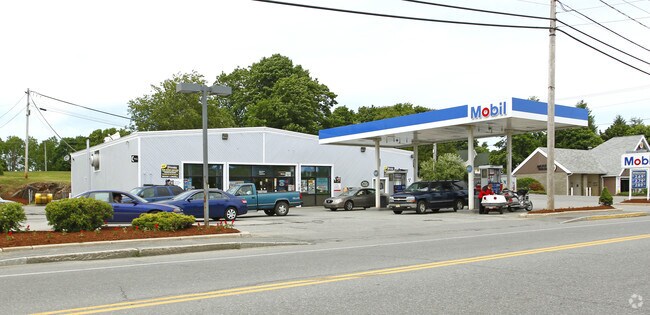
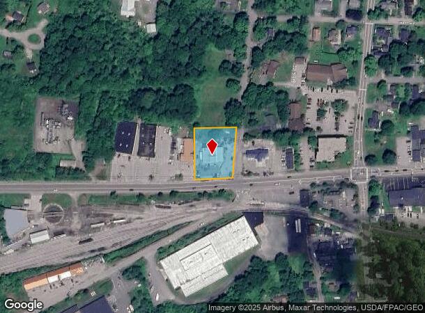
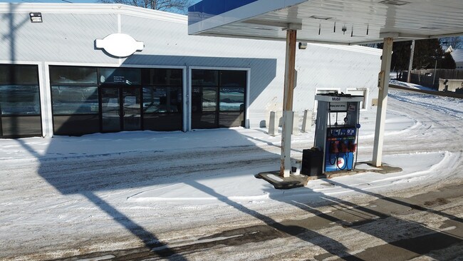
Property Record
191 Park St, Rockland, ME 04841
NEARBY LISTINGS FOR SALE OR LEASE
Property Detail
191 Park St
Departmentstore
Knox
X
Maine
23013C0351D
9000
2024
0.75 AC
2024
Other Market Areas
970600
ROCD-000051A-000000-009000
4,617 SF
DEMOGRAPHICS near 191 Park St
1 Mile
3 Mile
5 Mile
2024 Total Population
5,491
9,875
15,154
2029 Population
5,783
10,382
15,859
Pop Growth 2024-2029
+ 5.32%
+ 5.13%
+ 4.65%
Average Age
45
46
46
2024 Total Households
2,693
4,749
7,056
HH Growth 2024-2029
+ 5.38%
+ 5.18%
+ 4.72%
Median Household Inc
$42,009
$54,013
$58,988
Avg Household Size
1.90
2.00
2.10
2024 Avg HH Vehicles
1.00
2.00
2.00
Median Home Value
$182,805
$232,124
$246,576
Median Year Built
1951
1964
1968
Nearby Places
Map Layers
Map Styles
 Street
 Aerial
- Restaurants
- Banks
- Shops
- Fitness
- Groceries
SALE & LEASE HISTORY
LISTING DATE
SALE/LEASE

Sep 24, 2016
For Sale
Sep 23, 2016
For Sale
Jan 12, 2018
For Sale
Aug 29, 2017
For Sale
Nearby Properties
Address
Land Use
TOTAL SIZE
Lot Size
Zoning
Address
Land Use
TOTAL SIZE
Lot Size
Zoning
4.29 AC
Address
Land Use
TOTAL SIZE
Lot Size
Zoning
31.46 AC
IN
Address
Land Use
TOTAL SIZE
Lot Size
Zoning
194,179 SF
164.63 AC
Address
Land Use
TOTAL SIZE
Lot Size
Zoning
91,666 SF
7.31 AC
Address
Land Use
TOTAL SIZE
Lot Size
Zoning
5.74 AC
Address
Land Use
TOTAL SIZE
Lot Size
Zoning
145,347 SF
30.22 AC
HC
Address
Land Use
TOTAL SIZE
Lot Size
Zoning
3,577 SF
20.94 AC
Address
Land Use
TOTAL SIZE
Lot Size
Zoning
142,400 SF
19.68 AC
HC
Address
Land Use
TOTAL SIZE
Lot Size
Zoning
2,460 SF
5.46 AC
Address
Land Use
TOTAL SIZE
Lot Size
Zoning
170,216 SF
17.20 AC
Address
Land Use
TOTAL SIZE
Lot Size
Zoning
66,328 SF
11.52 AC
Address
Land Use
TOTAL SIZE
Lot Size
Zoning
50,910 SF
2.15 AC
HC
Address
Land Use
TOTAL SIZE
Lot Size
Zoning
195,140 SF
25.07 AC
Address
Land Use
TOTAL SIZE
Lot Size
Zoning
96,194 SF
24.39 AC
Address
Land Use
TOTAL SIZE
Lot Size
Zoning
24.33 AC
Address
Land Use
TOTAL SIZE
Lot Size
Zoning
40,774 SF
1.58 AC
Address
Land Use
TOTAL SIZE
Lot Size
Zoning
43.89 AC
Address
Land Use
TOTAL SIZE
Lot Size
Zoning
10 AC
RA
Address
Land Use
TOTAL SIZE
Lot Size
Zoning
78,730 SF
22.15 AC
Address
Land Use
TOTAL SIZE
Lot Size
Zoning
22,110 SF
22.61 AC
HC
Address
Land Use
TOTAL SIZE
Lot Size
Zoning
77,458 SF
7.16 AC
Address
Land Use
TOTAL SIZE
Lot Size
Zoning
40,256 SF
1.10 AC
Address
Land Use
TOTAL SIZE
Lot Size
Zoning
4.11 AC
Address
Land Use
TOTAL SIZE
Lot Size
Zoning
27,000 SF
19.33 AC
Address
Land Use
TOTAL SIZE
Lot Size
Zoning
233,776 SF
16.36 AC
Address
Land Use
TOTAL SIZE
Lot Size
Zoning
2.82 AC
Address
Land Use
TOTAL SIZE
Lot Size
Zoning
93,764 SF
10.45 AC
Address
Land Use
TOTAL SIZE
Lot Size
Zoning
55,298 SF
2.41 AC
Address
Land Use
TOTAL SIZE
Lot Size
Zoning
203.31 AC
IN
Address
Land Use
TOTAL SIZE
Lot Size
Zoning
21,831 SF
7.84 AC
HC
The World's #1 Commercial Real Estate Marketplace
Connect with us
© 2025 CoStar Group
The information above has been obtained from sources believed reliable. While we do not doubt its accuracy we have not verified it and make no guarantee, warranty or representation about it. It is your responsibility to independently confirm its accuracy and completeness. Any projections, opinions, assumptions, or estimates used are for example only and do not represent the current or future performance of the property. The value of this transaction to you depends on tax and other factors which should be evaluated by your tax, financial, and legal advisors. You and your advisors should conduct a careful, independent investigation of the property to determine to your satisfaction the suitability of the property for your needs.