Property Record
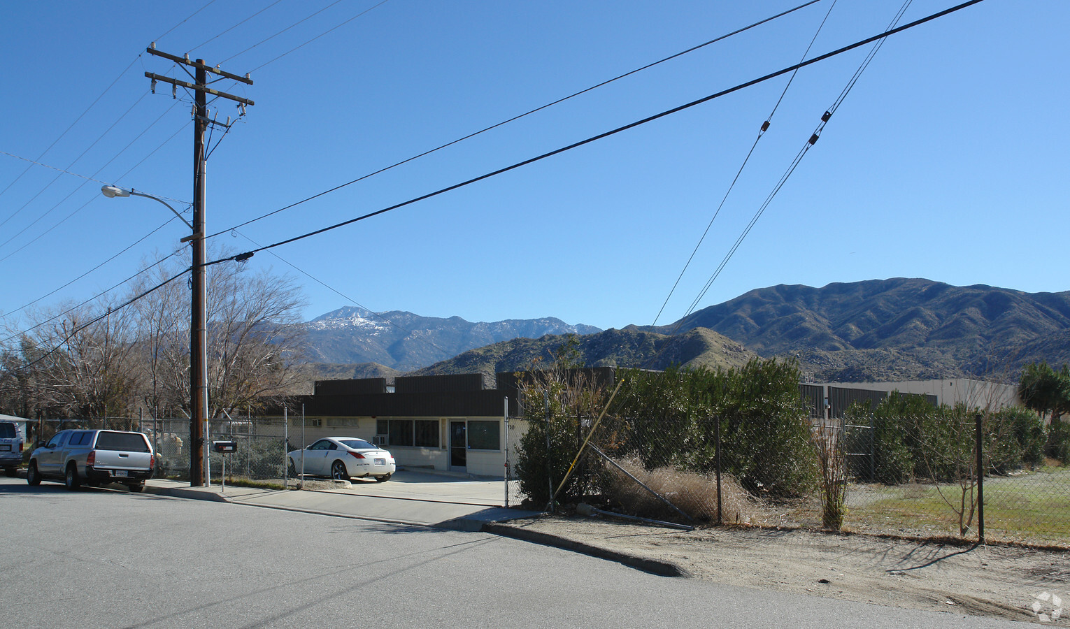
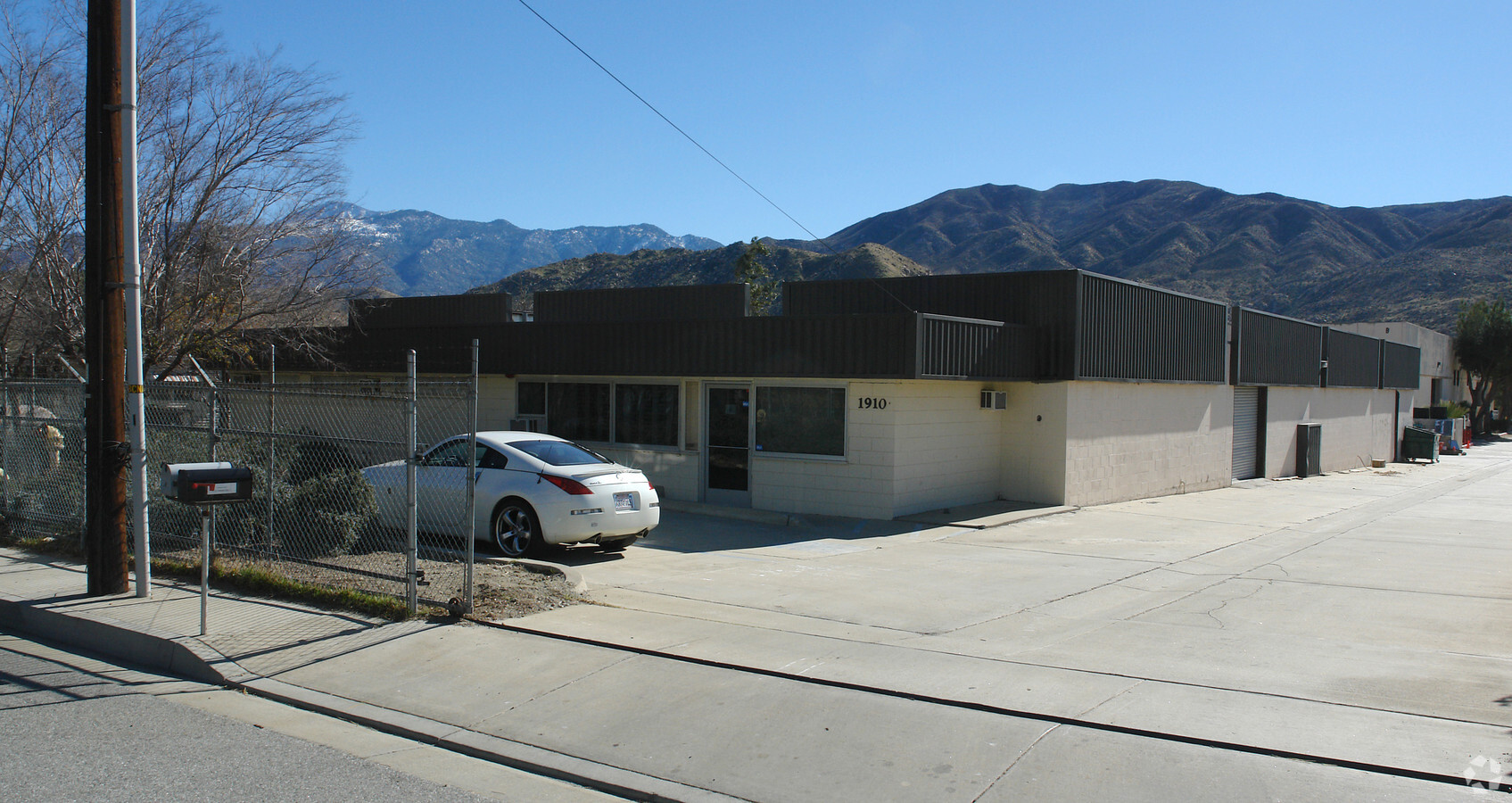
1910 E Westward Ave, Banning, CA 92220

NEARBY LISTINGS FOR SALE OR LEASE
Property Detail
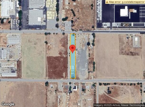
1910 E Westward Ave
Riverside-San Bernardino-Ontario, CA
Waverly Tr
532-160-007
POR LOT 7 MB 008/044 WAVERLY TR
Lightindustrial
Riverside
X
California
06065C0836G
7
2023
0.91 AC
2023
Beaumont/Hemet
043813
Inland Empire (California)
20,304 SF
DEMOGRAPHICS near 1910 E Westward Ave
1 Mile
3 Mile
5 Mile
2024 Total Population
3,119
19,994
32,499
2029 Population
3,246
21,068
34,211
Pop Growth 2024-2029
+ 4.07%
+ 5.37%
+ 5.27%
Average Age
36
36
42
2024 Total Households
616
5,883
11,417
HH Growth 2024-2029
+ 3.57%
+ 5.10%
+ 4.91%
Median Household Inc
$48,999
$53,900
$52,547
Avg Household Size
3.30
3.10
2.70
2024 Avg HH Vehicles
3.00
2.00
2.00
Median Home Value
$288,834
$283,780
$294,352
Median Year Built
1964
1969
1981
Nearby Places
- Restaurants
- Banks
- Shops
- Fitness
- Groceries
PUBLIC TRANSPORTATION
AIRPORT
Palm Springs International
DRIVE
WALK
Distance
Palm Springs International
33 min
26.7 mi
Freight Ports
Port of Long Beach
DRIVE
WALK
Distance
Port of Long Beach
112 min
87.7 mi
Nearby Properties
Address
Land Use
TOTAL SIZE
Lot Size
Zoning
Address
Land Use
TOTAL SIZE
Lot Size
Zoning
1,000,000 SF
63.69 AC
Address
Land Use
TOTAL SIZE
Lot Size
Zoning
1,083,737 SF
39.13 AC
Address
Land Use
TOTAL SIZE
Lot Size
Zoning
35.82 AC
Address
Land Use
TOTAL SIZE
Lot Size
Zoning
83,989 SF
39.10 AC
M1
Address
Land Use
TOTAL SIZE
Lot Size
Zoning
67,643 SF
4.34 AC
CPS
Address
Land Use
TOTAL SIZE
Lot Size
Zoning
82,587 SF
6.78 AC
Address
Land Use
TOTAL SIZE
Lot Size
Zoning
54,455 SF
5.53 AC
R3
Address
Land Use
TOTAL SIZE
Lot Size
Zoning
17,272 SF
1.99 AC
Address
Land Use
TOTAL SIZE
Lot Size
Zoning
50,000 SF
7.13 AC
CM
Address
Land Use
TOTAL SIZE
Lot Size
Zoning
29,928 SF
2.98 AC
Address
Land Use
TOTAL SIZE
Lot Size
Zoning
9.28 AC
M1
Address
Land Use
TOTAL SIZE
Lot Size
Zoning
93,469 SF
7.46 AC
Address
Land Use
TOTAL SIZE
Lot Size
Zoning
15,000 SF
0.99 AC
Address
Land Use
TOTAL SIZE
Lot Size
Zoning
15.29 AC
W2
Address
Land Use
TOTAL SIZE
Lot Size
Zoning
20,000 SF
2.87 AC
Address
Land Use
TOTAL SIZE
Lot Size
Zoning
15.25 AC
W2
Address
Land Use
TOTAL SIZE
Lot Size
Zoning
4.57 AC
Address
Land Use
TOTAL SIZE
Lot Size
Zoning
102,760 SF
13.29 AC
Address
Land Use
TOTAL SIZE
Lot Size
Zoning
51,600 SF
2.47 AC
M
Address
Land Use
TOTAL SIZE
Lot Size
Zoning
18,461 SF
1.16 AC
R3
Address
Land Use
TOTAL SIZE
Lot Size
Zoning
32,520 SF
2.01 AC
Address
Land Use
TOTAL SIZE
Lot Size
Zoning
70,400 SF
3.18 AC
Address
Land Use
TOTAL SIZE
Lot Size
Zoning
2,783 SF
1.01 AC
Address
Land Use
TOTAL SIZE
Lot Size
Zoning
30,000 SF
2.14 AC
Address
Land Use
TOTAL SIZE
Lot Size
Zoning
24,700 SF
2.43 AC
C2
Address
Land Use
TOTAL SIZE
Lot Size
Zoning
17,470 SF
1.45 AC
C2
Address
Land Use
TOTAL SIZE
Lot Size
Zoning
20,000 SF
1.75 AC
The World's #1 Commercial Real Estate Marketplace
Connect with us
© 2025 CoStar Group
The information above has been obtained from sources believed reliable. While we do not doubt its accuracy we have not verified it and make no guarantee, warranty or representation about it. It is your responsibility to independently confirm its accuracy and completeness. Any projections, opinions, assumptions, or estimates used are for example only and do not represent the current or future performance of the property. The value of this transaction to you depends on tax and other factors which should be evaluated by your tax, financial, and legal advisors. You and your advisors should conduct a careful, independent investigation of the property to determine to your satisfaction the suitability of the property for your needs.