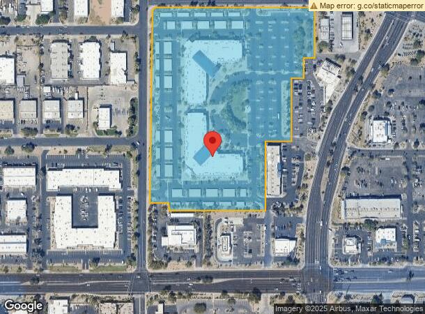
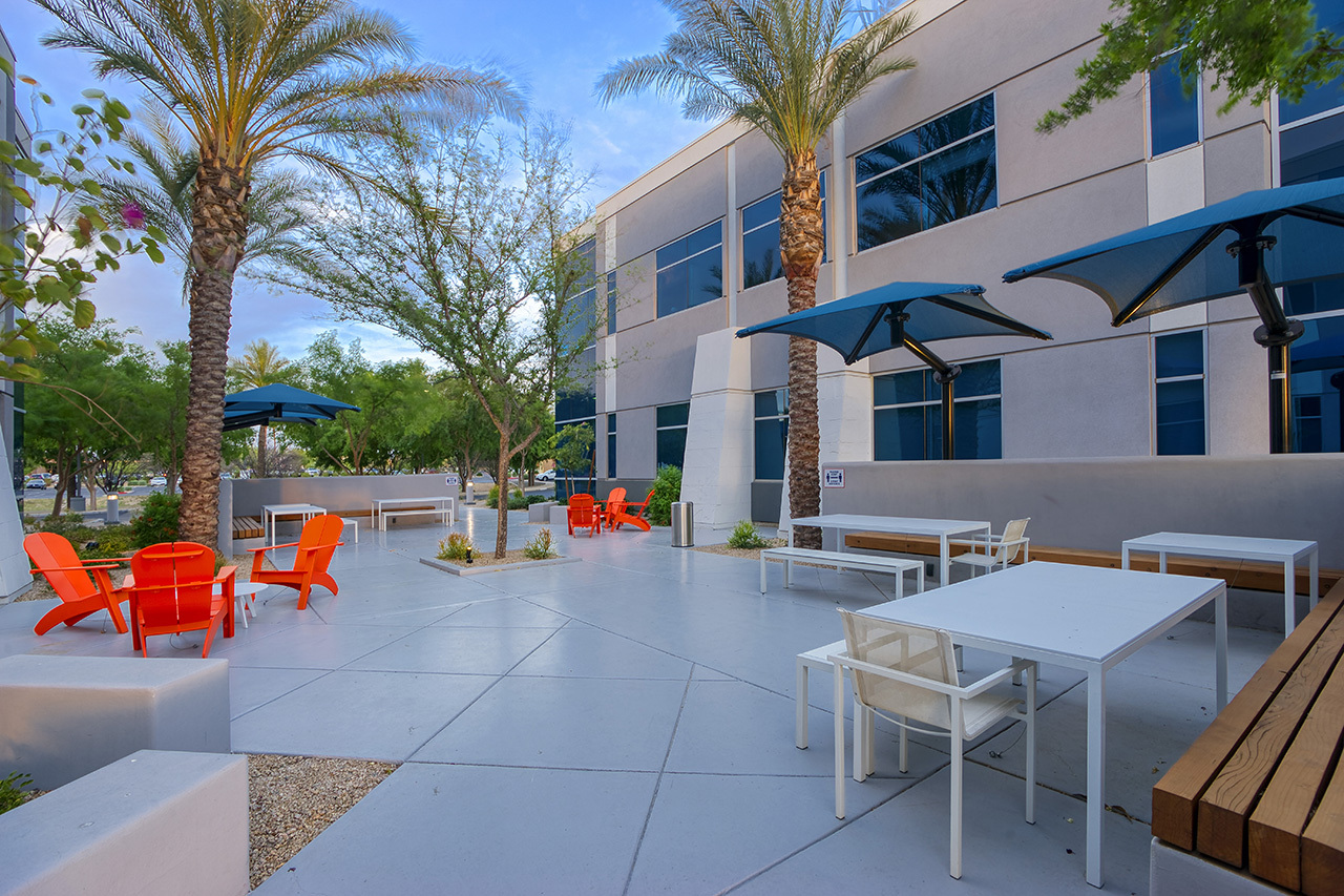
Property Record
1910 S Stapley Dr, Mesa, AZ 85204

Current Lease Availabilities
NEARBY LISTINGS FOR SALE OR LEASE
-
-
-
-
-
-
-
-
-
-
-
No Photo
-
-
-
-
-
-
View all Mesa listings for lease on LoopNet.com
Property Detail
1910 S Stapley Dr
Phoenix-Mesa-Scottsdale, AZ
LOTS 3 & 4 STAPLEY CORPORATE CENTER 2 MCR 739-42
139-11-097A
Maricopa
Officebuilding
Arizona
2024
3
2025
14.08 AC
422301
Superstition Corridor
184,558 SF
Phoenix
DEMOGRAPHICS near 1910 S Stapley Dr
1 Mile
3 Mile
5 Mile
2024 Total Population
8,932
146,861
423,873
2029 Population
9,562
157,999
457,241
Pop Growth 2024-2029
+ 7.05%
+ 7.58%
+ 7.87%
Average Age
35
35
38
2024 Total Households
2,958
52,176
159,396
HH Growth 2024-2029
+ 7.10%
+ 7.69%
+ 8.09%
Median Household Inc
$80,127
$63,559
$68,729
Avg Household Size
2.90
2.70
2.60
2024 Avg HH Vehicles
2.00
2.00
2.00
Median Home Value
$314,342
$337,779
$347,005
Median Year Built
1982
1982
1984
Nearby Places
- Restaurants
- Banks
- Shops
- Fitness
- Groceries
PUBLIC TRANSPORTATION
AIRPORT
Phoenix-Mesa Gateway
DRIVE
WALK
Distance
Phoenix-Mesa Gateway
22 min
13.9 mi
Phoenix Sky Harbor International
DRIVE
WALK
Distance
Phoenix Sky Harbor International
24 min
15.9 mi
Freight Ports
Port of San Diego
DRIVE
WALK
Distance
Port of San Diego
411 min
374.1 mi
Nearby Properties
Address
Land Use
TOTAL SIZE
Lot Size
Zoning
Address
Land Use
TOTAL SIZE
Lot Size
Zoning
301,190 SF
77.17 AC
PF
Address
Land Use
TOTAL SIZE
Lot Size
Zoning
377,442 SF
0.21 AC
C-DT
Address
Land Use
TOTAL SIZE
Lot Size
Zoning
739,944 SF
40.02 AC
MFM
Address
Land Use
TOTAL SIZE
Lot Size
Zoning
281,301 SF
19.13 AC
I-1
Address
Land Use
TOTAL SIZE
Lot Size
Zoning
411,683 SF
15.53 AC
RM3
Address
Land Use
TOTAL SIZE
Lot Size
Zoning
357,952 SF
33.73 AC
LI
Address
Land Use
TOTAL SIZE
Lot Size
Zoning
418,678 SF
18.63 AC
C-G
Address
Land Use
TOTAL SIZE
Lot Size
Zoning
309,031 SF
18.55 AC
Address
Land Use
TOTAL SIZE
Lot Size
Zoning
16.57 AC
PF
Address
Land Use
TOTAL SIZE
Lot Size
Zoning
427,210 SF
38.33 AC
PF
Address
Land Use
TOTAL SIZE
Lot Size
Zoning
572,119 SF
22.44 AC
PF
Address
Land Use
TOTAL SIZE
Lot Size
Zoning
344,641 SF
21.43 AC
I-1
Address
Land Use
TOTAL SIZE
Lot Size
Zoning
348,151 SF
20.69 AC
LI
Address
Land Use
TOTAL SIZE
Lot Size
Zoning
478,411 SF
4.07 AC
CDT
Address
Land Use
TOTAL SIZE
Lot Size
Zoning
115,920 SF
18.19 AC
Address
Land Use
TOTAL SIZE
Lot Size
Zoning
154,816 SF
35.89 AC
I-1
Address
Land Use
TOTAL SIZE
Lot Size
Zoning
199,472 SF
4.79 AC
C-DT
Address
Land Use
TOTAL SIZE
Lot Size
Zoning
367,012 SF
19.90 AC
M-H
Address
Land Use
TOTAL SIZE
Lot Size
Zoning
100,580 SF
22.70 AC
C-G
Address
Land Use
TOTAL SIZE
Lot Size
Zoning
270,243 SF
15.52 AC
M-M
Address
Land Use
TOTAL SIZE
Lot Size
Zoning
225,326 SF
16 AC
C-C
Address
Land Use
TOTAL SIZE
Lot Size
Zoning
90,920 SF
2.27 AC
C-O
Address
Land Use
TOTAL SIZE
Lot Size
Zoning
208,100 SF
10.82 AC
Address
Land Use
TOTAL SIZE
Lot Size
Zoning
172,200 SF
8.89 AC
PF
Address
Land Use
TOTAL SIZE
Lot Size
Zoning
309,059 SF
15.49 AC
M-M
Address
Land Use
TOTAL SIZE
Lot Size
Zoning
217,965 SF
23.27 AC
I-1
Address
Land Use
TOTAL SIZE
Lot Size
Zoning
347,420 SF
16.94 AC
M-H
Address
Land Use
TOTAL SIZE
Lot Size
Zoning
184,980 SF
6.67 AC
I-1
Address
Land Use
TOTAL SIZE
Lot Size
Zoning
230,826 SF
25.95 AC
PAD
The World's #1 Commercial Real Estate Marketplace
Connect with us
© 2025 CoStar Group
The information above has been obtained from sources believed reliable. While we do not doubt its accuracy we have not verified it and make no guarantee, warranty or representation about it. It is your responsibility to independently confirm its accuracy and completeness. Any projections, opinions, assumptions, or estimates used are for example only and do not represent the current or future performance of the property. The value of this transaction to you depends on tax and other factors which should be evaluated by your tax, financial, and legal advisors. You and your advisors should conduct a careful, independent investigation of the property to determine to your satisfaction the suitability of the property for your needs.