Property Record
19100 Asheville Hwy, Landrum, SC 29356
NEARBY LISTINGS FOR SALE OR LEASE
-
-
View all Landrum listings for sale on LoopNet.com
Property Detail
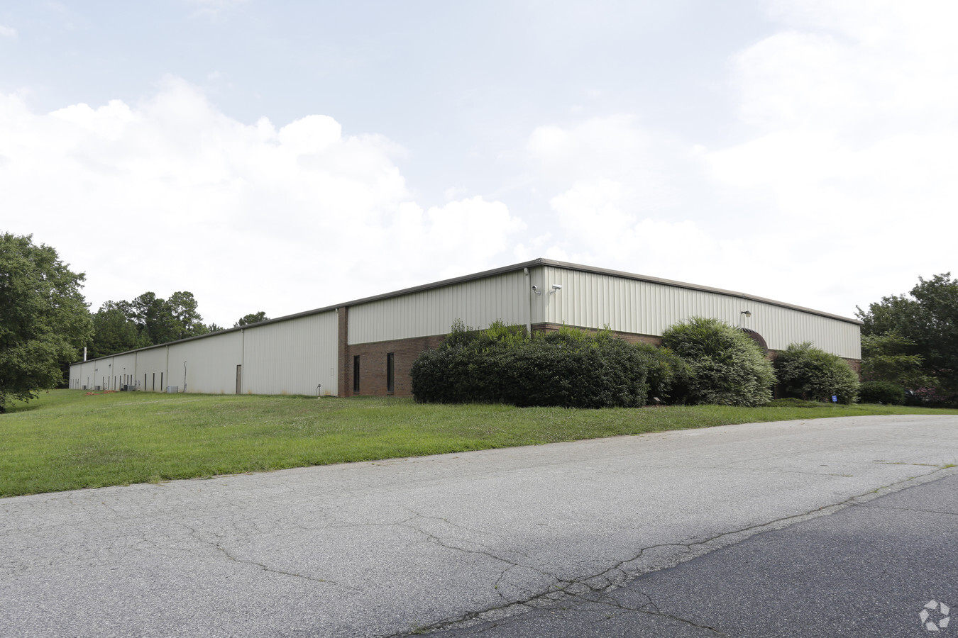
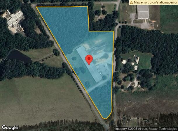
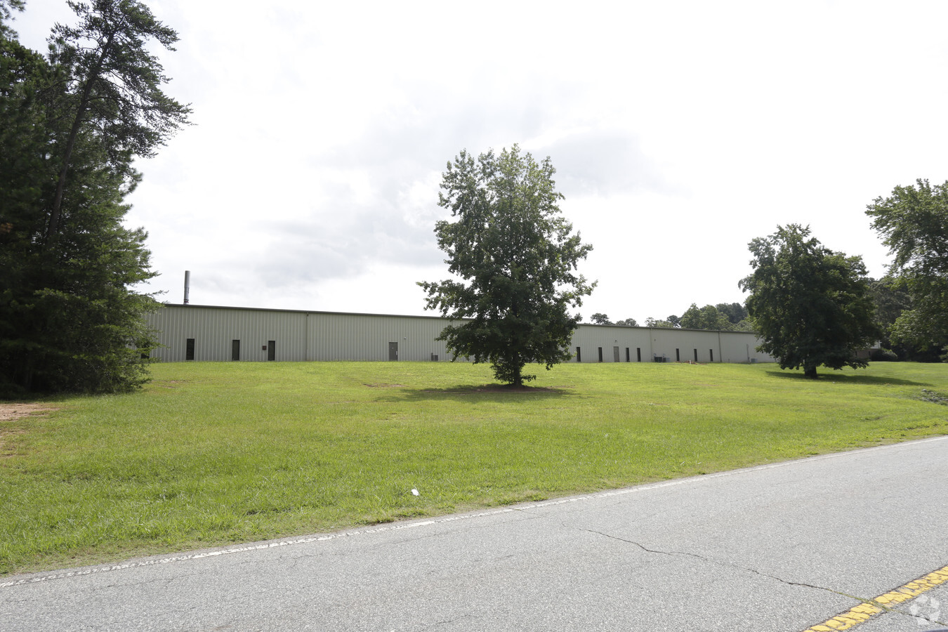
19100 Asheville Hwy
1-14-00-016.03
E SIDE US HWY 176 S OF LANDRUM MILL ROAD DB 56C-436-438 HWY R/W TAKEN TR 3
Realpropertynec
Spartanburg
X
South Carolina
45083C0018D
13.86 AC
2024
Upper Spartanburg Cty
2023
Greenville/Spartanburg
002404
Spartanburg, SC
40,800 SF
DEMOGRAPHICS near 19100 Asheville Hwy
1 Mile
3 Mile
5 Mile
2024 Total Population
530
6,650
14,194
2029 Population
605
7,559
16,063
Pop Growth 2024-2029
+ 14.15%
+ 13.67%
+ 13.17%
Average Age
44
44
44
2024 Total Households
208
2,800
5,798
HH Growth 2024-2029
+ 14.42%
+ 13.89%
+ 13.35%
Median Household Inc
$60,937
$51,318
$57,081
Avg Household Size
2.50
2.30
2.40
2024 Avg HH Vehicles
2.00
2.00
2.00
Median Home Value
$295,454
$219,201
$254,302
Median Year Built
1984
1978
1984
Nearby Places
- Restaurants
- Banks
- Shops
- Fitness
- Groceries
PUBLIC TRANSPORTATION
AIRPORT
Greenville Spartanburg International
DRIVE
WALK
Distance
Greenville Spartanburg International
44 min
25.3 mi
Asheville Regional
DRIVE
WALK
Distance
Asheville Regional
47 min
36.2 mi
Freight Ports
North Charleston Terminal
DRIVE
WALK
Distance
North Charleston Terminal
240 min
214.0 mi
Nearby Properties
Address
Land Use
TOTAL SIZE
Lot Size
Zoning
Address
Land Use
TOTAL SIZE
Lot Size
Zoning
56,601 SF
29.83 AC
Address
Land Use
TOTAL SIZE
Lot Size
Zoning
4,402 SF
5.65 AC
Address
Land Use
TOTAL SIZE
Lot Size
Zoning
8,026 SF
2 AC
Address
Land Use
TOTAL SIZE
Lot Size
Zoning
98,780 SF
40.19 AC
Address
Land Use
TOTAL SIZE
Lot Size
Zoning
1,853 SF
0.37 AC
Address
Land Use
TOTAL SIZE
Lot Size
Zoning
1,066 SF
14.36 AC
Address
Land Use
TOTAL SIZE
Lot Size
Zoning
12,120 SF
6.90 AC
Address
Land Use
TOTAL SIZE
Lot Size
Zoning
42,510 SF
9.06 AC
Address
Land Use
TOTAL SIZE
Lot Size
Zoning
3,556 SF
1.40 AC
Address
Land Use
TOTAL SIZE
Lot Size
Zoning
10,336 SF
2.41 AC
Address
Land Use
TOTAL SIZE
Lot Size
Zoning
2,522 SF
12.13 AC
Address
Land Use
TOTAL SIZE
Lot Size
Zoning
4,228 SF
0.76 AC
Address
Land Use
TOTAL SIZE
Lot Size
Zoning
4,332 SF
1.45 AC
Address
Land Use
TOTAL SIZE
Lot Size
Zoning
14,896 SF
1.40 AC
Address
Land Use
TOTAL SIZE
Lot Size
Zoning
40,160 SF
3.32 AC
Address
Land Use
TOTAL SIZE
Lot Size
Zoning
6,720 SF
7 AC
Address
Land Use
TOTAL SIZE
Lot Size
Zoning
Address
Land Use
TOTAL SIZE
Lot Size
Zoning
8,092 SF
1.14 AC
Address
Land Use
TOTAL SIZE
Lot Size
Zoning
8,174 SF
0.87 AC
Address
Land Use
TOTAL SIZE
Lot Size
Zoning
792 SF
0.41 AC
Address
Land Use
TOTAL SIZE
Lot Size
Zoning
5,392 SF
1.64 AC
Address
Land Use
TOTAL SIZE
Lot Size
Zoning
2,444 SF
2 AC
Address
Land Use
TOTAL SIZE
Lot Size
Zoning
1,500 SF
0.46 AC
Address
Land Use
TOTAL SIZE
Lot Size
Zoning
85.48 AC
Address
Land Use
TOTAL SIZE
Lot Size
Zoning
4,878 SF
0.18 AC
Address
Land Use
TOTAL SIZE
Lot Size
Zoning
3,436 SF
0.61 AC
Address
Land Use
TOTAL SIZE
Lot Size
Zoning
40.69 AC
Address
Land Use
TOTAL SIZE
Lot Size
Zoning
1,200 SF
2.73 AC
Address
Land Use
TOTAL SIZE
Lot Size
Zoning
9,597 SF
0.92 AC
The World's #1 Commercial Real Estate Marketplace
Connect with us
© 2025 CoStar Group
The information above has been obtained from sources believed reliable. While we do not doubt its accuracy we have not verified it and make no guarantee, warranty or representation about it. It is your responsibility to independently confirm its accuracy and completeness. Any projections, opinions, assumptions, or estimates used are for example only and do not represent the current or future performance of the property. The value of this transaction to you depends on tax and other factors which should be evaluated by your tax, financial, and legal advisors. You and your advisors should conduct a careful, independent investigation of the property to determine to your satisfaction the suitability of the property for your needs.