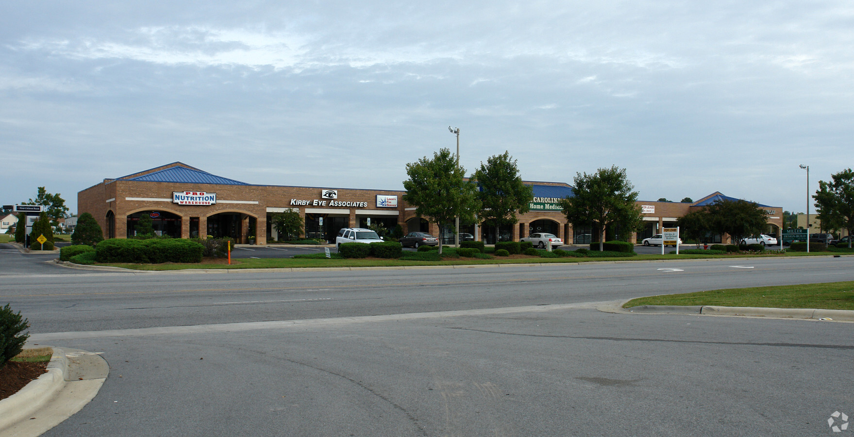
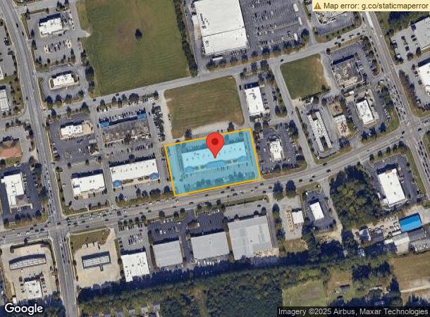
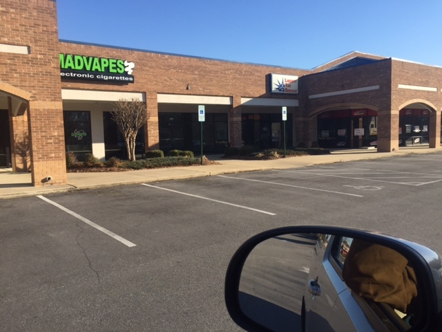
Property Record
1913 E Fire Tower Rd, Greenville, NC 27858
NEARBY LISTINGS FOR SALE OR LEASE
Property Detail
1913 E Fire Tower Rd
Greenville, NC
Covengton Downe
055864
COVENGTON DOWNE
Stripcommercialcenter
Pitt
X
North Carolina
3720468600K
3
2024
2.07 AC
2024
Southeast Greenville
000502
Other Market Areas
19,613 SF
DEMOGRAPHICS near 1913 E Fire Tower Rd
1 Mile
3 Mile
5 Mile
2024 Total Population
10,545
61,098
116,616
2029 Population
11,077
63,978
122,515
Pop Growth 2024-2029
+ 5.05%
+ 4.71%
+ 5.06%
Average Age
35
36
36
2024 Total Households
5,190
26,456
49,245
HH Growth 2024-2029
+ 5.39%
+ 5.16%
+ 5.56%
Median Household Inc
$42,852
$47,817
$45,482
Avg Household Size
2.00
2.20
2.20
2024 Avg HH Vehicles
2.00
2.00
2.00
Median Home Value
$186,176
$207,046
$189,718
Median Year Built
1996
1989
1993
Nearby Places
- Restaurants
- Banks
- Shops
- Fitness
- Groceries
PUBLIC TRANSPORTATION
AIRPORT
Pitt-Greenville
DRIVE
WALK
Distance
Pitt-Greenville
18 min
9.2 mi
Freight Ports
Port of Morehead City
DRIVE
WALK
Distance
Port of Morehead City
121 min
81.1 mi
SALE & LEASE HISTORY
LISTING DATE
SALE/LEASE

Sep 25, 2016
For Lease
May 05, 2020
For Lease
Mar 02, 2018
For Lease
Nearby Properties
Address
Land Use
TOTAL SIZE
Lot Size
Zoning
Address
Land Use
TOTAL SIZE
Lot Size
Zoning
1,555,005 SF
61.20 AC
OR
Address
Land Use
TOTAL SIZE
Lot Size
Zoning
207,166 SF
36.57 AC
OR
Address
Land Use
TOTAL SIZE
Lot Size
Zoning
780,261 SF
36.60 AC
OR
Address
Land Use
TOTAL SIZE
Lot Size
Zoning
1,002,223 SF
39.45 AC
OR
Address
Land Use
TOTAL SIZE
Lot Size
Zoning
302,575 SF
29.53 AC
MI
Address
Land Use
TOTAL SIZE
Lot Size
Zoning
473,026 SF
0.69 AC
OR
Address
Land Use
TOTAL SIZE
Lot Size
Zoning
682,180 SF
4.57 AC
CDF-UC
Address
Land Use
TOTAL SIZE
Lot Size
Zoning
512,349 SF
39.27 AC
CG
Address
Land Use
TOTAL SIZE
Lot Size
Zoning
33,163 SF
20.14 AC
OR
Address
Land Use
TOTAL SIZE
Lot Size
Zoning
33,791 SF
21.01 AC
OR
Address
Land Use
TOTAL SIZE
Lot Size
Zoning
282,000 SF
0.94 AC
OR
Address
Land Use
TOTAL SIZE
Lot Size
Zoning
24,161 SF
53.66 AC
R6A
Address
Land Use
TOTAL SIZE
Lot Size
Zoning
24,993 SF
15.81 AC
OR
Address
Land Use
TOTAL SIZE
Lot Size
Zoning
24,032 SF
22.74 AC
R6
Address
Land Use
TOTAL SIZE
Lot Size
Zoning
356,216 SF
4.08 AC
CDF-UC
Address
Land Use
TOTAL SIZE
Lot Size
Zoning
138,115 SF
13.60 AC
OR
Address
Land Use
TOTAL SIZE
Lot Size
Zoning
16,462 SF
30.51 AC
OR
Address
Land Use
TOTAL SIZE
Lot Size
Zoning
25,290 SF
18.26 AC
OR
Address
Land Use
TOTAL SIZE
Lot Size
Zoning
152,055 SF
1.77 AC
OR
Address
Land Use
TOTAL SIZE
Lot Size
Zoning
103,256 SF
8.80 AC
OR
Address
Land Use
TOTAL SIZE
Lot Size
Zoning
251,265 SF
30.17 AC
0&I
Address
Land Use
TOTAL SIZE
Lot Size
Zoning
20,138 SF
26.90 AC
R6A
Address
Land Use
TOTAL SIZE
Lot Size
Zoning
6,148 SF
10.75 AC
R6
Address
Land Use
TOTAL SIZE
Lot Size
Zoning
152,334 SF
15.92 AC
CG
Address
Land Use
TOTAL SIZE
Lot Size
Zoning
19,183 SF
5.85 AC
OR
Address
Land Use
TOTAL SIZE
Lot Size
Zoning
145,476 SF
18.92 AC
CG
Address
Land Use
TOTAL SIZE
Lot Size
Zoning
31.04 AC
R6S
Address
Land Use
TOTAL SIZE
Lot Size
Zoning
194,420 SF
40 AC
RR
Address
Land Use
TOTAL SIZE
Lot Size
Zoning
20,742 SF
12.83 AC
R6
Address
Land Use
TOTAL SIZE
Lot Size
Zoning
121,384 SF
17.80 AC
CG
The World's #1 Commercial Real Estate Marketplace
Connect with us
© 2025 CoStar Group
The information above has been obtained from sources believed reliable. While we do not doubt its accuracy we have not verified it and make no guarantee, warranty or representation about it. It is your responsibility to independently confirm its accuracy and completeness. Any projections, opinions, assumptions, or estimates used are for example only and do not represent the current or future performance of the property. The value of this transaction to you depends on tax and other factors which should be evaluated by your tax, financial, and legal advisors. You and your advisors should conduct a careful, independent investigation of the property to determine to your satisfaction the suitability of the property for your needs.