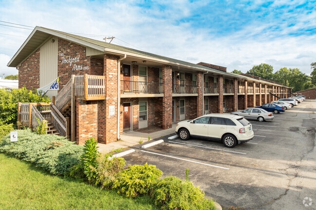
Property Record
1915 Rockford Ln, Louisville, KY 40216


NEARBY LISTINGS FOR SALE OR LEASE
Property Detail
1915 Rockford Ln
102007330000
Willowdale
Apartment
2.308 AC
X
Jefferson
21111C0072F
Kentucky
2025
2.31 AC
2025
Shively
012501
Louisville
24,494 SF
Louisville-Jefferson County, KY-IN
DEMOGRAPHICS near 1915 Rockford Ln
1 Mile
3 Mile
5 Mile
2024 Total Population
10,132
82,785
190,258
2029 Population
10,000
81,939
188,525
Pop Growth 2024-2029
(1.30%)
(1.02%)
(0.91%)
Average Age
40
39
38
2024 Total Households
4,294
33,738
76,140
HH Growth 2024-2029
(1.37%)
(1.07%)
(0.97%)
Median Household Inc
$44,402
$46,459
$44,661
Avg Household Size
2.30
2.40
2.40
2024 Avg HH Vehicles
2.00
2.00
2.00
Median Home Value
$152,302
$159,185
$148,056
Median Year Built
1959
1963
1960
Nearby Places
Map Layers
Map Styles
 Street
 Aerial
- Restaurants
- Banks
- Shops
- Fitness
- Groceries
PUBLIC TRANSPORTATION
AIRPORT
Louisville Muhammad Ali International
DRIVE
WALK
Distance
Louisville Muhammad Ali International
13 min
6.1 mi
Freight Ports
Port of Toledo
DRIVE
WALK
Distance
Port of Toledo
364 min
312.0 mi
Nearby Properties
Address
Land Use
TOTAL SIZE
Lot Size
Zoning
Address
Land Use
TOTAL SIZE
Lot Size
Zoning
194,084 SF
24.87 AC
EZ1-ENTERP
Address
Land Use
TOTAL SIZE
Lot Size
Zoning
22,113 SF
19.01 AC
R4-RESIDEN
Address
Land Use
TOTAL SIZE
Lot Size
Zoning
16.31 AC
OR1-OFFICE
Address
Land Use
TOTAL SIZE
Lot Size
Zoning
26.79 AC
R4-RESIDEN
Address
Land Use
TOTAL SIZE
Lot Size
Zoning
256,872 SF
23.71 AC
C1-COMMERC
Address
Land Use
TOTAL SIZE
Lot Size
Zoning
5,560 SF
Address
Land Use
TOTAL SIZE
Lot Size
Zoning
2,880 SF
17.14 AC
R6-RESIDEN
Address
Land Use
TOTAL SIZE
Lot Size
Zoning
38.34 AC
Address
Land Use
TOTAL SIZE
Lot Size
Zoning
308 SF
57.16 AC
EZ1-ENTERP
Address
Land Use
TOTAL SIZE
Lot Size
Zoning
270 SF
121 AC
M3-INDUSTR
Address
Land Use
TOTAL SIZE
Lot Size
Zoning
164,677 SF
13.54 AC
EZ1-ENTERP
Address
Land Use
TOTAL SIZE
Lot Size
Zoning
139,200 SF
29.50 AC
EZ1-ENTERP
Address
Land Use
TOTAL SIZE
Lot Size
Zoning
29.54 AC
R5-RESIDEN
Address
Land Use
TOTAL SIZE
Lot Size
Zoning
19,032 SF
5.88 AC
C1-COMMERC
Address
Land Use
TOTAL SIZE
Lot Size
Zoning
13,600 SF
14.89 AC
R7-RESIDEN
Address
Land Use
TOTAL SIZE
Lot Size
Zoning
4,250 SF
2.83 AC
OR1-OFFICE
Address
Land Use
TOTAL SIZE
Lot Size
Zoning
220,844 SF
29.19 AC
C2-COMMERC
Address
Land Use
TOTAL SIZE
Lot Size
Zoning
9.95 AC
Address
Land Use
TOTAL SIZE
Lot Size
Zoning
21.36 AC
Address
Land Use
TOTAL SIZE
Lot Size
Zoning
11,136 SF
11.02 AC
R4-RESIDEN
Address
Land Use
TOTAL SIZE
Lot Size
Zoning
259,570 SF
20.38 AC
EZ1-ENTERP
Address
Land Use
TOTAL SIZE
Lot Size
Zoning
2,352 SF
2.42 AC
C2-COMMERC
Address
Land Use
TOTAL SIZE
Lot Size
Zoning
15,928 SF
13.67 AC
R4-RESIDEN
Address
Land Use
TOTAL SIZE
Lot Size
Zoning
Address
Land Use
TOTAL SIZE
Lot Size
Zoning
19,000 SF
12.86 AC
EZ1-ENTERP
Address
Land Use
TOTAL SIZE
Lot Size
Zoning
24,896 SF
5.47 AC
C1-COMMERC
Address
Land Use
TOTAL SIZE
Lot Size
Zoning
5,720 SF
93.67 AC
EZ1-ENTERP
Address
Land Use
TOTAL SIZE
Lot Size
Zoning
19,375 SF
10.11 AC
C1-COMMERC
Address
Land Use
TOTAL SIZE
Lot Size
Zoning
121,509 SF
4.48 AC
Address
Land Use
TOTAL SIZE
Lot Size
Zoning
20,258 SF
60.94 AC
M3-INDUSTR
The World's #1 Commercial Real Estate Marketplace
Connect with us
© 2025 CoStar Group
The information above has been obtained from sources believed reliable. While we do not doubt its accuracy we have not verified it and make no guarantee, warranty or representation about it. It is your responsibility to independently confirm its accuracy and completeness. Any projections, opinions, assumptions, or estimates used are for example only and do not represent the current or future performance of the property. The value of this transaction to you depends on tax and other factors which should be evaluated by your tax, financial, and legal advisors. You and your advisors should conduct a careful, independent investigation of the property to determine to your satisfaction the suitability of the property for your needs.