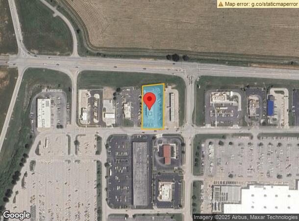
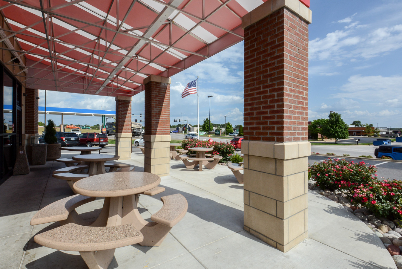
Property Record
1915 W Marler Ln, Ozark, MO 65721

NEARBY LISTINGS FOR SALE OR LEASE
Property Detail
1915 W Marler Ln
Springfield, MO
Ozark Centre
11-0.8-34-000-000-002.017
LOT 2C OZARK CENTRE REPLAT LOT 2 4 7
Commercialnec
Christian
X
Missouri
29043C0088D
2c,2
2023
0.88 AC
2023
East Christian County
020303
Springfield
7,600 SF
DEMOGRAPHICS near 1915 W Marler Ln
1 Mile
3 Mile
5 Mile
2024 Total Population
2,984
18,839
48,215
2029 Population
3,370
21,226
54,522
Pop Growth 2024-2029
+ 12.94%
+ 12.67%
+ 13.08%
Average Age
37
38
39
2024 Total Households
1,106
6,854
17,909
HH Growth 2024-2029
+ 13.11%
+ 12.77%
+ 13.14%
Median Household Inc
$59,435
$67,985
$71,596
Avg Household Size
2.60
2.70
2.60
2024 Avg HH Vehicles
2.00
2.00
2.00
Median Home Value
$180,600
$198,832
$231,958
Median Year Built
1992
1995
1998
Nearby Places
- Restaurants
- Banks
- Shops
- Fitness
- Groceries
PUBLIC TRANSPORTATION
AIRPORT
Springfield-Branson Ntl
DRIVE
WALK
Distance
Springfield-Branson Ntl
43 min
30.5 mi
Freight Ports
Tulsa Port of Inola
DRIVE
WALK
Distance
Tulsa Port of Inola
207 min
184.9 mi
SALE & LEASE HISTORY
LISTING DATE
SALE/LEASE

Jan 12, 2018
For Sale
Nearby Properties
Address
Land Use
TOTAL SIZE
Lot Size
Zoning
Address
Land Use
TOTAL SIZE
Lot Size
Zoning
258,856 SF
17.41 AC
Address
Land Use
TOTAL SIZE
Lot Size
Zoning
263,810 SF
17.94 AC
Address
Land Use
TOTAL SIZE
Lot Size
Zoning
54.39 AC
INC
Address
Land Use
TOTAL SIZE
Lot Size
Zoning
48,100 SF
10.57 AC
Address
Land Use
TOTAL SIZE
Lot Size
Zoning
38,524 SF
6.54 AC
Address
Land Use
TOTAL SIZE
Lot Size
Zoning
27,268 SF
3.51 AC
Address
Land Use
TOTAL SIZE
Lot Size
Zoning
67,368 SF
7.98 AC
Address
Land Use
TOTAL SIZE
Lot Size
Zoning
28,000 SF
3.62 AC
Address
Land Use
TOTAL SIZE
Lot Size
Zoning
114,296 SF
20 AC
Address
Land Use
TOTAL SIZE
Lot Size
Zoning
20,997 SF
6.46 AC
Address
Land Use
TOTAL SIZE
Lot Size
Zoning
106,250 SF
8.01 AC
Address
Land Use
TOTAL SIZE
Lot Size
Zoning
17,626 SF
5.26 AC
Address
Land Use
TOTAL SIZE
Lot Size
Zoning
82,000 SF
4.50 AC
Address
Land Use
TOTAL SIZE
Lot Size
Zoning
11,190 SF
13.34 AC
Address
Land Use
TOTAL SIZE
Lot Size
Zoning
Address
Land Use
TOTAL SIZE
Lot Size
Zoning
4,304 SF
26.17 AC
Address
Land Use
TOTAL SIZE
Lot Size
Zoning
11,520 SF
8.62 AC
Address
Land Use
TOTAL SIZE
Lot Size
Zoning
66,038 SF
6.24 AC
Address
Land Use
TOTAL SIZE
Lot Size
Zoning
4,050 SF
4.89 AC
Address
Land Use
TOTAL SIZE
Lot Size
Zoning
32,000 SF
3.11 AC
Address
Land Use
TOTAL SIZE
Lot Size
Zoning
75,008 SF
6.12 AC
Address
Land Use
TOTAL SIZE
Lot Size
Zoning
4,534 SF
22.04 AC
Address
Land Use
TOTAL SIZE
Lot Size
Zoning
17,864 SF
3.73 AC
Address
Land Use
TOTAL SIZE
Lot Size
Zoning
7,808 SF
2.39 AC
Address
Land Use
TOTAL SIZE
Lot Size
Zoning
7,328 SF
2.81 AC
Address
Land Use
TOTAL SIZE
Lot Size
Zoning
3,654 SF
2.11 AC
Address
Land Use
TOTAL SIZE
Lot Size
Zoning
11,800 SF
1.53 AC
Address
Land Use
TOTAL SIZE
Lot Size
Zoning
12,620 SF
1.42 AC
Address
Land Use
TOTAL SIZE
Lot Size
Zoning
92,231 SF
4.20 AC
Address
Land Use
TOTAL SIZE
Lot Size
Zoning
8,650 SF
3.03 AC
The World's #1 Commercial Real Estate Marketplace
Connect with us
© 2025 CoStar Group
The information above has been obtained from sources believed reliable. While we do not doubt its accuracy we have not verified it and make no guarantee, warranty or representation about it. It is your responsibility to independently confirm its accuracy and completeness. Any projections, opinions, assumptions, or estimates used are for example only and do not represent the current or future performance of the property. The value of this transaction to you depends on tax and other factors which should be evaluated by your tax, financial, and legal advisors. You and your advisors should conduct a careful, independent investigation of the property to determine to your satisfaction the suitability of the property for your needs.