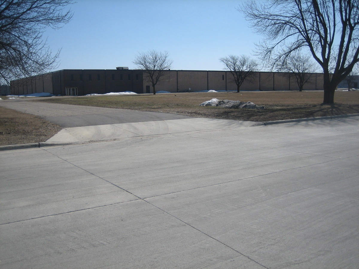
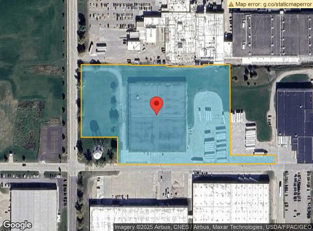
Property Record
1919 Margaretha Ave, Albert Lea, MN 56007
NEARBY LISTINGS FOR SALE OR LEASE
Property Detail
1919 Margaretha Ave
Albert Lea, MN
Jobs Building Subdivision
34.069.0210
JOBS BUILDING SUBDIVISION LOT-32+ LOT 32, LOT 33 EXC N 5 FT, LOT 34 EXC N 11 FT, LOT 35 EXC E 50 FT LOT 46 EXC E 50 FT, LOTS
Industrialgeneral
Freeborn
X
Minnesota
27047C0380C
32-35
2024
9.94 AC
2024
Minnesota South Area
180500
Other Market Areas
DEMOGRAPHICS near 1919 Margaretha Ave
1 Mile
3 Mile
5 Mile
2024 Total Population
2,564
16,378
20,323
2029 Population
2,571
16,336
20,280
Pop Growth 2024-2029
+ 0.27%
(0.26%)
(0.21%)
Average Age
38
41
43
2024 Total Households
985
6,966
8,673
HH Growth 2024-2029
+ 0.20%
(0.26%)
(0.21%)
Median Household Inc
$46,144
$50,890
$54,437
Avg Household Size
2.50
2.20
2.20
2024 Avg HH Vehicles
2.00
2.00
2.00
Median Home Value
$77,672
$114,329
$132,964
Median Year Built
1953
1956
1959
Nearby Places
- Restaurants
- Banks
- Shops
- Fitness
- Groceries
Nearby Properties
Address
Land Use
TOTAL SIZE
Lot Size
Zoning
Address
Land Use
TOTAL SIZE
Lot Size
Zoning
8.30 AC
PD
Address
Land Use
TOTAL SIZE
Lot Size
Zoning
Address
Land Use
TOTAL SIZE
Lot Size
Zoning
26.38 AC
Address
Land Use
TOTAL SIZE
Lot Size
Zoning
15.50 AC
Address
Land Use
TOTAL SIZE
Lot Size
Zoning
5.68 AC
PD
Address
Land Use
TOTAL SIZE
Lot Size
Zoning
Address
Land Use
TOTAL SIZE
Lot Size
Zoning
5.41 AC
PD
Address
Land Use
TOTAL SIZE
Lot Size
Zoning
69,582 SF
12.88 AC
B2
Address
Land Use
TOTAL SIZE
Lot Size
Zoning
Address
Land Use
TOTAL SIZE
Lot Size
Zoning
6.96 AC
I2
Address
Land Use
TOTAL SIZE
Lot Size
Zoning
31.20 AC
IDD
Address
Land Use
TOTAL SIZE
Lot Size
Zoning
Address
Land Use
TOTAL SIZE
Lot Size
Zoning
4.98 AC
Address
Land Use
TOTAL SIZE
Lot Size
Zoning
12.80 AC
PD
Address
Land Use
TOTAL SIZE
Lot Size
Zoning
0.88 AC
R3
Address
Land Use
TOTAL SIZE
Lot Size
Zoning
9.37 AC
I2
Address
Land Use
TOTAL SIZE
Lot Size
Zoning
6.64 AC
PD
Address
Land Use
TOTAL SIZE
Lot Size
Zoning
2.51 AC
R3
Address
Land Use
TOTAL SIZE
Lot Size
Zoning
0.29 AC
Address
Land Use
TOTAL SIZE
Lot Size
Zoning
0.26 AC
B3
Address
Land Use
TOTAL SIZE
Lot Size
Zoning
1.71 AC
PD
Address
Land Use
TOTAL SIZE
Lot Size
Zoning
14.73 AC
B4
Address
Land Use
TOTAL SIZE
Lot Size
Zoning
3.63 AC
Address
Land Use
TOTAL SIZE
Lot Size
Zoning
0.73 AC
I1
Address
Land Use
TOTAL SIZE
Lot Size
Zoning
6.94 AC
Address
Land Use
TOTAL SIZE
Lot Size
Zoning
44,604 SF
3.85 AC
Address
Land Use
TOTAL SIZE
Lot Size
Zoning
45.28 AC
PD
Address
Land Use
TOTAL SIZE
Lot Size
Zoning
2.77 AC
The World's #1 Commercial Real Estate Marketplace
Connect with us
© 2025 CoStar Group
The information above has been obtained from sources believed reliable. While we do not doubt its accuracy we have not verified it and make no guarantee, warranty or representation about it. It is your responsibility to independently confirm its accuracy and completeness. Any projections, opinions, assumptions, or estimates used are for example only and do not represent the current or future performance of the property. The value of this transaction to you depends on tax and other factors which should be evaluated by your tax, financial, and legal advisors. You and your advisors should conduct a careful, independent investigation of the property to determine to your satisfaction the suitability of the property for your needs.