Property Record
1919 N Main St, Pearland, TX 77581
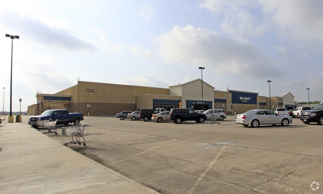

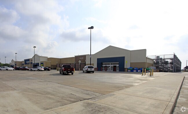
Property Detail
1919 N Main St
Houston-Pasadena-The Woodlands, TX
PEARLAND CENTRAL WAL-MART (A0542 & A0233)(PEARLAND) BLK 1 LOT RESERVE A (COMMERCIAL) ACRES 26.83
7017-0001-000
Brazoria
Commercialnec
Texas
B and X Area of moderate flood hazard, usually the area between the limits of the 100-year and 500-year floods.
a
2024
26.83 AC
2025
Southeast Outlier
660401
Houston
221,377 SF
NEARBY LISTINGS FOR SALE OR LEASE
DEMOGRAPHICS near 1919 N Main St
1 mile
3 mile
5 mile
2025 Total Population
8,489
74,119
199,150
2030 Population
9,256
80,090
214,034
Pop Growth 2025-2030
+ 9.04%
+ 8.06%
+ 7.47%
Average Age
36
37
37
2025 Total Households
2,915
24,364
65,525
HH Growth 2025-2030
+ 9.37%
+ 8.37%
+ 7.71%
Median Household Inc
$115,561
$107,574
$92,560
Avg Household Size
2.90
3.00
3.00
2025 Avg HH Vehicles
2.00
2.00
2.00
Median Home Value
$351,148
$313,594
$291,349
Median Year Built
2001
2000
1996
Nearby Places
Map Layers
Map Styles
 Street
 Aerial
Layers
 Traffic
 Biking
Places
Listings with unknown addresses are not visible on the map
- Restaurants
- Banks
- Shops
- Fitness
- Groceries
PUBLIC TRANSPORTATION
AIRPORT
William P Hobby
Drive
Walk
Distance
William P Hobby
14 min
5.5 mi
George Bush Intcntl/Houston
Drive
Walk
Distance
George Bush Intcntl/Houston
49 min
36.2 mi
Freight Ports
Port of Houston
Drive
Walk
Distance
Port of Houston
25 min
13.7 mi
Nearby Properties
Address
Land Use
TOTAL SIZE
Lot Size
Zoning
Address
Land Use
TOTAL SIZE
Lot Size
Zoning
83.37 AC
0004
Address
Land Use
TOTAL SIZE
Lot Size
Zoning
589,830 SF
47.20 AC
Address
Land Use
TOTAL SIZE
Lot Size
Zoning
359,985 SF
12.56 AC
Address
Land Use
TOTAL SIZE
Lot Size
Zoning
64.56 AC
0016
Address
Land Use
TOTAL SIZE
Lot Size
Zoning
236,642 SF
11.48 AC
Address
Land Use
TOTAL SIZE
Lot Size
Zoning
309,102 SF
16.81 AC
Address
Land Use
TOTAL SIZE
Lot Size
Zoning
7.42 AC
Address
Land Use
TOTAL SIZE
Lot Size
Zoning
128,754 SF
14.83 AC
Address
Land Use
TOTAL SIZE
Lot Size
Zoning
97,736 SF
16.49 AC
Address
Land Use
TOTAL SIZE
Lot Size
Zoning
252,472 SF
13.28 AC
Address
Land Use
TOTAL SIZE
Lot Size
Zoning
72,543 SF
22.64 AC
Address
Land Use
TOTAL SIZE
Lot Size
Zoning
14.93 AC
Address
Land Use
TOTAL SIZE
Lot Size
Zoning
144,879 SF
8.91 AC
Address
Land Use
TOTAL SIZE
Lot Size
Zoning
285,328 SF
40.75 AC
Address
Land Use
TOTAL SIZE
Lot Size
Zoning
110,990 SF
18.25 AC
Address
Land Use
TOTAL SIZE
Lot Size
Zoning
89.23 AC
Address
Land Use
TOTAL SIZE
Lot Size
Zoning
195,856 SF
20.81 AC
Address
Land Use
TOTAL SIZE
Lot Size
Zoning
155,524 SF
7.86 AC
Address
Land Use
TOTAL SIZE
Lot Size
Zoning
157,128 SF
10 AC
0041
Address
Land Use
TOTAL SIZE
Lot Size
Zoning
148,902 SF
11.40 AC
Address
Land Use
TOTAL SIZE
Lot Size
Zoning
114,828 SF
7.94 AC
Address
Land Use
TOTAL SIZE
Lot Size
Zoning
134,596 SF
7.21 AC
Address
Land Use
TOTAL SIZE
Lot Size
Zoning
67,218 SF
30.11 AC
Address
Land Use
TOTAL SIZE
Lot Size
Zoning
44,546 SF
7.54 AC
Address
Land Use
TOTAL SIZE
Lot Size
Zoning
67,595 SF
4.97 AC
Address
Land Use
TOTAL SIZE
Lot Size
Zoning
112,800 SF
3.20 AC
Address
Land Use
TOTAL SIZE
Lot Size
Zoning
124,152 SF
9.57 AC
0051
Address
Land Use
TOTAL SIZE
Lot Size
Zoning
99,578 SF
11.63 AC
Address
Land Use
TOTAL SIZE
Lot Size
Zoning
106,341 SF
12.12 AC
0550
The World's #1 Commercial Real Estate Marketplace
Connect with us
© 2026 CoStar Group
The information above has been obtained from sources believed reliable. While we do not doubt its accuracy we have not verified it and make no guarantee, warranty or representation about it. It is your responsibility to independently confirm its accuracy and completeness. Any projections, opinions, assumptions, or estimates used are for example only and do not represent the current or future performance of the property. The value of this transaction to you depends on tax and other factors which should be evaluated by your tax, financial, and legal advisors. You and your advisors should conduct a careful, independent investigation of the property to determine to your satisfaction the suitability of the property for your needs.