Property Record
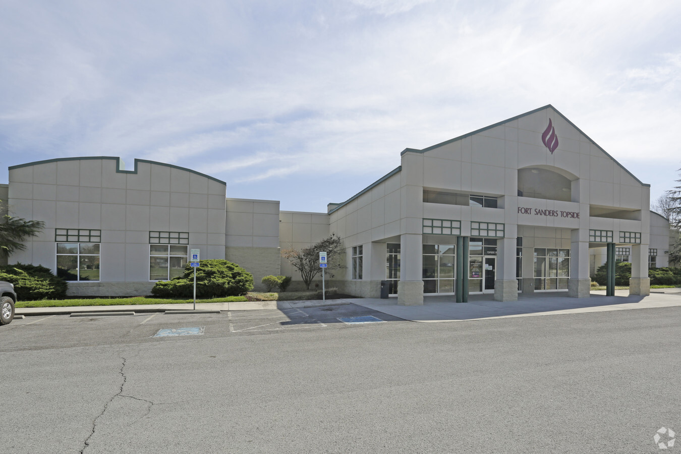
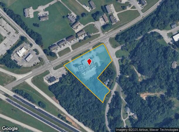
1921 Topside Rd, Louisville, TN 37777

NEARBY LISTINGS FOR SALE OR LEASE
-
-
No Photo
-
View all Louisville listings for sale on LoopNet.com
Property Detail
1921 Topside Rd
017C-A-001.00
Orville Wayne Judd Sr
Medicalbuilding
FERRY VIEW SUB 1175A FT SANDERS OFFICE/MEDICAL
X
Blount
47009C0130C
Tennessee
2023
3.40 AC
2024
Blount County
010301
Knoxville
34,600 SF
Knoxville, TN
DEMOGRAPHICS near 1921 Topside Rd
1 Mile
3 Mile
5 Mile
2024 Total Population
2,504
12,540
49,721
2029 Population
2,717
13,641
53,878
Pop Growth 2024-2029
+ 8.51%
+ 8.78%
+ 8.36%
Average Age
42
42
42
2024 Total Households
1,075
5,446
20,287
HH Growth 2024-2029
+ 8.56%
+ 8.80%
+ 8.43%
Median Household Inc
$63,923
$62,018
$75,424
Avg Household Size
2.20
2.20
2.40
2024 Avg HH Vehicles
2.00
2.00
2.00
Median Home Value
$252,980
$260,172
$312,998
Median Year Built
1987
1984
1982
Nearby Places
- Restaurants
- Banks
- Shops
- Fitness
- Groceries
PUBLIC TRANSPORTATION
AIRPORT
McGhee Tyson
DRIVE
WALK
Distance
McGhee Tyson
8 min
3.9 mi
Freight Ports
Georgia Ports - Savannah
DRIVE
WALK
Distance
Georgia Ports - Savannah
498 min
423.2 mi
Nearby Properties
Address
Land Use
TOTAL SIZE
Lot Size
Zoning
Address
Land Use
TOTAL SIZE
Lot Size
Zoning
1,401.64 AC
AIR
Address
Land Use
TOTAL SIZE
Lot Size
Zoning
222.60 AC
G
Address
Land Use
TOTAL SIZE
Lot Size
Zoning
29,040 SF
8.91 AC
G
Address
Land Use
TOTAL SIZE
Lot Size
Zoning
477.90 AC
I
Address
Land Use
TOTAL SIZE
Lot Size
Zoning
52,476 SF
20.82 AC
S
Address
Land Use
TOTAL SIZE
Lot Size
Zoning
57,667 SF
26.40 AC
S
Address
Land Use
TOTAL SIZE
Lot Size
Zoning
29,765 SF
14.67 AC
E
Address
Land Use
TOTAL SIZE
Lot Size
Zoning
26,060 SF
22.66 AC
E
Address
Land Use
TOTAL SIZE
Lot Size
Zoning
175,681 SF
AIR
Address
Land Use
TOTAL SIZE
Lot Size
Zoning
68,180 SF
35.92 AC
AIR
Address
Land Use
TOTAL SIZE
Lot Size
Zoning
93,969 SF
13.55 AC
S
Address
Land Use
TOTAL SIZE
Lot Size
Zoning
5,490 SF
19.60 AC
S
Address
Land Use
TOTAL SIZE
Lot Size
Zoning
48,590 SF
16.67 AC
G
Address
Land Use
TOTAL SIZE
Lot Size
Zoning
6,048 SF
14.76 AC
S
Address
Land Use
TOTAL SIZE
Lot Size
Zoning
30.10 AC
OS
Address
Land Use
TOTAL SIZE
Lot Size
Zoning
55,689 SF
2.28 AC
E
Address
Land Use
TOTAL SIZE
Lot Size
Zoning
61,810 SF
3.10 AC
E
Address
Land Use
TOTAL SIZE
Lot Size
Zoning
27,992 SF
2.32 AC
F
Address
Land Use
TOTAL SIZE
Lot Size
Zoning
75.56 AC
I
Address
Land Use
TOTAL SIZE
Lot Size
Zoning
52,612 SF
6.60 AC
E2
Address
Land Use
TOTAL SIZE
Lot Size
Zoning
40,231 SF
1.77 AC
E
Address
Land Use
TOTAL SIZE
Lot Size
Zoning
102,245 SF
5 AC
F
Address
Land Use
TOTAL SIZE
Lot Size
Zoning
57,034 SF
7 AC
E
Address
Land Use
TOTAL SIZE
Lot Size
Zoning
40,859 SF
11.71 AC
E
Address
Land Use
TOTAL SIZE
Lot Size
Zoning
6,042 SF
1.37 AC
G
Address
Land Use
TOTAL SIZE
Lot Size
Zoning
6,456 SF
4.21 AC
S
Address
Land Use
TOTAL SIZE
Lot Size
Zoning
45,777 SF
2.45 AC
E
Address
Land Use
TOTAL SIZE
Lot Size
Zoning
51,283 SF
8.08 AC
IC
Address
Land Use
TOTAL SIZE
Lot Size
Zoning
2,652 SF
28.50 AC
E
Address
Land Use
TOTAL SIZE
Lot Size
Zoning
40,000 SF
10.70 AC
E2
The World's #1 Commercial Real Estate Marketplace
Connect with us
© 2025 CoStar Group
The information above has been obtained from sources believed reliable. While we do not doubt its accuracy we have not verified it and make no guarantee, warranty or representation about it. It is your responsibility to independently confirm its accuracy and completeness. Any projections, opinions, assumptions, or estimates used are for example only and do not represent the current or future performance of the property. The value of this transaction to you depends on tax and other factors which should be evaluated by your tax, financial, and legal advisors. You and your advisors should conduct a careful, independent investigation of the property to determine to your satisfaction the suitability of the property for your needs.