Property Record
193 Jack Crevalle Dr S, Freeport, FL 32439


NEARBY LISTINGS FOR SALE OR LEASE
Property Detail
193 Jack Crevalle Dr S
Crestview-Fort Walton Beach-Destin, FL
Freeport
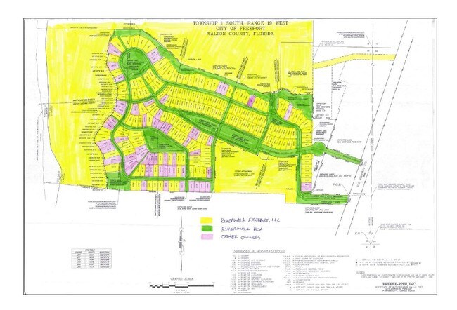
22-1S-19-23000-015-0031
ALL THE N1/2 OF SEC 22-1S-19W E OF FREEPORT CREEK LESS: THE E 660FT ALSO LESS: THE N 330 FT OF THE W 1320FT ALSO LESS: THE PARCEL CONVEYED TO HARVIE ALTMAN & WIFE AS REC IN OR 227-100 OR 1081-267 AND ALSO: COM AT SE/C OF NE1/4 W ALONG 1/4 SEC LIN
Campgroundrvpark
Walton
A
Florida
12131C0557H
31
2025
93.38 AC
2025
Florida Panhandle Area
950502
Other Market Areas
46,904 SF
DEMOGRAPHICS near 193 Jack Crevalle Dr S
1 Mile
3 Mile
5 Mile
2024 Total Population
1,253
7,574
10,160
2029 Population
1,543
9,438
12,604
Pop Growth 2024-2029
+ 23.14%
+ 24.61%
+ 24.06%
Average Age
38
38
38
2024 Total Households
457
2,764
3,749
HH Growth 2024-2029
+ 23.41%
+ 24.96%
+ 24.33%
Median Household Inc
$60,259
$51,544
$49,745
Avg Household Size
2.60
2.70
2.60
2024 Avg HH Vehicles
2.00
2.00
2.00
Median Home Value
$307,051
$295,514
$282,626
Median Year Built
2003
2009
2007
Nearby Places
Map Layers
Map Styles
 Street
 Aerial
- Restaurants
- Banks
- Shops
- Fitness
- Groceries
PUBLIC TRANSPORTATION
AIRPORT
Eglin AFB/Destin-Ft Walton Beach
DRIVE
WALK
Distance
Eglin AFB/Destin-Ft Walton Beach
66 min
31.5 mi
Northwest Florida Beaches International
DRIVE
WALK
Distance
Northwest Florida Beaches International
46 min
32.2 mi
Freight Ports
Port of Panama City
DRIVE
WALK
Distance
Port of Panama City
61 min
40.6 mi
Nearby Properties
Address
Land Use
TOTAL SIZE
Lot Size
Zoning
Address
Land Use
TOTAL SIZE
Lot Size
Zoning
176,047 SF
29.75 AC
Address
Land Use
TOTAL SIZE
Lot Size
Zoning
469,205 SF
21.39 AC
BYLAGR
Address
Land Use
TOTAL SIZE
Lot Size
Zoning
334,804 SF
13.94 AC
MUNI
Address
Land Use
TOTAL SIZE
Lot Size
Zoning
311,974 SF
7.28 AC
Address
Land Use
TOTAL SIZE
Lot Size
Zoning
161,667 SF
26.97 AC
3310
Address
Land Use
TOTAL SIZE
Lot Size
Zoning
63,166 SF
9.06 AC
3310
Address
Land Use
TOTAL SIZE
Lot Size
Zoning
306.09 AC
3310
Address
Land Use
TOTAL SIZE
Lot Size
Zoning
87,549 SF
11 AC
Address
Land Use
TOTAL SIZE
Lot Size
Zoning
1,759 SF
0.63 AC
Address
Land Use
TOTAL SIZE
Lot Size
Zoning
88.24 AC
3310
Address
Land Use
TOTAL SIZE
Lot Size
Zoning
81,765 SF
5.51 AC
BYLAGR
Address
Land Use
TOTAL SIZE
Lot Size
Zoning
2,072 SF
23.08 AC
MUNI
Address
Land Use
TOTAL SIZE
Lot Size
Zoning
5,624 SF
1.35 AC
3310
Address
Land Use
TOTAL SIZE
Lot Size
Zoning
31,217 SF
5.45 AC
3310
Address
Land Use
TOTAL SIZE
Lot Size
Zoning
12,472 SF
10.63 AC
Address
Land Use
TOTAL SIZE
Lot Size
Zoning
51,885 SF
8.65 AC
3310
Address
Land Use
TOTAL SIZE
Lot Size
Zoning
16,297 SF
13.93 AC
Address
Land Use
TOTAL SIZE
Lot Size
Zoning
4,400 SF
6.04 AC
3310
Address
Land Use
TOTAL SIZE
Lot Size
Zoning
16,804 SF
2.07 AC
Address
Land Use
TOTAL SIZE
Lot Size
Zoning
12,290 SF
1.45 AC
Address
Land Use
TOTAL SIZE
Lot Size
Zoning
30,164 SF
2.23 AC
3310
Address
Land Use
TOTAL SIZE
Lot Size
Zoning
10.84 AC
MUNI
Address
Land Use
TOTAL SIZE
Lot Size
Zoning
12,080 SF
3.50 AC
3310
Address
Land Use
TOTAL SIZE
Lot Size
Zoning
924 SF
11.89 AC
3310
Address
Land Use
TOTAL SIZE
Lot Size
Zoning
17,730 SF
2.68 AC
Address
Land Use
TOTAL SIZE
Lot Size
Zoning
9,475 SF
8.45 AC
3310
Address
Land Use
TOTAL SIZE
Lot Size
Zoning
5,040 SF
36.94 AC
Address
Land Use
TOTAL SIZE
Lot Size
Zoning
38,148 SF
4.04 AC
3310
Address
Land Use
TOTAL SIZE
Lot Size
Zoning
59,516 SF
4.84 AC
MUNI
The World's #1 Commercial Real Estate Marketplace
Connect with us
© 2026 CoStar Group
The information above has been obtained from sources believed reliable. While we do not doubt its accuracy we have not verified it and make no guarantee, warranty or representation about it. It is your responsibility to independently confirm its accuracy and completeness. Any projections, opinions, assumptions, or estimates used are for example only and do not represent the current or future performance of the property. The value of this transaction to you depends on tax and other factors which should be evaluated by your tax, financial, and legal advisors. You and your advisors should conduct a careful, independent investigation of the property to determine to your satisfaction the suitability of the property for your needs.