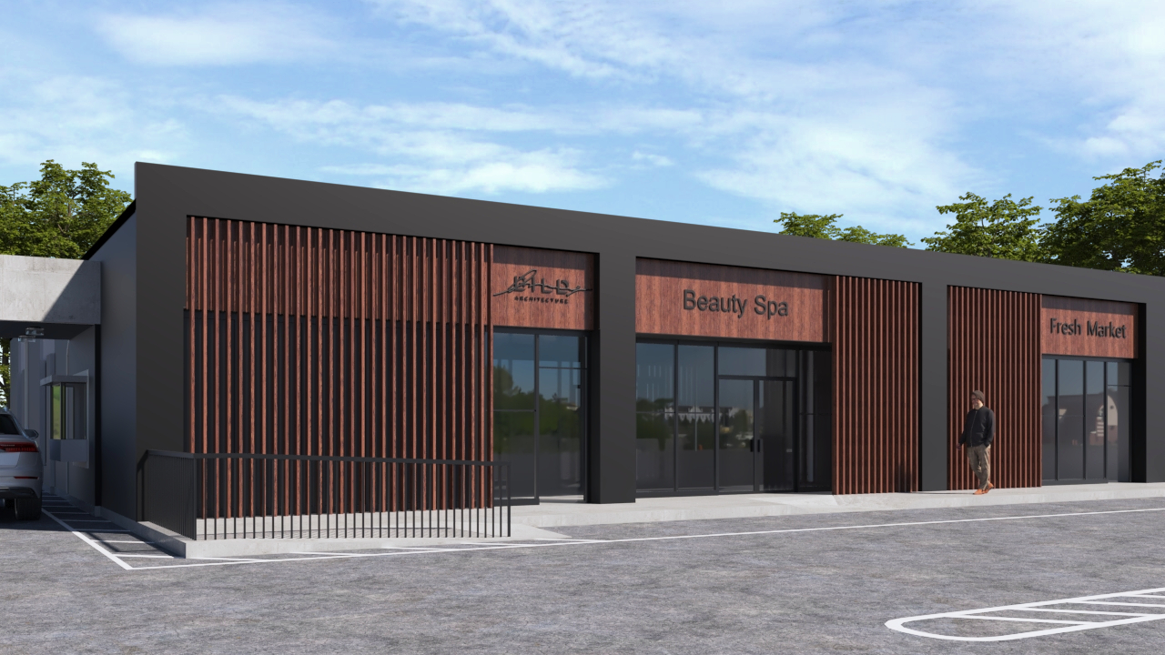
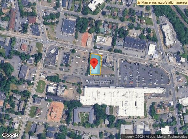
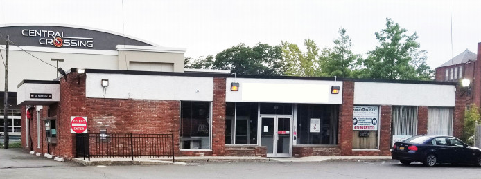
Property Record
193 Route 59, Spring Valley, NY 10977
NEARBY LISTINGS FOR SALE OR LEASE
-
-
-
-
-
No Photo
-
-
-
View all Spring Valley listings for lease on LoopNet.com
Property Detail
193 Route 59
392605-057-055-0001-024-000-0000
Rockland
Financialbuilding
New York
X
24.000
36087C0156G
0.43 AC
2023
Ramapo
2023
Northern New Jersey
012403
New York-Jersey City-White Plains, NY-NJ
5,600 SF
DEMOGRAPHICS near 193 Route 59
1 Mile
3 Mile
5 Mile
2024 Total Population
32,923
144,194
244,664
2029 Population
32,575
143,114
243,960
Pop Growth 2024-2029
(1.06%)
(0.75%)
(0.29%)
Average Age
31
32
36
2024 Total Households
8,586
36,702
70,463
HH Growth 2024-2029
(1.04%)
(0.78%)
(0.24%)
Median Household Inc
$56,959
$80,232
$103,239
Avg Household Size
3.60
3.70
3.30
2024 Avg HH Vehicles
1.00
2.00
2.00
Median Home Value
$377,369
$562,637
$623,806
Median Year Built
1977
1973
1971
Nearby Places
- Restaurants
- Banks
- Shops
- Fitness
- Groceries
PUBLIC TRANSPORTATION
COMMUTER RAIL
Spring Valley (Pascack Valley Line - NJ Transit Commuter Rail (NJ Transit))
DRIVE
WALK
Distance
Spring Valley (Pascack Valley Line - NJ Transit Commuter Rail (NJ Transit))
1 min
7 min
0.4 mi
Nanuet (Pascack Valley Line - NJ Transit Commuter Rail (NJ Transit))
DRIVE
WALK
Distance
Nanuet (Pascack Valley Line - NJ Transit Commuter Rail (NJ Transit))
5 min
2.5 mi
AIRPORT
Westchester County
DRIVE
WALK
Distance
Westchester County
35 min
24.6 mi
Laguardia
DRIVE
WALK
Distance
Laguardia
50 min
34.0 mi
New York Stewart International
DRIVE
WALK
Distance
New York Stewart International
55 min
41.5 mi
Freight Ports
NY - Red Hook Container Terminal
DRIVE
WALK
Distance
NY - Red Hook Container Terminal
56 min
37.3 mi
SALE & LEASE HISTORY
LISTING DATE
SALE/LEASE

Oct 02, 2017
For Lease
Nearby Properties
Address
Land Use
TOTAL SIZE
Lot Size
Zoning
Address
Land Use
TOTAL SIZE
Lot Size
Zoning
171,608 SF
23.10 AC
LI
Address
Land Use
TOTAL SIZE
Lot Size
Zoning
57,447 SF
180.20 AC
LI
Address
Land Use
TOTAL SIZE
Lot Size
Zoning
73,141 SF
174.09 AC
R-50
Address
Land Use
TOTAL SIZE
Lot Size
Zoning
37,600 SF
31.41 AC
Address
Land Use
TOTAL SIZE
Lot Size
Zoning
12,416 SF
39.20 AC
05 - COMME
Address
Land Use
TOTAL SIZE
Lot Size
Zoning
152,854 SF
18.75 AC
RS
Address
Land Use
TOTAL SIZE
Lot Size
Zoning
80,980 SF
21.80 AC
CS
Address
Land Use
TOTAL SIZE
Lot Size
Zoning
67,962 SF
8.30 AC
Address
Land Use
TOTAL SIZE
Lot Size
Zoning
189,652 SF
49.40 AC
Address
Land Use
TOTAL SIZE
Lot Size
Zoning
183,643 SF
24.20 AC
Address
Land Use
TOTAL SIZE
Lot Size
Zoning
11,008 SF
11.95 AC
Address
Land Use
TOTAL SIZE
Lot Size
Zoning
2,220 SF
15.10 AC
Address
Land Use
TOTAL SIZE
Lot Size
Zoning
76,977 SF
21.90 AC
Address
Land Use
TOTAL SIZE
Lot Size
Zoning
7,376 SF
60 AC
Address
Land Use
TOTAL SIZE
Lot Size
Zoning
25.20 AC
Address
Land Use
TOTAL SIZE
Lot Size
Zoning
70,527 SF
10.20 AC
RSH
Address
Land Use
TOTAL SIZE
Lot Size
Zoning
150,981 SF
14.85 AC
LO
Address
Land Use
TOTAL SIZE
Lot Size
Zoning
160,504 SF
14.30 AC
RS
Address
Land Use
TOTAL SIZE
Lot Size
Zoning
246,340 SF
14.91 AC
LI
Address
Land Use
TOTAL SIZE
Lot Size
Zoning
117,950 SF
11.13 AC
05 - COMME
Address
Land Use
TOTAL SIZE
Lot Size
Zoning
141,846 SF
12.81 AC
05 - COMME
Address
Land Use
TOTAL SIZE
Lot Size
Zoning
275,724 SF
40 AC
R1
Address
Land Use
TOTAL SIZE
Lot Size
Zoning
4,492 SF
14.50 AC
Address
Land Use
TOTAL SIZE
Lot Size
Zoning
64,024 SF
7.30 AC
Address
Land Use
TOTAL SIZE
Lot Size
Zoning
101,628 SF
9.23 AC
05 - COMME
Address
Land Use
TOTAL SIZE
Lot Size
Zoning
38,056 SF
21.21 AC
R-15C
Address
Land Use
TOTAL SIZE
Lot Size
Zoning
78,895 SF
18.20 AC
Address
Land Use
TOTAL SIZE
Lot Size
Zoning
57,225 SF
4.60 AC
05 - COMME
Address
Land Use
TOTAL SIZE
Lot Size
Zoning
121,674 SF
11.53 AC
Address
Land Use
TOTAL SIZE
Lot Size
Zoning
1,656 SF
20 AC
The World's #1 Commercial Real Estate Marketplace
Connect with us
© 2025 CoStar Group
The information above has been obtained from sources believed reliable. While we do not doubt its accuracy we have not verified it and make no guarantee, warranty or representation about it. It is your responsibility to independently confirm its accuracy and completeness. Any projections, opinions, assumptions, or estimates used are for example only and do not represent the current or future performance of the property. The value of this transaction to you depends on tax and other factors which should be evaluated by your tax, financial, and legal advisors. You and your advisors should conduct a careful, independent investigation of the property to determine to your satisfaction the suitability of the property for your needs.