No Photo
Property Record
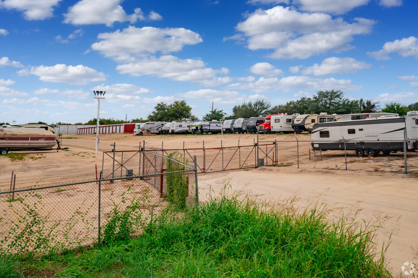
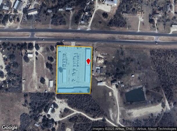
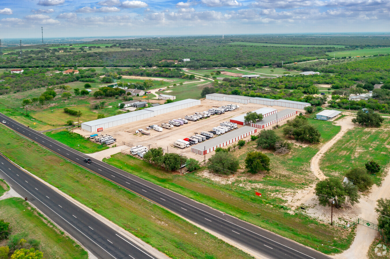
1934 Us Highway 90 W, Castroville, TX 78009
NEARBY LISTINGS FOR SALE OR LEASE
-
-
View all Castroville listings for sale on LoopNet.com
Property Detail
1934 Us Highway 90 W
San Antonio-New Braunfels, TX
Matt Hutzler Subdivision
58524
MATT HUTZLER SUBDIVISION LOT 3
Commercialnec
Medina
X
Texas
48325C0510D
3
2023
5.10 AC
2024
Medina County
000103
San Antonio
40,920 SF
DEMOGRAPHICS near 1934 Us Highway 90 W
1 Mile
3 Mile
5 Mile
2024 Total Population
739
7,091
9,484
2029 Population
826
8,032
10,785
Pop Growth 2024-2029
+ 11.77%
+ 13.27%
+ 13.72%
Average Age
43
42
41
2024 Total Households
273
2,494
3,297
HH Growth 2024-2029
+ 12.09%
+ 13.63%
+ 14.07%
Median Household Inc
$83,928
$74,326
$74,587
Avg Household Size
2.70
2.80
2.80
2024 Avg HH Vehicles
2.00
2.00
2.00
Median Home Value
$319,791
$224,301
$199,837
Median Year Built
1990
1993
1995
Nearby Places
- Restaurants
- Banks
- Shops
- Fitness
- Groceries
PUBLIC TRANSPORTATION
AIRPORT
San Antonio International
DRIVE
WALK
Distance
San Antonio International
38 min
31.7 mi
Freight Ports
Port of Corpus Christi
DRIVE
WALK
Distance
Port of Corpus Christi
174 min
167.2 mi
Nearby Properties
Address
Land Use
TOTAL SIZE
Lot Size
Zoning
Address
Land Use
TOTAL SIZE
Lot Size
Zoning
165,943 SF
16.91 AC
Address
Land Use
TOTAL SIZE
Lot Size
Zoning
1,844 SF
2.23 AC
Address
Land Use
TOTAL SIZE
Lot Size
Zoning
3,594 SF
2.23 AC
Address
Land Use
TOTAL SIZE
Lot Size
Zoning
7,564 SF
10.40 AC
Address
Land Use
TOTAL SIZE
Lot Size
Zoning
14,300 SF
3.30 AC
Address
Land Use
TOTAL SIZE
Lot Size
Zoning
4,516 SF
2.66 AC
Address
Land Use
TOTAL SIZE
Lot Size
Zoning
32,986 SF
1.91 AC
Address
Land Use
TOTAL SIZE
Lot Size
Zoning
7,209 SF
4 AC
Address
Land Use
TOTAL SIZE
Lot Size
Zoning
1,704 SF
2.33 AC
Address
Land Use
TOTAL SIZE
Lot Size
Zoning
35,528 SF
2.56 AC
Address
Land Use
TOTAL SIZE
Lot Size
Zoning
191.40 AC
Address
Land Use
TOTAL SIZE
Lot Size
Zoning
5,527 SF
4.08 AC
Address
Land Use
TOTAL SIZE
Lot Size
Zoning
9,004 SF
0.92 AC
Address
Land Use
TOTAL SIZE
Lot Size
Zoning
10,080 SF
5 AC
Address
Land Use
TOTAL SIZE
Lot Size
Zoning
3,370 SF
5.01 AC
Address
Land Use
TOTAL SIZE
Lot Size
Zoning
3,727 SF
1.69 AC
Address
Land Use
TOTAL SIZE
Lot Size
Zoning
27,443 SF
4.27 AC
Address
Land Use
TOTAL SIZE
Lot Size
Zoning
9,195 SF
0.86 AC
Address
Land Use
TOTAL SIZE
Lot Size
Zoning
37,390 SF
1.61 AC
Address
Land Use
TOTAL SIZE
Lot Size
Zoning
29,000 SF
0.84 AC
Address
Land Use
TOTAL SIZE
Lot Size
Zoning
7,900 SF
6.31 AC
Address
Land Use
TOTAL SIZE
Lot Size
Zoning
34,200 SF
9.45 AC
Address
Land Use
TOTAL SIZE
Lot Size
Zoning
19,471 SF
1.18 AC
Address
Land Use
TOTAL SIZE
Lot Size
Zoning
19,447 SF
5.42 AC
Address
Land Use
TOTAL SIZE
Lot Size
Zoning
12,766 SF
0.66 AC
Address
Land Use
TOTAL SIZE
Lot Size
Zoning
23,486 SF
0.72 AC
Address
Land Use
TOTAL SIZE
Lot Size
Zoning
12,126 SF
75.56 AC
Address
Land Use
TOTAL SIZE
Lot Size
Zoning
7,800 SF
0.52 AC
Address
Land Use
TOTAL SIZE
Lot Size
Zoning
2,664 SF
1.22 AC
The World's #1 Commercial Real Estate Marketplace
Connect with us
© 2025 CoStar Group
The information above has been obtained from sources believed reliable. While we do not doubt its accuracy we have not verified it and make no guarantee, warranty or representation about it. It is your responsibility to independently confirm its accuracy and completeness. Any projections, opinions, assumptions, or estimates used are for example only and do not represent the current or future performance of the property. The value of this transaction to you depends on tax and other factors which should be evaluated by your tax, financial, and legal advisors. You and your advisors should conduct a careful, independent investigation of the property to determine to your satisfaction the suitability of the property for your needs.