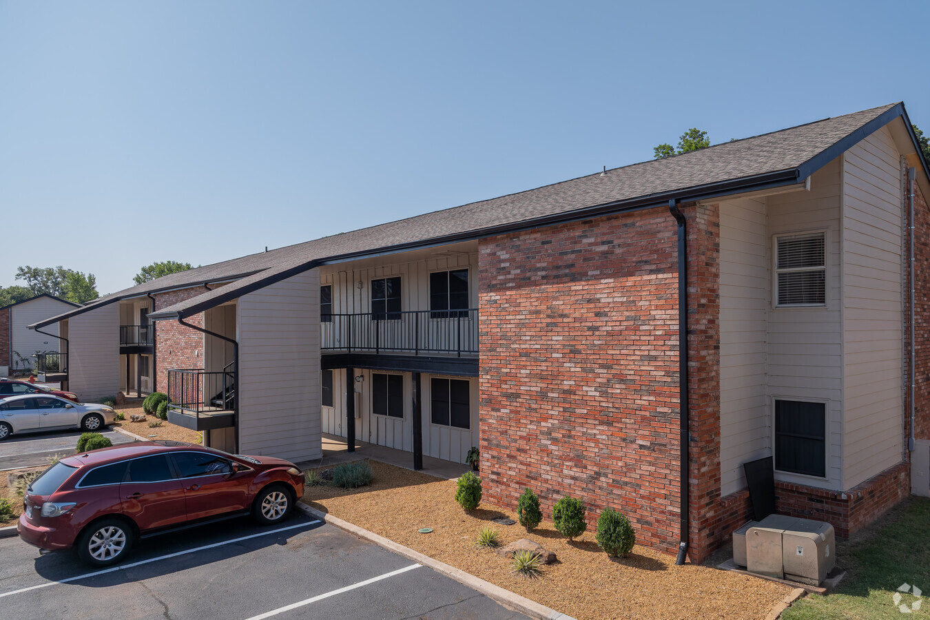
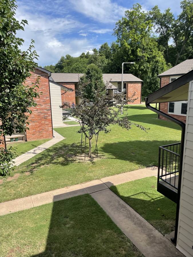
Property Record
1936 Fillmore Ave, Norman, OK 73072
NEARBY LISTINGS FOR SALE OR LEASE
Property Detail
1936 Fillmore Ave
R0041962
Presidential 1
Multifamilydwelling
PRESIDENTIAL NO 1 BLK 4 AND PRT SE/4 2-8-3W BEG NWLY MOST CORNER S33 W74.135`S49 E699.205` N48 E80` N41 W197.64` N52 W524.96` POB
AE
Cleveland
40027C0280J
Oklahoma
2023
5.30 AC
2023
Outer Norman
201104
Oklahoma City
109,851 SF
Oklahoma City, OK
DEMOGRAPHICS near 1936 Fillmore Ave
1 Mile
3 Mile
5 Mile
2024 Total Population
5,343
51,689
115,280
2029 Population
5,570
54,106
121,114
Pop Growth 2024-2029
+ 4.25%
+ 4.68%
+ 5.06%
Average Age
39
36
36
2024 Total Households
2,339
19,734
46,151
HH Growth 2024-2029
+ 4.40%
+ 5.15%
+ 5.31%
Median Household Inc
$44,387
$51,639
$55,208
Avg Household Size
2.20
2.10
2.20
2024 Avg HH Vehicles
1.00
2.00
2.00
Median Home Value
$204,369
$231,416
$209,740
Median Year Built
1977
1978
1986
Nearby Places
- Restaurants
- Banks
- Shops
- Fitness
- Groceries
PUBLIC TRANSPORTATION
COMMUTER RAIL
Norman Amtrak Station (Heartland Flyer - Amtrak)
DRIVE
WALK
Distance
Norman Amtrak Station (Heartland Flyer - Amtrak)
10 min
3.9 mi
AIRPORT
Will Rogers World
DRIVE
WALK
Distance
Will Rogers World
35 min
22.6 mi
Freight Ports
Tulsa Port Of Catoosa
DRIVE
WALK
Distance
Tulsa Port Of Catoosa
157 min
141.8 mi
Nearby Properties
Address
Land Use
TOTAL SIZE
Lot Size
Zoning
Address
Land Use
TOTAL SIZE
Lot Size
Zoning
24.50 AC
Address
Land Use
TOTAL SIZE
Lot Size
Zoning
18,644 SF
2.16 AC
CO
Address
Land Use
TOTAL SIZE
Lot Size
Zoning
4.86 AC
Address
Land Use
TOTAL SIZE
Lot Size
Zoning
3.75 AC
Address
Land Use
TOTAL SIZE
Lot Size
Zoning
Address
Land Use
TOTAL SIZE
Lot Size
Zoning
Address
Land Use
TOTAL SIZE
Lot Size
Zoning
Address
Land Use
TOTAL SIZE
Lot Size
Zoning
0.86 AC
Address
Land Use
TOTAL SIZE
Lot Size
Zoning
Address
Land Use
TOTAL SIZE
Lot Size
Zoning
60,000 SF
4.39 AC
RM
Address
Land Use
TOTAL SIZE
Lot Size
Zoning
Address
Land Use
TOTAL SIZE
Lot Size
Zoning
7.20 AC
Address
Land Use
TOTAL SIZE
Lot Size
Zoning
Address
Land Use
TOTAL SIZE
Lot Size
Zoning
18,768 SF
2.43 AC
CO
Address
Land Use
TOTAL SIZE
Lot Size
Zoning
0.41 AC
R2
Address
Land Use
TOTAL SIZE
Lot Size
Zoning
0.33 AC
R2
Address
Land Use
TOTAL SIZE
Lot Size
Zoning
Address
Land Use
TOTAL SIZE
Lot Size
Zoning
24,641 SF
3 AC
Address
Land Use
TOTAL SIZE
Lot Size
Zoning
32,789 SF
9.50 AC
I1
Address
Land Use
TOTAL SIZE
Lot Size
Zoning
3.70 AC
Address
Land Use
TOTAL SIZE
Lot Size
Zoning
20,270 SF
1.17 AC
R1
Address
Land Use
TOTAL SIZE
Lot Size
Zoning
11,391 SF
1.10 AC
Address
Land Use
TOTAL SIZE
Lot Size
Zoning
9.53 AC
Address
Land Use
TOTAL SIZE
Lot Size
Zoning
13,005 SF
18.37 AC
Address
Land Use
TOTAL SIZE
Lot Size
Zoning
83,482 SF
5.36 AC
C2
Address
Land Use
TOTAL SIZE
Lot Size
Zoning
443,969 SF
32.37 AC
C2
Address
Land Use
TOTAL SIZE
Lot Size
Zoning
0.40 AC
R2
Address
Land Use
TOTAL SIZE
Lot Size
Zoning
2.92 AC
Address
Land Use
TOTAL SIZE
Lot Size
Zoning
35,127 SF
2.34 AC
C2
The World's #1 Commercial Real Estate Marketplace
Connect with us
© 2025 CoStar Group
The information above has been obtained from sources believed reliable. While we do not doubt its accuracy we have not verified it and make no guarantee, warranty or representation about it. It is your responsibility to independently confirm its accuracy and completeness. Any projections, opinions, assumptions, or estimates used are for example only and do not represent the current or future performance of the property. The value of this transaction to you depends on tax and other factors which should be evaluated by your tax, financial, and legal advisors. You and your advisors should conduct a careful, independent investigation of the property to determine to your satisfaction the suitability of the property for your needs.