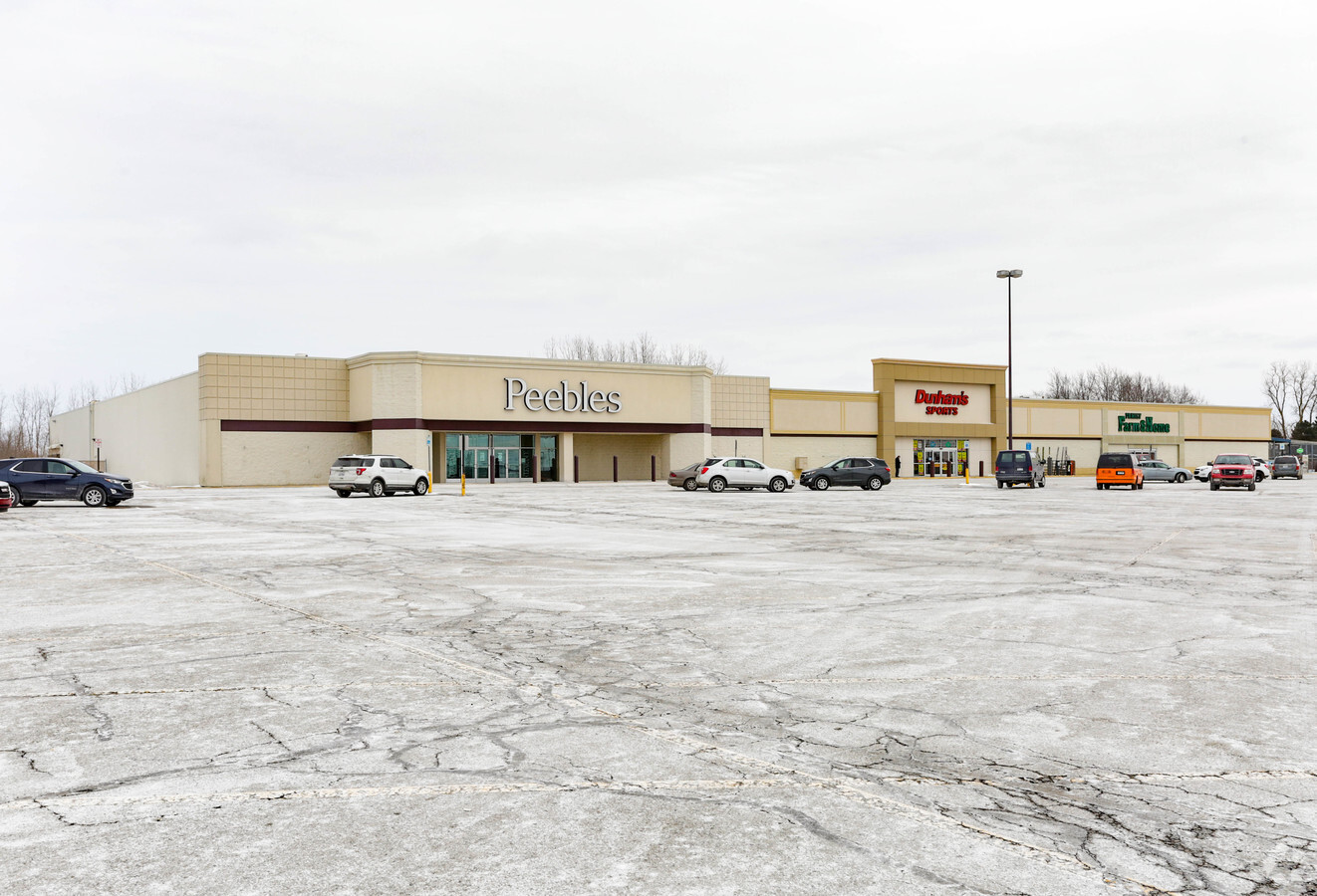
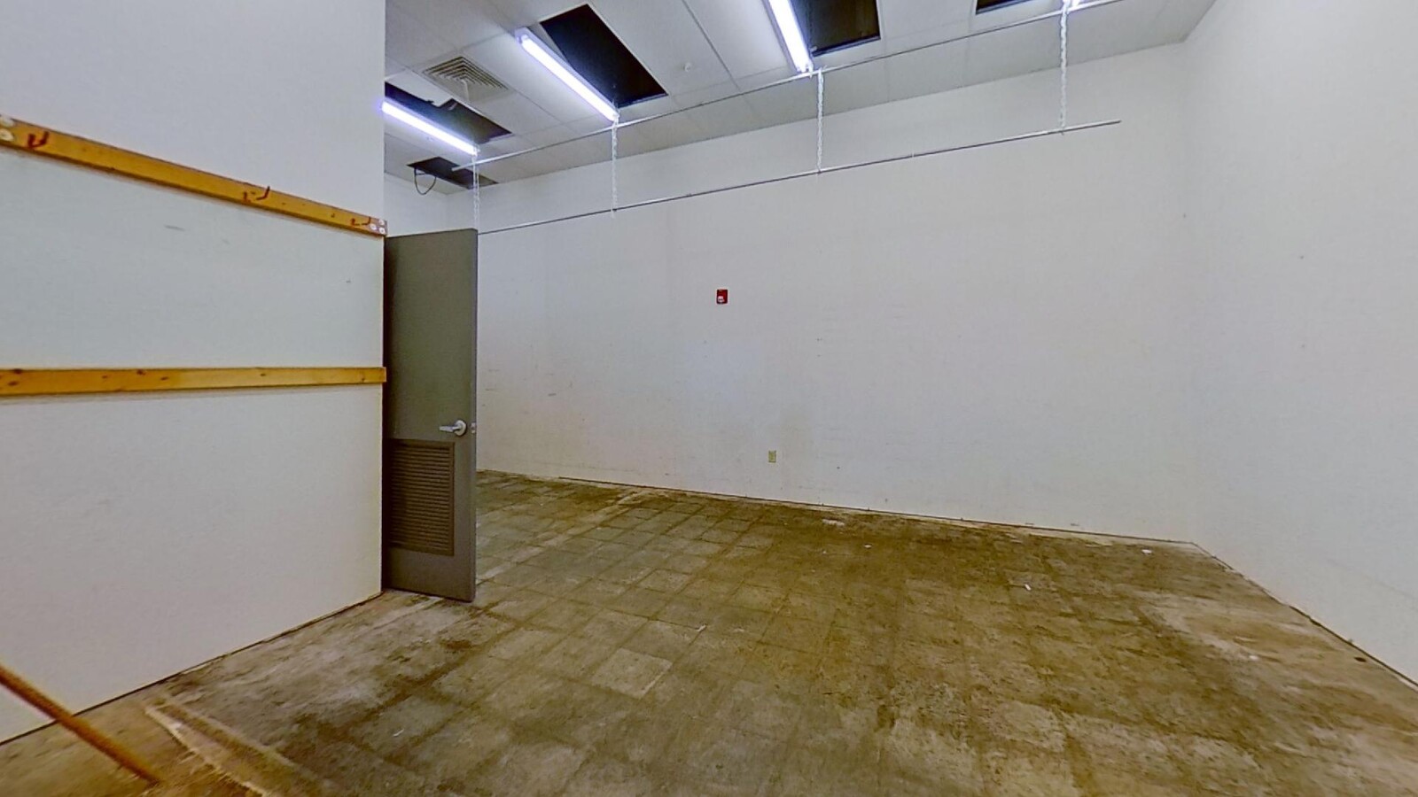
Property Record
1939 S Scott Rd, Saint Johns, MI 48879
NEARBY LISTINGS FOR SALE OR LEASE
Property Detail
1939 S Scott Rd
030-015-300-092-00
COM E 260.94 FT FROM SW COR OF SEC 15 T7N R2W, N 388.84 FT, E 46.19 FT, N 227FT, E 337.41 FT, S 137.24 FT, E 369.50 FT, S 488.38 FT, W 753.16 FT TO BEG.
Stripcommercialcenter
Clinton
X
Michigan
26037C0181D
9.33 AC
2023
Outlying Clinton County
2024
West Michigan
010901
Lansing-East Lansing, MI
70,510 SF
DEMOGRAPHICS near 1939 S Scott Rd
1 Mile
3 Mile
5 Mile
2024 Total Population
2,571
10,506
12,688
2029 Population
2,616
10,731
12,936
Pop Growth 2024-2029
+ 1.75%
+ 2.14%
+ 1.95%
Average Age
43
42
42
2024 Total Households
1,080
4,351
5,153
HH Growth 2024-2029
+ 1.67%
+ 2.09%
+ 1.94%
Median Household Inc
$77,168
$71,261
$73,773
Avg Household Size
2.30
2.30
2.40
2024 Avg HH Vehicles
2.00
2.00
2.00
Median Home Value
$200,769
$182,823
$193,445
Median Year Built
1976
1970
1971
Nearby Places
- Restaurants
- Banks
- Shops
- Fitness
- Groceries
PUBLIC TRANSPORTATION
AIRPORT
Capital Region International
DRIVE
WALK
Distance
Capital Region International
29 min
19.1 mi
Freight Ports
Port of Toledo
DRIVE
WALK
Distance
Port of Toledo
165 min
131.9 mi
SALE & LEASE HISTORY
LISTING DATE
SALE/LEASE

Sep 24, 2016
For Sale
Dec 03, 2020
For Lease
Nearby Properties
Address
Land Use
TOTAL SIZE
Lot Size
Zoning
Address
Land Use
TOTAL SIZE
Lot Size
Zoning
375,000 SF
Address
Land Use
TOTAL SIZE
Lot Size
Zoning
339,220 SF
36.58 AC
I-1
Address
Land Use
TOTAL SIZE
Lot Size
Zoning
106,182 SF
65 AC
Address
Land Use
TOTAL SIZE
Lot Size
Zoning
46,540 SF
13.78 AC
RO
Address
Land Use
TOTAL SIZE
Lot Size
Zoning
116.63 AC
A2
Address
Land Use
TOTAL SIZE
Lot Size
Zoning
137,552 SF
16.85 AC
I-2
Address
Land Use
TOTAL SIZE
Lot Size
Zoning
75,000 SF
Address
Land Use
TOTAL SIZE
Lot Size
Zoning
163,881 SF
14.07 AC
I-1
Address
Land Use
TOTAL SIZE
Lot Size
Zoning
190,942 SF
18.57 AC
C-2
Address
Land Use
TOTAL SIZE
Lot Size
Zoning
80 AC
AGR
Address
Land Use
TOTAL SIZE
Lot Size
Zoning
79,006 SF
31.12 AC
R3
Address
Land Use
TOTAL SIZE
Lot Size
Zoning
24,890 SF
8.13 AC
R3
Address
Land Use
TOTAL SIZE
Lot Size
Zoning
54,390 SF
22.62 AC
MC
Address
Land Use
TOTAL SIZE
Lot Size
Zoning
22,740 SF
4.13 AC
GC
Address
Land Use
TOTAL SIZE
Lot Size
Zoning
36,505 SF
14.76 AC
GC
Address
Land Use
TOTAL SIZE
Lot Size
Zoning
6,208 SF
7.09 AC
R3
Address
Land Use
TOTAL SIZE
Lot Size
Zoning
69,347 SF
11.25 AC
GC
Address
Land Use
TOTAL SIZE
Lot Size
Zoning
51,312 SF
5.60 AC
GC
Address
Land Use
TOTAL SIZE
Lot Size
Zoning
34,423 SF
2.92 AC
O
Address
Land Use
TOTAL SIZE
Lot Size
Zoning
50,630 SF
2.77 AC
R3
Address
Land Use
TOTAL SIZE
Lot Size
Zoning
13,300 SF
32.81 AC
A-2
Address
Land Use
TOTAL SIZE
Lot Size
Zoning
17,141 SF
2.91 AC
I-1
Address
Land Use
TOTAL SIZE
Lot Size
Zoning
7,520 SF
3.21 AC
R3
Address
Land Use
TOTAL SIZE
Lot Size
Zoning
17,760 SF
3.59 AC
R3
Address
Land Use
TOTAL SIZE
Lot Size
Zoning
792 SF
14.48 AC
RMH
Address
Land Use
TOTAL SIZE
Lot Size
Zoning
17,760 SF
3.42 AC
R3
Address
Land Use
TOTAL SIZE
Lot Size
Zoning
8,897 SF
2.89 AC
GC
Address
Land Use
TOTAL SIZE
Lot Size
Zoning
89,500 SF
15.03 AC
C-2
Address
Land Use
TOTAL SIZE
Lot Size
Zoning
54,154 SF
4.28 AC
I-1
The World's #1 Commercial Real Estate Marketplace
Connect with us
© 2025 CoStar Group
The information above has been obtained from sources believed reliable. While we do not doubt its accuracy we have not verified it and make no guarantee, warranty or representation about it. It is your responsibility to independently confirm its accuracy and completeness. Any projections, opinions, assumptions, or estimates used are for example only and do not represent the current or future performance of the property. The value of this transaction to you depends on tax and other factors which should be evaluated by your tax, financial, and legal advisors. You and your advisors should conduct a careful, independent investigation of the property to determine to your satisfaction the suitability of the property for your needs.