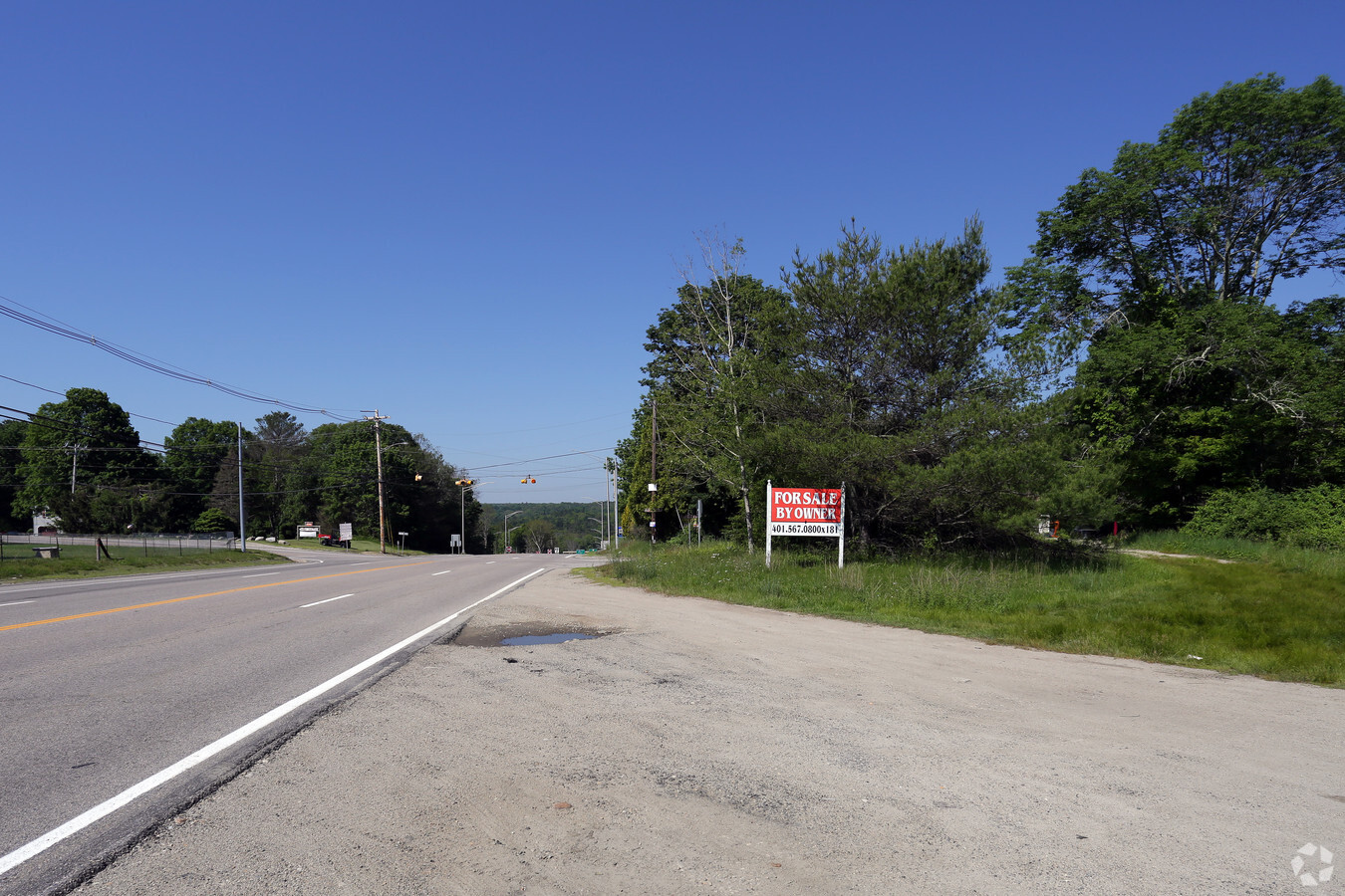
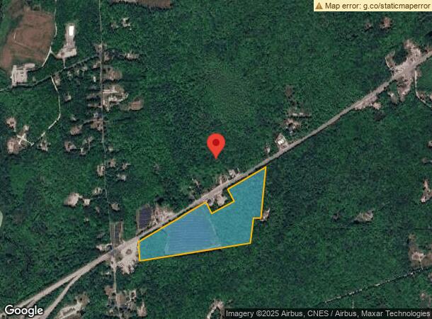
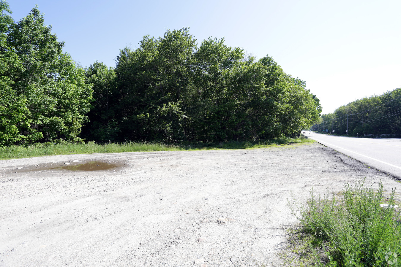
Property Record
194 Danielson Pike, Foster, RI 02825
NEARBY LISTINGS FOR SALE OR LEASE
-
-
View all Foster listings for sale on LoopNet.com
Property Detail
194 Danielson Pike
FOST-000010-000000-000087
Providence
Commercialacreage
Rhode Island
X
87
44007C0245H
30.98 AC
2024
Foster/Scituate
2024
Providence
013300
Providence-Warwick, RI-MA
DEMOGRAPHICS near 194 Danielson Pike
1 Mile
3 Mile
5 Mile
2024 Total Population
316
3,416
14,703
2029 Population
312
3,371
14,643
Pop Growth 2024-2029
(1.27%)
(1.32%)
(0.41%)
Average Age
44
44
43
2024 Total Households
125
1,357
5,972
HH Growth 2024-2029
(1.60%)
(1.25%)
(0.32%)
Median Household Inc
$88,602
$87,019
$76,586
Avg Household Size
2.50
2.50
2.40
2024 Avg HH Vehicles
2.00
2.00
2.00
Median Home Value
$264,893
$277,087
$262,060
Median Year Built
1976
1979
1971
Nearby Places
- Restaurants
- Banks
- Shops
- Fitness
- Groceries
PUBLIC TRANSPORTATION
AIRPORT
Rhode Island Tf Green International
DRIVE
WALK
Distance
Rhode Island Tf Green International
35 min
26.1 mi
Freight Ports
Port of Davisville, RI
DRIVE
WALK
Distance
Port of Davisville, RI
47 min
35.3 mi
Nearby Properties
Address
Land Use
TOTAL SIZE
Lot Size
Zoning
Address
Land Use
TOTAL SIZE
Lot Size
Zoning
50,170 SF
17.22 AC
30
Address
Land Use
TOTAL SIZE
Lot Size
Zoning
6,250 SF
225 AC
RD
Address
Land Use
TOTAL SIZE
Lot Size
Zoning
Address
Land Use
TOTAL SIZE
Lot Size
Zoning
4,528 SF
7.10 AC
1
Address
Land Use
TOTAL SIZE
Lot Size
Zoning
15,840 SF
14.90 AC
RD
Address
Land Use
TOTAL SIZE
Lot Size
Zoning
647 AC
RD
Address
Land Use
TOTAL SIZE
Lot Size
Zoning
9,828 SF
10.16 AC
1
Address
Land Use
TOTAL SIZE
Lot Size
Zoning
6,820 SF
1.50 AC
20
Address
Land Use
TOTAL SIZE
Lot Size
Zoning
10,545 SF
23 AC
30
Address
Land Use
TOTAL SIZE
Lot Size
Zoning
1,728 SF
13.01 AC
1
Address
Land Use
TOTAL SIZE
Lot Size
Zoning
1,161 SF
6.10 AC
1
Address
Land Use
TOTAL SIZE
Lot Size
Zoning
1,696 SF
5 AC
1
Address
Land Use
TOTAL SIZE
Lot Size
Zoning
1,638 SF
2.75 AC
30
Address
Land Use
TOTAL SIZE
Lot Size
Zoning
4,208 SF
0.50 AC
30
Address
Land Use
TOTAL SIZE
Lot Size
Zoning
10,544 SF
4.40 AC
RD
Address
Land Use
TOTAL SIZE
Lot Size
Zoning
2,000 SF
99.10 AC
30
Address
Land Use
TOTAL SIZE
Lot Size
Zoning
768 SF
5.30 AC
1
Address
Land Use
TOTAL SIZE
Lot Size
Zoning
1,408 SF
1 AC
30
Address
Land Use
TOTAL SIZE
Lot Size
Zoning
2,286 SF
40.04 AC
30
Address
Land Use
TOTAL SIZE
Lot Size
Zoning
1,184 SF
2 AC
1
Address
Land Use
TOTAL SIZE
Lot Size
Zoning
1,793 SF
1 AC
1
Address
Land Use
TOTAL SIZE
Lot Size
Zoning
1,386 SF
0.62 AC
1
Address
Land Use
TOTAL SIZE
Lot Size
Zoning
3,012 SF
4.59 AC
30
Address
Land Use
TOTAL SIZE
Lot Size
Zoning
552 SF
2.30 AC
1
Address
Land Use
TOTAL SIZE
Lot Size
Zoning
6,863 SF
23.09 AC
30
Address
Land Use
TOTAL SIZE
Lot Size
Zoning
10,000 SF
13.46 AC
1
Address
Land Use
TOTAL SIZE
Lot Size
Zoning
1,920 SF
16.43 AC
30
Address
Land Use
TOTAL SIZE
Lot Size
Zoning
3,772 SF
9.30 AC
30
Address
Land Use
TOTAL SIZE
Lot Size
Zoning
2,964 SF
11 AC
1
The World's #1 Commercial Real Estate Marketplace
Connect with us
© 2025 CoStar Group
The information above has been obtained from sources believed reliable. While we do not doubt its accuracy we have not verified it and make no guarantee, warranty or representation about it. It is your responsibility to independently confirm its accuracy and completeness. Any projections, opinions, assumptions, or estimates used are for example only and do not represent the current or future performance of the property. The value of this transaction to you depends on tax and other factors which should be evaluated by your tax, financial, and legal advisors. You and your advisors should conduct a careful, independent investigation of the property to determine to your satisfaction the suitability of the property for your needs.