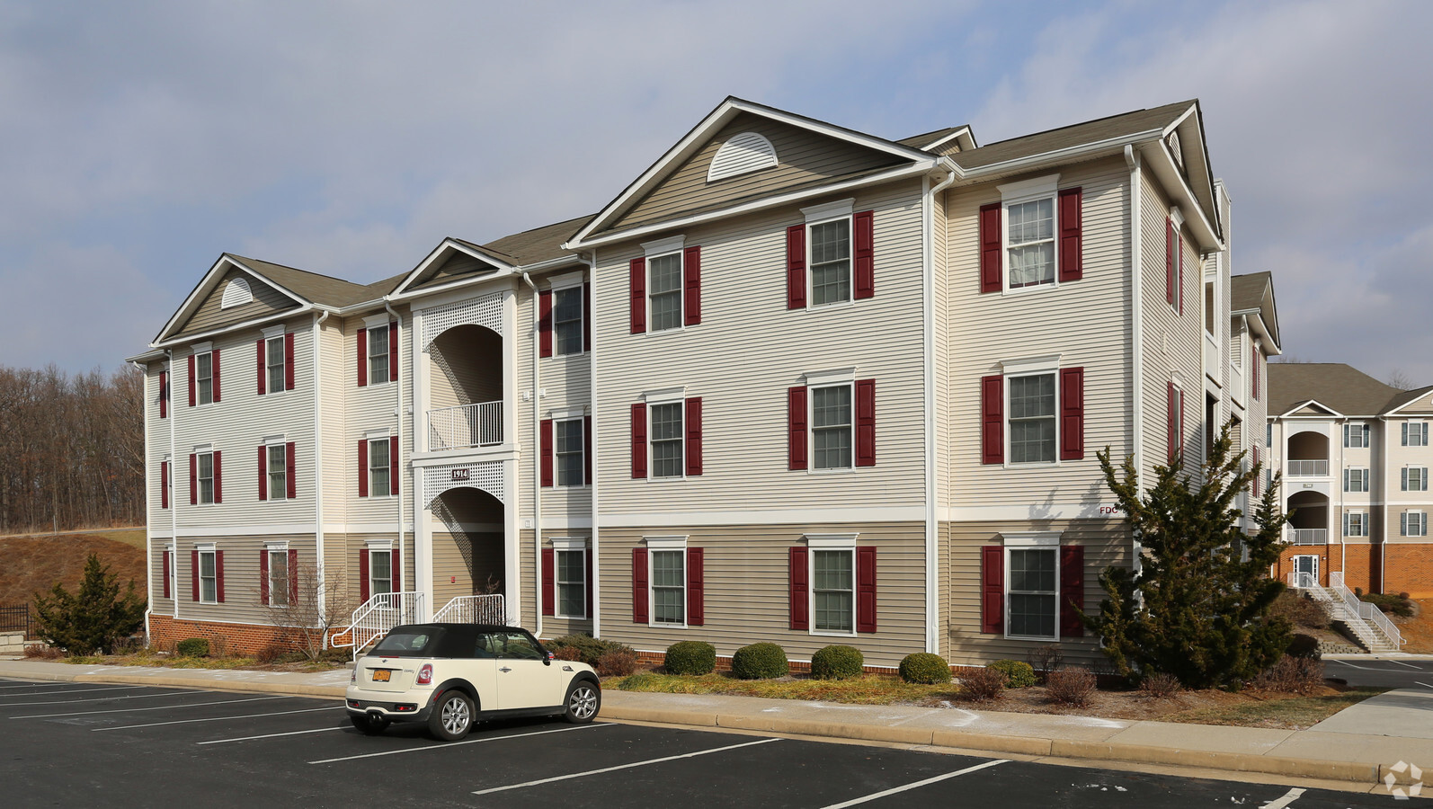
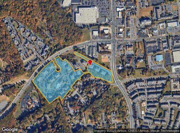
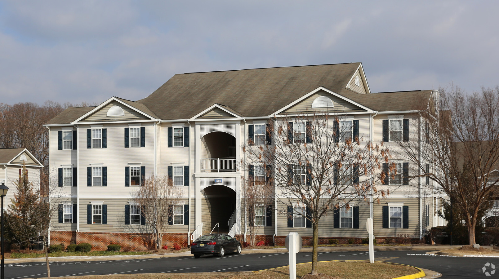
Property Record
1941 Sunchase Dr, Harrisonburg, VA 22801
NEARBY LISTINGS FOR SALE OR LEASE
Property Detail
1941 Sunchase Dr
084-A-14
Sunchase Subdivision
Multifamilydwelling
SS STONEY DR
AE
Harrisonburg
51165C0411D
Virginia
2024
204 AC
2024
Staunton & Harrisonburg
000205
Other Market Areas
16,620 SF
Harrisonburg, VA
DEMOGRAPHICS near 1941 Sunchase Dr
1 Mile
3 Mile
5 Mile
2024 Total Population
14,692
58,867
73,644
2029 Population
14,659
58,787
73,812
Pop Growth 2024-2029
(0.22%)
(0.14%)
+ 0.23%
Average Age
28
33
35
2024 Total Households
4,751
20,083
25,637
HH Growth 2024-2029
(0.11%)
(0.04%)
+ 0.26%
Median Household Inc
$40,465
$58,253
$61,529
Avg Household Size
2.50
2.60
2.50
2024 Avg HH Vehicles
2.00
2.00
2.00
Median Home Value
$240,857
$269,882
$291,035
Median Year Built
1999
1991
1990
Nearby Places
- Restaurants
- Banks
- Shops
- Fitness
- Groceries
PUBLIC TRANSPORTATION
AIRPORT
Charlottesville-Albemarle
DRIVE
WALK
Distance
Charlottesville-Albemarle
65 min
45.3 mi
Freight Ports
Virginia Port Authority - Richmond
DRIVE
WALK
Distance
Virginia Port Authority - Richmond
159 min
121.7 mi
Nearby Properties
Address
Land Use
TOTAL SIZE
Lot Size
Zoning
Address
Land Use
TOTAL SIZE
Lot Size
Zoning
143.09 AC
MULTI DWEL
Address
Land Use
TOTAL SIZE
Lot Size
Zoning
68.88 AC
GENERAL IN
Address
Land Use
TOTAL SIZE
Lot Size
Zoning
114.53 AC
MULTI DWEL
Address
Land Use
TOTAL SIZE
Lot Size
Zoning
9.63 AC
MULTI DWEL
Address
Land Use
TOTAL SIZE
Lot Size
Zoning
Address
Land Use
TOTAL SIZE
Lot Size
Zoning
49.87 AC
GENERAL BU
Address
Land Use
TOTAL SIZE
Lot Size
Zoning
100,172 SF
0.78 AC
MULTI DWEL
Address
Land Use
TOTAL SIZE
Lot Size
Zoning
3,960 SF
0.01 AC
MULTI DWEL
Address
Land Use
TOTAL SIZE
Lot Size
Zoning
36.81 AC
PLANNED RE
Address
Land Use
TOTAL SIZE
Lot Size
Zoning
219,561 SF
55.38 AC
GENERAL IN
Address
Land Use
TOTAL SIZE
Lot Size
Zoning
11.56 AC
GENERAL BU
Address
Land Use
TOTAL SIZE
Lot Size
Zoning
510,400 SF
36.28 AC
GENERAL IN
Address
Land Use
TOTAL SIZE
Lot Size
Zoning
11.07 AC
RESIDENTIA
Address
Land Use
TOTAL SIZE
Lot Size
Zoning
236,916 SF
3.72 AC
MULTI DWEL
Address
Land Use
TOTAL SIZE
Lot Size
Zoning
4,128 SF
0.65 AC
MULTI DWEL
Address
Land Use
TOTAL SIZE
Lot Size
Zoning
16,620 SF
204 AC
HIGH DENSI
Address
Land Use
TOTAL SIZE
Lot Size
Zoning
14,490 SF
190 AC
PLANNED UN
Address
Land Use
TOTAL SIZE
Lot Size
Zoning
4,455 SF
0.02 AC
MULTI DWEL
Address
Land Use
TOTAL SIZE
Lot Size
Zoning
86,400 SF
37.26 AC
GENERAL BU
Address
Land Use
TOTAL SIZE
Lot Size
Zoning
14,856 SF
168 AC
MULTI DWEL
Address
Land Use
TOTAL SIZE
Lot Size
Zoning
87,927 SF
18.07 AC
GENERAL BU
Address
Land Use
TOTAL SIZE
Lot Size
Zoning
5,000 SF
12.96 AC
GENERAL IN
Address
Land Use
TOTAL SIZE
Lot Size
Zoning
6.10 AC
PLANNED MU
Address
Land Use
TOTAL SIZE
Lot Size
Zoning
MULTI DWEL
Address
Land Use
TOTAL SIZE
Lot Size
Zoning
99,334 SF
19.46 AC
GENERAL BU
Address
Land Use
TOTAL SIZE
Lot Size
Zoning
12.17 AC
PLANNED RE
Address
Land Use
TOTAL SIZE
Lot Size
Zoning
55,440 SF
3.41 AC
MULTI DWEL
Address
Land Use
TOTAL SIZE
Lot Size
Zoning
4,630 SF
17.31 AC
R3
Address
Land Use
TOTAL SIZE
Lot Size
Zoning
53,840 SF
19.68 AC
GENERAL BU
Address
Land Use
TOTAL SIZE
Lot Size
Zoning
146,940 SF
32.91 AC
SINGLE FAM
The World's #1 Commercial Real Estate Marketplace
Connect with us
© 2025 CoStar Group
The information above has been obtained from sources believed reliable. While we do not doubt its accuracy we have not verified it and make no guarantee, warranty or representation about it. It is your responsibility to independently confirm its accuracy and completeness. Any projections, opinions, assumptions, or estimates used are for example only and do not represent the current or future performance of the property. The value of this transaction to you depends on tax and other factors which should be evaluated by your tax, financial, and legal advisors. You and your advisors should conduct a careful, independent investigation of the property to determine to your satisfaction the suitability of the property for your needs.