Property Record
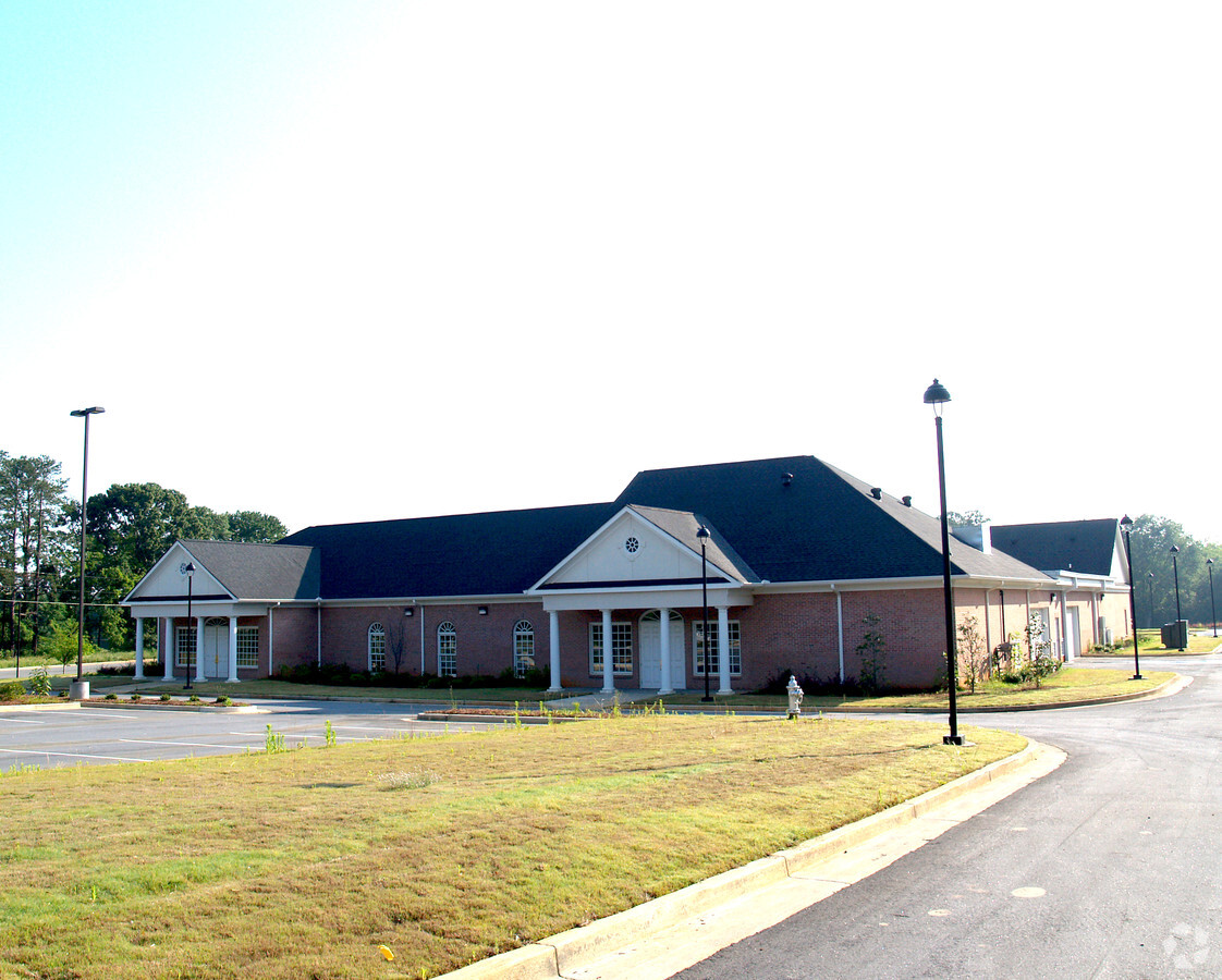
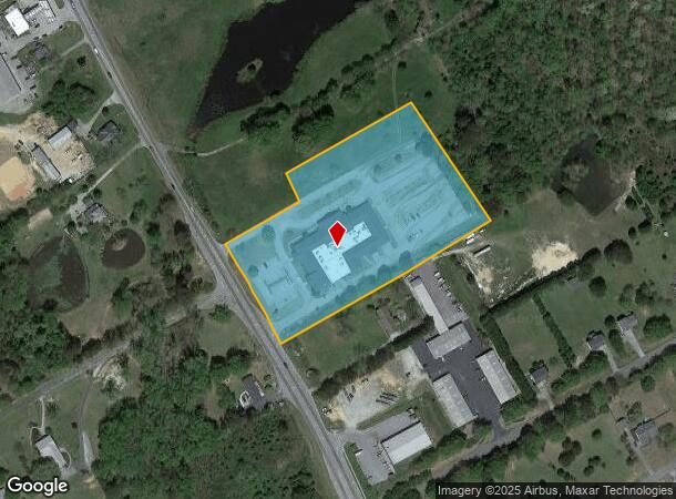
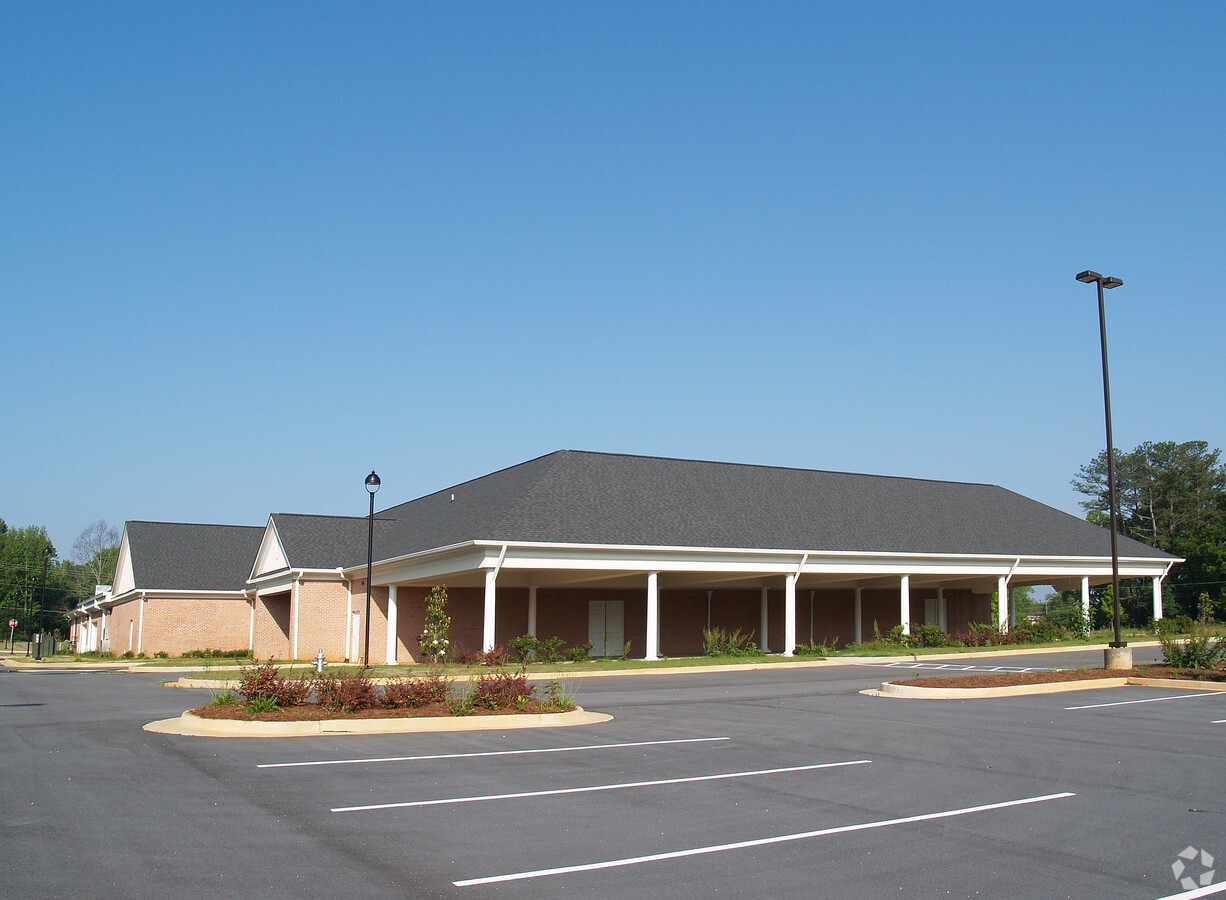
1949 Highway 81, Loganville, GA 30052

NEARBY LISTINGS FOR SALE OR LEASE
-
-
View all Loganville listings for sale on LoopNet.com
Property Detail
1949 Highway 81
C051000000189000
09167-County Nbhd/Spot
Charitableorganization
6.10AC
X
Walton
13297C0125E
Georgia
0
6.10 AC
2024
Walton County
110601
Atlanta
31,464 SF
Atlanta-Sandy Springs-Roswell, GA
DEMOGRAPHICS near 1949 Highway 81
1 Mile
3 Mile
5 Mile
2024 Total Population
1,588
15,322
42,401
2029 Population
1,818
17,581
48,734
Pop Growth 2024-2029
+ 14.48%
+ 14.74%
+ 14.94%
Average Age
41
41
40
2024 Total Households
557
5,132
14,288
HH Growth 2024-2029
+ 14.72%
+ 15.04%
+ 15.23%
Median Household Inc
$83,333
$83,294
$83,903
Avg Household Size
2.80
2.90
2.90
2024 Avg HH Vehicles
3.00
2.00
2.00
Median Home Value
$256,818
$265,137
$270,695
Median Year Built
1994
1996
1997
Nearby Places
- Restaurants
- Banks
- Shops
- Fitness
- Groceries
Nearby Properties
Address
Land Use
TOTAL SIZE
Lot Size
Zoning
Address
Land Use
TOTAL SIZE
Lot Size
Zoning
235,653 SF
103.54 AC
GPU
Address
Land Use
TOTAL SIZE
Lot Size
Zoning
148,320 SF
35.90 AC
A1
Address
Land Use
TOTAL SIZE
Lot Size
Zoning
95,842 SF
25.91 AC
A1
Address
Land Use
TOTAL SIZE
Lot Size
Zoning
34,128 SF
61.26 AC
A1 B2 M1
Address
Land Use
TOTAL SIZE
Lot Size
Zoning
28,284 SF
6.45 AC
CN
Address
Land Use
TOTAL SIZE
Lot Size
Zoning
6,322 SF
1.85 AC
CH
Address
Land Use
TOTAL SIZE
Lot Size
Zoning
2,646 SF
21.85 AC
A1 A2 WP2
Address
Land Use
TOTAL SIZE
Lot Size
Zoning
4,000 SF
6.76 AC
B2
Address
Land Use
TOTAL SIZE
Lot Size
Zoning
37.27 AC
MHP
Address
Land Use
TOTAL SIZE
Lot Size
Zoning
15,718 SF
45.40 AC
A1 WP2
Address
Land Use
TOTAL SIZE
Lot Size
Zoning
220.19 AC
A1
Address
Land Use
TOTAL SIZE
Lot Size
Zoning
101.78 AC
R22 OSC
Address
Land Use
TOTAL SIZE
Lot Size
Zoning
38,400 SF
27.76 AC
C2 WP2
Address
Land Use
TOTAL SIZE
Lot Size
Zoning
3,300 SF
6.35 AC
GPU
Address
Land Use
TOTAL SIZE
Lot Size
Zoning
3,200 SF
16.05 AC
I1
Address
Land Use
TOTAL SIZE
Lot Size
Zoning
18,180 SF
10 AC
A1
Address
Land Use
TOTAL SIZE
Lot Size
Zoning
25,804 SF
12.15 AC
M1
Address
Land Use
TOTAL SIZE
Lot Size
Zoning
8,858 SF
12.48 AC
A1
Address
Land Use
TOTAL SIZE
Lot Size
Zoning
6,850 SF
1.85 AC
CH
Address
Land Use
TOTAL SIZE
Lot Size
Zoning
7,140 SF
3.24 AC
C1 WP2
Address
Land Use
TOTAL SIZE
Lot Size
Zoning
12,602 SF
4.08 AC
C1 WP2
Address
Land Use
TOTAL SIZE
Lot Size
Zoning
6,000 SF
3.79 AC
B3
Address
Land Use
TOTAL SIZE
Lot Size
Zoning
5,200 SF
1.98 AC
B1
Address
Land Use
TOTAL SIZE
Lot Size
Zoning
4,800 SF
5 AC
M1
Address
Land Use
TOTAL SIZE
Lot Size
Zoning
12,905 SF
10.34 AC
A1
Address
Land Use
TOTAL SIZE
Lot Size
Zoning
112.19 AC
A1 R1 WP2
Address
Land Use
TOTAL SIZE
Lot Size
Zoning
6,066 SF
1.25 AC
CH
Address
Land Use
TOTAL SIZE
Lot Size
Zoning
9,205 SF
2 AC
B2
Address
Land Use
TOTAL SIZE
Lot Size
Zoning
9,432 SF
1.41 AC
B3
The World's #1 Commercial Real Estate Marketplace
Connect with us
© 2025 CoStar Group
The information above has been obtained from sources believed reliable. While we do not doubt its accuracy we have not verified it and make no guarantee, warranty or representation about it. It is your responsibility to independently confirm its accuracy and completeness. Any projections, opinions, assumptions, or estimates used are for example only and do not represent the current or future performance of the property. The value of this transaction to you depends on tax and other factors which should be evaluated by your tax, financial, and legal advisors. You and your advisors should conduct a careful, independent investigation of the property to determine to your satisfaction the suitability of the property for your needs.