Property Record
195 Route 6, Mahopac, NY 10541


NEARBY LISTINGS FOR SALE OR LEASE
Property Detail
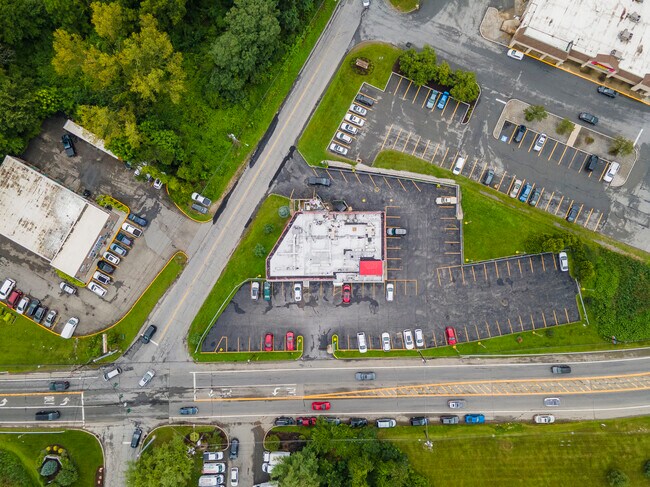
195 Route 6
372000-086-011-0001-023-000-0000
Putnam
Restaurantbuilding
New York
X
23.00
36079C0207E
0.91 AC
2024
Carmel
2024
Westchester/So Connecticut
011202
Dutchess County-Putnam County, NY
8,557 SF
DEMOGRAPHICS near 195 Route 6
1 Mile
3 Mile
5 Mile
2024 Total Population
3,988
32,699
68,522
2029 Population
3,930
32,339
67,706
Pop Growth 2024-2029
(1.45%)
(1.10%)
(1.19%)
Average Age
43
45
45
2024 Total Households
1,472
12,475
25,174
HH Growth 2024-2029
(1.56%)
(1.11%)
(1.28%)
Median Household Inc
$115,195
$115,555
$129,856
Avg Household Size
2.70
2.60
2.70
2024 Avg HH Vehicles
2.00
2.00
2.00
Median Home Value
$482,030
$448,061
$473,782
Median Year Built
1975
1972
1971
Nearby Places
Map Layers
Map Styles
 Street
 Aerial
- Restaurants
- Banks
- Shops
- Fitness
- Groceries
PUBLIC TRANSPORTATION
COMMUTER RAIL
Croton Falls Station (Harlem Line - Metro-North Commuter Railroad Company (Metro-North))
DRIVE
WALK
Distance
Croton Falls Station (Harlem Line - Metro-North Commuter Railroad Company (Metro-North))
15 min
6.1 mi
Purdy's Station (Harlem Line - Metro-North Commuter Railroad Company (Metro-North))
DRIVE
WALK
Distance
Purdy's Station (Harlem Line - Metro-North Commuter Railroad Company (Metro-North))
16 min
7.7 mi
AIRPORT
Westchester County
DRIVE
WALK
Distance
Westchester County
35 min
24.7 mi
New York Stewart International
DRIVE
WALK
Distance
New York Stewart International
60 min
34.8 mi
Freight Ports
NY - Red Hook Container Terminal
DRIVE
WALK
Distance
NY - Red Hook Container Terminal
84 min
57.1 mi
SALE & LEASE HISTORY
LISTING DATE
SALE/LEASE

May 01, 2023
For Sale
Jun 27, 2023
For Sale
Nearby Properties
Address
Land Use
TOTAL SIZE
Lot Size
Zoning
Address
Land Use
TOTAL SIZE
Lot Size
Zoning
232,607 SF
61.47 AC
R
Address
Land Use
TOTAL SIZE
Lot Size
Zoning
1,656 SF
80.06 AC
R
Address
Land Use
TOTAL SIZE
Lot Size
Zoning
108,614 SF
4.77 AC
R
Address
Land Use
TOTAL SIZE
Lot Size
Zoning
147,668 SF
18.15 AC
C
Address
Land Use
TOTAL SIZE
Lot Size
Zoning
162,634 SF
23.76 AC
R
Address
Land Use
TOTAL SIZE
Lot Size
Zoning
400 SF
6.29 AC
C
Address
Land Use
TOTAL SIZE
Lot Size
Zoning
14,817 SF
15.25 AC
NW
Address
Land Use
TOTAL SIZE
Lot Size
Zoning
447.03 AC
R-120
Address
Land Use
TOTAL SIZE
Lot Size
Zoning
72,125 SF
20.35 AC
R
Address
Land Use
TOTAL SIZE
Lot Size
Zoning
7,843 SF
1.07 AC
C
Address
Land Use
TOTAL SIZE
Lot Size
Zoning
72,482 SF
2.37 AC
C
Address
Land Use
TOTAL SIZE
Lot Size
Zoning
24,319 SF
133.03 AC
R
Address
Land Use
TOTAL SIZE
Lot Size
Zoning
9,768 SF
7.21 AC
R
Address
Land Use
TOTAL SIZE
Lot Size
Zoning
40,194 SF
6.60 AC
C
Address
Land Use
TOTAL SIZE
Lot Size
Zoning
87,153 SF
12 AC
R
Address
Land Use
TOTAL SIZE
Lot Size
Zoning
593.73 AC
W
Address
Land Use
TOTAL SIZE
Lot Size
Zoning
54,918 SF
3.16 AC
C
Address
Land Use
TOTAL SIZE
Lot Size
Zoning
69,743 SF
3.67 AC
C
Address
Land Use
TOTAL SIZE
Lot Size
Zoning
47,099 SF
2.04 AC
R
Address
Land Use
TOTAL SIZE
Lot Size
Zoning
60,000 SF
2.05 AC
C
Address
Land Use
TOTAL SIZE
Lot Size
Zoning
8,697 SF
1.31 AC
R
Address
Land Use
TOTAL SIZE
Lot Size
Zoning
19,300 SF
1.50 AC
C
Address
Land Use
TOTAL SIZE
Lot Size
Zoning
15,500 SF
1.21 AC
C
Address
Land Use
TOTAL SIZE
Lot Size
Zoning
15,196 SF
1.67 AC
R
Address
Land Use
TOTAL SIZE
Lot Size
Zoning
19,310 SF
107.91 AC
R
Address
Land Use
TOTAL SIZE
Lot Size
Zoning
27.32 AC
Address
Land Use
TOTAL SIZE
Lot Size
Zoning
6,889 SF
0.92 AC
R
Address
Land Use
TOTAL SIZE
Lot Size
Zoning
15,874 SF
2.70 AC
R
Address
Land Use
TOTAL SIZE
Lot Size
Zoning
9,936 SF
30.83 AC
CBP
Address
Land Use
TOTAL SIZE
Lot Size
Zoning
21,890 SF
3 AC
C
The World's #1 Commercial Real Estate Marketplace
Connect with us
© 2025 CoStar Group
The information above has been obtained from sources believed reliable. While we do not doubt its accuracy we have not verified it and make no guarantee, warranty or representation about it. It is your responsibility to independently confirm its accuracy and completeness. Any projections, opinions, assumptions, or estimates used are for example only and do not represent the current or future performance of the property. The value of this transaction to you depends on tax and other factors which should be evaluated by your tax, financial, and legal advisors. You and your advisors should conduct a careful, independent investigation of the property to determine to your satisfaction the suitability of the property for your needs.