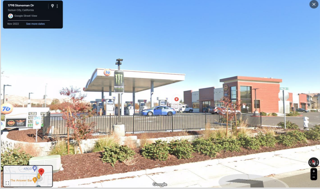
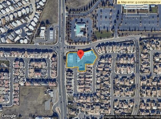
Property Record
1951 Walters Rd, Suisun City, CA 94585
NEARBY LISTINGS FOR SALE OR LEASE
Property Detail
1951 Walters Rd
Vallejo-Fairfield, CA
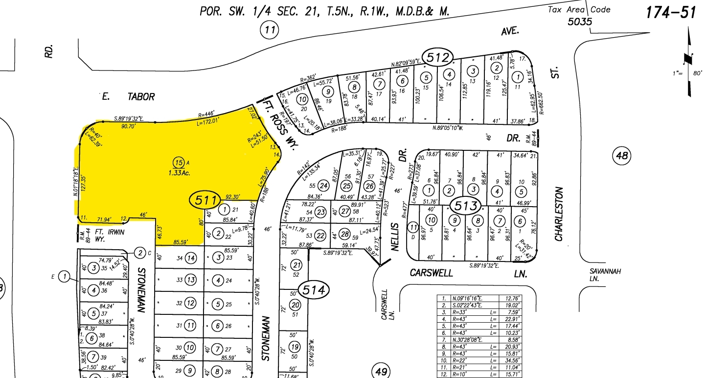
Zephyr Estates
0174-511-150
ZEPHYR ESTATES SUB BK-BG 89-44 LOT A
Servicestation
Solano
X
California
06095C0288E
a
2023
1.33 AC
2023
Fairfield
252706
North Bay/Santa Rosa
DEMOGRAPHICS near 1951 Walters Rd
1 Mile
3 Mile
5 Mile
2024 Total Population
6,521
86,317
146,336
2029 Population
6,385
85,634
144,953
Pop Growth 2024-2029
(2.09%)
(0.79%)
(0.95%)
Average Age
41
37
38
2024 Total Households
2,166
27,078
45,896
HH Growth 2024-2029
(2.08%)
(0.85%)
(1.05%)
Median Household Inc
$91,610
$86,585
$88,986
Avg Household Size
3.00
3.10
3.00
2024 Avg HH Vehicles
2.00
2.00
2.00
Median Home Value
$434,243
$474,314
$496,294
Median Year Built
1985
1983
1983
Nearby Places
- Restaurants
- Banks
- Shops
- Fitness
- Groceries
PUBLIC TRANSPORTATION
COMMUTER RAIL
Fairfield-Vacaville (Capitol Corridor - Amtrak)
DRIVE
WALK
Distance
Fairfield-Vacaville (Capitol Corridor - Amtrak)
5 min
2.7 mi
Suisun-Fairfield (Capitol Corridor - Capitol Corridor Joint Powers Authority)
DRIVE
WALK
Distance
Suisun-Fairfield (Capitol Corridor - Capitol Corridor Joint Powers Authority)
8 min
4.2 mi
Freight Ports
Port of Richmond
DRIVE
WALK
Distance
Port of Richmond
54 min
40.5 mi
SALE & LEASE HISTORY
LISTING DATE
SALE/LEASE

Mar 19, 2024
For Sale
Nearby Properties
Address
Land Use
TOTAL SIZE
Lot Size
Zoning
Address
Land Use
TOTAL SIZE
Lot Size
Zoning
999,999 SF
55.81 AC
LTD IND
Address
Land Use
TOTAL SIZE
Lot Size
Zoning
184,572 SF
10.95 AC
Address
Land Use
TOTAL SIZE
Lot Size
Zoning
143,531 SF
13.45 AC
Address
Land Use
TOTAL SIZE
Lot Size
Zoning
172,856 SF
10.11 AC
Address
Land Use
TOTAL SIZE
Lot Size
Zoning
170,958 SF
14.65 AC
Address
Land Use
TOTAL SIZE
Lot Size
Zoning
144,972 SF
18.47 AC
Address
Land Use
TOTAL SIZE
Lot Size
Zoning
140,853 SF
25.35 AC
Address
Land Use
TOTAL SIZE
Lot Size
Zoning
177,945 SF
18.31 AC
Address
Land Use
TOTAL SIZE
Lot Size
Zoning
151,537 SF
8.66 AC
Address
Land Use
TOTAL SIZE
Lot Size
Zoning
Address
Land Use
TOTAL SIZE
Lot Size
Zoning
76,195 SF
8.43 AC
Address
Land Use
TOTAL SIZE
Lot Size
Zoning
113,320 SF
6.63 AC
Address
Land Use
TOTAL SIZE
Lot Size
Zoning
90,416 SF
6.03 AC
MULTIRE
Address
Land Use
TOTAL SIZE
Lot Size
Zoning
144,466 SF
8.07 AC
MULTI-RES
Address
Land Use
TOTAL SIZE
Lot Size
Zoning
185,292 SF
10.18 AC
Address
Land Use
TOTAL SIZE
Lot Size
Zoning
285,080 SF
15.35 AC
Address
Land Use
TOTAL SIZE
Lot Size
Zoning
6,156 SF
0.36 AC
Address
Land Use
TOTAL SIZE
Lot Size
Zoning
0.98 AC
Address
Land Use
TOTAL SIZE
Lot Size
Zoning
0.68 AC
Address
Land Use
TOTAL SIZE
Lot Size
Zoning
7,680 SF
0.05 AC
Address
Land Use
TOTAL SIZE
Lot Size
Zoning
Address
Land Use
TOTAL SIZE
Lot Size
Zoning
0.25 AC
Address
Land Use
TOTAL SIZE
Lot Size
Zoning
0.10 AC
Address
Land Use
TOTAL SIZE
Lot Size
Zoning
0.11 AC
Address
Land Use
TOTAL SIZE
Lot Size
Zoning
Address
Land Use
TOTAL SIZE
Lot Size
Zoning
0.10 AC
Address
Land Use
TOTAL SIZE
Lot Size
Zoning
0.10 AC
Address
Land Use
TOTAL SIZE
Lot Size
Zoning
Address
Land Use
TOTAL SIZE
Lot Size
Zoning
0.10 AC
Address
Land Use
TOTAL SIZE
Lot Size
Zoning
0.15 AC
The World's #1 Commercial Real Estate Marketplace
Connect with us
© 2025 CoStar Group
The information above has been obtained from sources believed reliable. While we do not doubt its accuracy we have not verified it and make no guarantee, warranty or representation about it. It is your responsibility to independently confirm its accuracy and completeness. Any projections, opinions, assumptions, or estimates used are for example only and do not represent the current or future performance of the property. The value of this transaction to you depends on tax and other factors which should be evaluated by your tax, financial, and legal advisors. You and your advisors should conduct a careful, independent investigation of the property to determine to your satisfaction the suitability of the property for your needs.