Property Record
19621 State Highway 413, Reeds Spring, MO 65737

NEARBY LISTINGS FOR SALE OR LEASE
-
-
View all Reeds Spring listings for sale on LoopNet.com
Property Detail
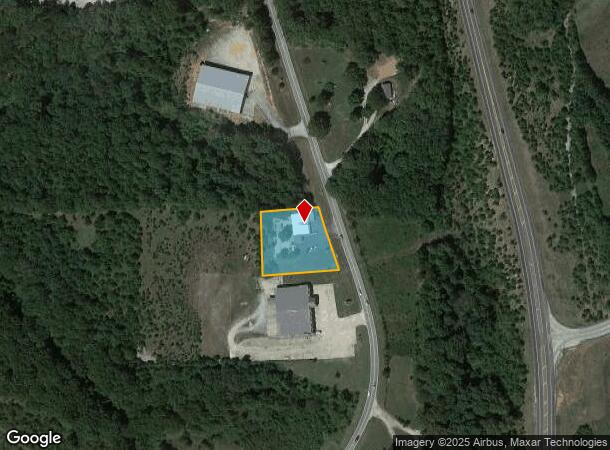
19621 State Highway 413
Branson, MO
Dogwood Trls
11-1.0-12-000-000-004.001
BEG 1698 E OF NW COR SEC 12 THENCE E 188 SE ALONG R/W 180 W 242 N202 TO POB ALSO A PORTION OF THE SE1/4 OF THE SW 1/4 COMMENCING AT A STONE MARKING SE CORNER OF SE SW; THENCE NW 710.27 TO POB ALSO BEING ON THE WESTRLY ROW OF OLD ST HWY 13
Daycare
Stone
X
Missouri
29209C0205D
2
2024
0.96 AC
2025
Branson
090605
Other Market Areas
4,481 SF
DEMOGRAPHICS near 19621 State Highway 413
1 Mile
3 Mile
5 Mile
2024 Total Population
426
2,564
6,895
2029 Population
461
2,748
7,514
Pop Growth 2024-2029
+ 8.22%
+ 7.18%
+ 8.98%
Average Age
46
44
46
2024 Total Households
176
1,023
2,863
HH Growth 2024-2029
+ 6.82%
+ 6.35%
+ 8.56%
Median Household Inc
$50,312
$42,058
$53,575
Avg Household Size
2.40
2.40
2.30
2024 Avg HH Vehicles
2.00
2.00
2.00
Median Home Value
$174,999
$159,338
$199,921
Median Year Built
1998
1992
1995
Nearby Places
Map Layers
Map Styles
 Street
 Aerial
- Restaurants
- Banks
- Shops
- Fitness
- Groceries
Nearby Properties
Address
Land Use
TOTAL SIZE
Lot Size
Zoning
Address
Land Use
TOTAL SIZE
Lot Size
Zoning
108,452 SF
47.84 AC
A-1
Address
Land Use
TOTAL SIZE
Lot Size
Zoning
153,535 SF
18.72 AC
NA
Address
Land Use
TOTAL SIZE
Lot Size
Zoning
6,000 SF
11.93 AC
NA
Address
Land Use
TOTAL SIZE
Lot Size
Zoning
44,979 SF
12.80 AC
NA
Address
Land Use
TOTAL SIZE
Lot Size
Zoning
74,763 SF
28.27 AC
NA
Address
Land Use
TOTAL SIZE
Lot Size
Zoning
7,088 SF
1.98 AC
C-2
Address
Land Use
TOTAL SIZE
Lot Size
Zoning
14,748 SF
1.60 AC
NA
Address
Land Use
TOTAL SIZE
Lot Size
Zoning
77,252 SF
36.08 AC
A-1
Address
Land Use
TOTAL SIZE
Lot Size
Zoning
15,000 SF
2.32 AC
NA
Address
Land Use
TOTAL SIZE
Lot Size
Zoning
93,998 SF
39 AC
NA
Address
Land Use
TOTAL SIZE
Lot Size
Zoning
23,640 SF
29.64 AC
NA
Address
Land Use
TOTAL SIZE
Lot Size
Zoning
92,520 SF
Address
Land Use
TOTAL SIZE
Lot Size
Zoning
25,052 SF
3.98 AC
NA
Address
Land Use
TOTAL SIZE
Lot Size
Zoning
11,860 SF
5.40 AC
C-2
Address
Land Use
TOTAL SIZE
Lot Size
Zoning
36,558 SF
7.60 AC
NA
Address
Land Use
TOTAL SIZE
Lot Size
Zoning
8,100 SF
1.13 AC
Address
Land Use
TOTAL SIZE
Lot Size
Zoning
8,915 SF
3.27 AC
C-2
Address
Land Use
TOTAL SIZE
Lot Size
Zoning
400,000 SF
0.04 AC
Address
Land Use
TOTAL SIZE
Lot Size
Zoning
46,225 SF
Address
Land Use
TOTAL SIZE
Lot Size
Zoning
3,520 SF
1.30 AC
Address
Land Use
TOTAL SIZE
Lot Size
Zoning
4,335 SF
0.90 AC
RR-1
Address
Land Use
TOTAL SIZE
Lot Size
Zoning
3,702 SF
36.98 AC
C-2
Address
Land Use
TOTAL SIZE
Lot Size
Zoning
5,932 SF
1.87 AC
NA
Address
Land Use
TOTAL SIZE
Lot Size
Zoning
4,403 SF
2.07 AC
NA
Address
Land Use
TOTAL SIZE
Lot Size
Zoning
8,964 SF
1.76 AC
NA
Address
Land Use
TOTAL SIZE
Lot Size
Zoning
6,625 SF
3.83 AC
NA
Address
Land Use
TOTAL SIZE
Lot Size
Zoning
15,039 SF
2 AC
NA
The World's #1 Commercial Real Estate Marketplace
Connect with us
© 2026 CoStar Group
The information above has been obtained from sources believed reliable. While we do not doubt its accuracy we have not verified it and make no guarantee, warranty or representation about it. It is your responsibility to independently confirm its accuracy and completeness. Any projections, opinions, assumptions, or estimates used are for example only and do not represent the current or future performance of the property. The value of this transaction to you depends on tax and other factors which should be evaluated by your tax, financial, and legal advisors. You and your advisors should conduct a careful, independent investigation of the property to determine to your satisfaction the suitability of the property for your needs.