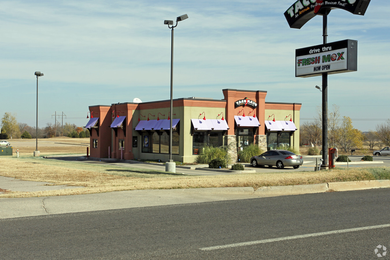
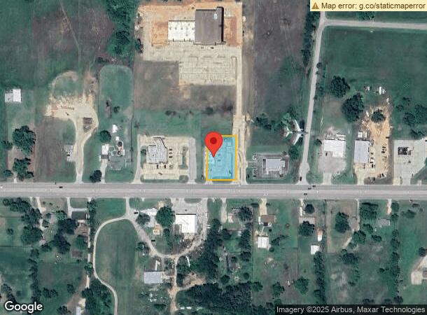
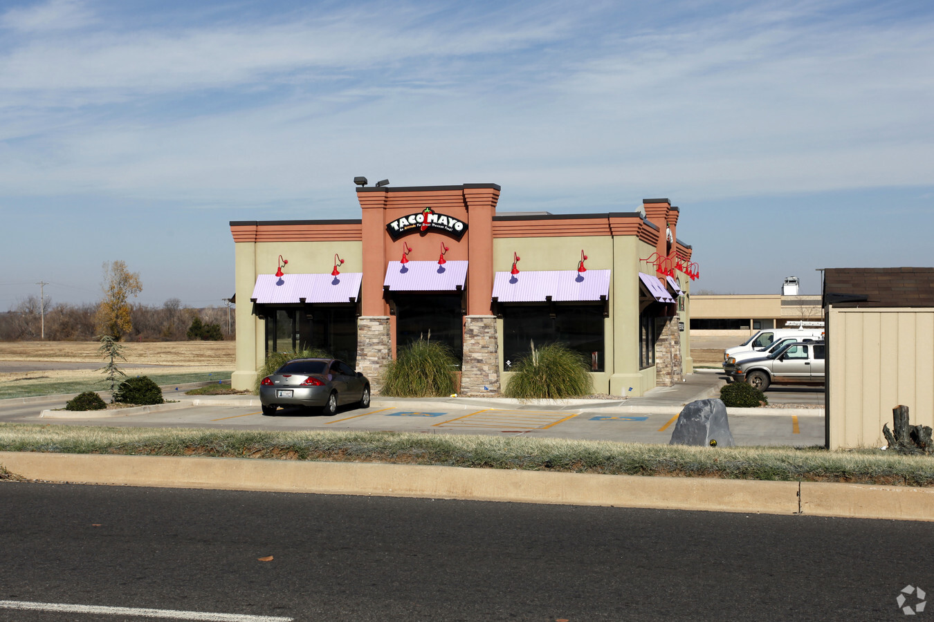
Property Record
19635 Ne 23Rd St, Harrah, OK 73045
NEARBY LISTINGS FOR SALE OR LEASE
Property Detail
19635 Ne 23Rd St
192454565
Unpltd Pt Sec 22 12N 1E
Restaurantbuilding
UNPLTD PT SEC 22 12N 1E 000 000 PT SE4 SEC 22 12N 1E BEG 1750FT W & 50FT N OF SE/C SE4 TH N200FT W130FT S200FT E130FT TO BEG CONT .61ACRS MORE OR LESS
X
Oklahoma
40081C0610E
Oklahoma
2023
0.60 AC
2023
East Oklahoma County
109003
Oklahoma City
2,200 SF
Oklahoma City, OK
DEMOGRAPHICS near 19635 Ne 23Rd St
1 Mile
3 Mile
5 Mile
2024 Total Population
982
6,955
18,806
2029 Population
1,005
7,097
19,176
Pop Growth 2024-2029
+ 2.34%
+ 2.04%
+ 1.97%
Average Age
43
41
41
2024 Total Households
381
2,702
6,927
HH Growth 2024-2029
+ 2.36%
+ 2.11%
+ 2.01%
Median Household Inc
$50,769
$66,945
$74,145
Avg Household Size
2.40
2.50
2.60
2024 Avg HH Vehicles
2.00
2.00
2.00
Median Home Value
$211,403
$199,518
$217,022
Median Year Built
1975
1984
1988
Nearby Places
- Restaurants
- Banks
- Shops
- Fitness
- Groceries
PUBLIC TRANSPORTATION
AIRPORT
Will Rogers World
DRIVE
WALK
Distance
Will Rogers World
44 min
34.1 mi
Freight Ports
Tulsa Port Of Catoosa
DRIVE
WALK
Distance
Tulsa Port Of Catoosa
116 min
109.1 mi
Nearby Properties
Address
Land Use
TOTAL SIZE
Lot Size
Zoning
Address
Land Use
TOTAL SIZE
Lot Size
Zoning
28,054 SF
2 AC
Address
Land Use
TOTAL SIZE
Lot Size
Zoning
99,544 SF
7.91 AC
Address
Land Use
TOTAL SIZE
Lot Size
Zoning
52,620 SF
2.48 AC
Address
Land Use
TOTAL SIZE
Lot Size
Zoning
37,136 SF
6.76 AC
Address
Land Use
TOTAL SIZE
Lot Size
Zoning
15,180 SF
1.84 AC
Address
Land Use
TOTAL SIZE
Lot Size
Zoning
77,668 SF
4.98 AC
Address
Land Use
TOTAL SIZE
Lot Size
Zoning
21,660 SF
2.70 AC
Address
Land Use
TOTAL SIZE
Lot Size
Zoning
31,640 SF
5.19 AC
Address
Land Use
TOTAL SIZE
Lot Size
Zoning
19,083 SF
6.03 AC
Address
Land Use
TOTAL SIZE
Lot Size
Zoning
21,348 SF
1.34 AC
Address
Land Use
TOTAL SIZE
Lot Size
Zoning
18,900 SF
3.38 AC
Address
Land Use
TOTAL SIZE
Lot Size
Zoning
9,000 SF
0.64 AC
Address
Land Use
TOTAL SIZE
Lot Size
Zoning
15,624 SF
1.59 AC
Address
Land Use
TOTAL SIZE
Lot Size
Zoning
28,800 SF
12.10 AC
Address
Land Use
TOTAL SIZE
Lot Size
Zoning
1,344 SF
0.14 AC
Address
Land Use
TOTAL SIZE
Lot Size
Zoning
10,806 SF
6 AC
Address
Land Use
TOTAL SIZE
Lot Size
Zoning
15,880 SF
31 AC
Address
Land Use
TOTAL SIZE
Lot Size
Zoning
3,627 SF
0.08 AC
Address
Land Use
TOTAL SIZE
Lot Size
Zoning
3,104 SF
0.96 AC
Address
Land Use
TOTAL SIZE
Lot Size
Zoning
1,794 SF
9.26 AC
Address
Land Use
TOTAL SIZE
Lot Size
Zoning
21,918 SF
3.19 AC
Address
Land Use
TOTAL SIZE
Lot Size
Zoning
8,262 SF
4.58 AC
Address
Land Use
TOTAL SIZE
Lot Size
Zoning
28,212 SF
44.33 AC
Address
Land Use
TOTAL SIZE
Lot Size
Zoning
12,000 SF
10.02 AC
Address
Land Use
TOTAL SIZE
Lot Size
Zoning
14,080 SF
31.56 AC
Address
Land Use
TOTAL SIZE
Lot Size
Zoning
7,560 SF
0.65 AC
Address
Land Use
TOTAL SIZE
Lot Size
Zoning
1,898 SF
0.47 AC
Address
Land Use
TOTAL SIZE
Lot Size
Zoning
6,840 SF
1.11 AC
Address
Land Use
TOTAL SIZE
Lot Size
Zoning
19,286 SF
2.27 AC
Address
Land Use
TOTAL SIZE
Lot Size
Zoning
4,000 SF
1.02 AC
The World's #1 Commercial Real Estate Marketplace
Connect with us
© 2025 CoStar Group
The information above has been obtained from sources believed reliable. While we do not doubt its accuracy we have not verified it and make no guarantee, warranty or representation about it. It is your responsibility to independently confirm its accuracy and completeness. Any projections, opinions, assumptions, or estimates used are for example only and do not represent the current or future performance of the property. The value of this transaction to you depends on tax and other factors which should be evaluated by your tax, financial, and legal advisors. You and your advisors should conduct a careful, independent investigation of the property to determine to your satisfaction the suitability of the property for your needs.