Property Record
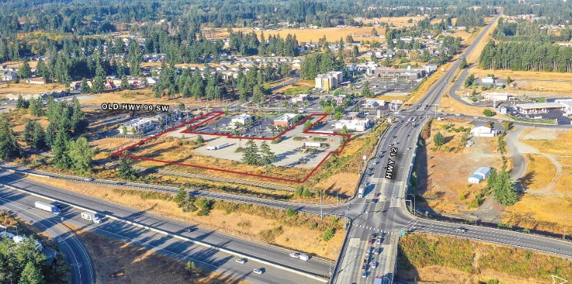
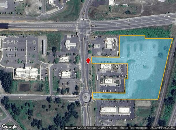
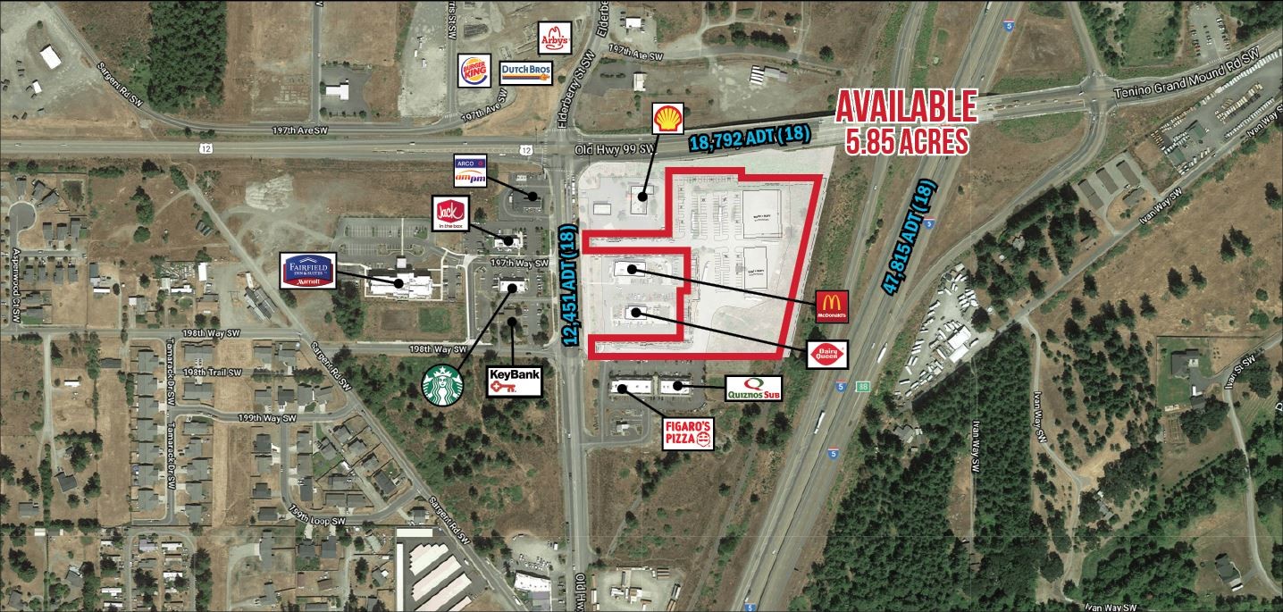
19722 Old Highway 99 Sw, Rochester, WA 98579
NEARBY LISTINGS FOR SALE OR LEASE
Property Detail
19722 Old Highway 99 Sw
Olympia-Tumwater, WA
Jackson Fruit Tracts
55702500000
SECTION 12 TOWNSHIP 15 RANGE 3W QUARTER SW NW & NW SW PLAT JACKSON FRUIT TRACTS BLA13104607TC TR A DOCUMENT 4364309
Vacantlandnec
Thurston
X
Washington
53067C0445F
25
2024
5.70 AC
2024
Outlying Thurston County
012720
Olympia
DEMOGRAPHICS near 19722 Old Highway 99 Sw
1 Mile
3 Mile
5 Mile
2024 Total Population
2,093
8,226
21,830
2029 Population
2,235
8,679
23,359
Pop Growth 2024-2029
+ 6.78%
+ 5.51%
+ 7.00%
Average Age
37
40
41
2024 Total Households
690
2,898
7,977
HH Growth 2024-2029
+ 6.81%
+ 5.52%
+ 7.21%
Median Household Inc
$76,645
$82,590
$77,303
Avg Household Size
2.90
2.80
2.60
2024 Avg HH Vehicles
3.00
3.00
2.00
Median Home Value
$306,579
$367,718
$376,994
Median Year Built
1999
1994
1992
Nearby Places
- Restaurants
- Banks
- Shops
- Fitness
- Groceries
PUBLIC TRANSPORTATION
COMMUTER RAIL
Centralia Amtrak Station (Amtrak Cascades - Amtrak, Coast Starlight - Amtrak)
DRIVE
WALK
Distance
Centralia Amtrak Station (Amtrak Cascades - Amtrak, Coast Starlight - Amtrak)
12 min
7.4 mi
Freight Ports
Port of Grays Harbor, WA
DRIVE
WALK
Distance
Port of Grays Harbor, WA
71 min
47.9 mi
SALE & LEASE HISTORY
LISTING DATE
SALE/LEASE

Sep 24, 2016
For Sale
Nov 14, 2019
For Lease
Jun 29, 2022
For Lease
Nearby Properties
Address
Land Use
TOTAL SIZE
Lot Size
Zoning
Address
Land Use
TOTAL SIZE
Lot Size
Zoning
441,608 SF
Address
Land Use
TOTAL SIZE
Lot Size
Zoning
229,011 SF
209.52 AC
PID
Address
Land Use
TOTAL SIZE
Lot Size
Zoning
155,458 SF
15.80 AC
PMP
Address
Land Use
TOTAL SIZE
Lot Size
Zoning
648,548 SF
16.50 AC
Address
Land Use
TOTAL SIZE
Lot Size
Zoning
297,970 SF
19.32 AC
PID
Address
Land Use
TOTAL SIZE
Lot Size
Zoning
158,948 SF
77.13 AC
RRR1/5
Address
Land Use
TOTAL SIZE
Lot Size
Zoning
23,908 SF
3.74 AC
AC
Address
Land Use
TOTAL SIZE
Lot Size
Zoning
22.44 AC
PMP
Address
Land Use
TOTAL SIZE
Lot Size
Zoning
768 SF
34.16 AC
PID
Address
Land Use
TOTAL SIZE
Lot Size
Zoning
42,658 SF
4.77 AC
RCC
Address
Land Use
TOTAL SIZE
Lot Size
Zoning
12,616 SF
7.56 AC
AC
Address
Land Use
TOTAL SIZE
Lot Size
Zoning
28,248 SF
4.92 AC
PID
Address
Land Use
TOTAL SIZE
Lot Size
Zoning
4,997 SF
1.13 AC
AC
Address
Land Use
TOTAL SIZE
Lot Size
Zoning
3,848 SF
12.90 AC
R3-6/1
Address
Land Use
TOTAL SIZE
Lot Size
Zoning
10,672 SF
22.93 AC
RCC
Address
Land Use
TOTAL SIZE
Lot Size
Zoning
2,604 SF
6.85 AC
RRR1/5
Address
Land Use
TOTAL SIZE
Lot Size
Zoning
36,440 SF
1.92 AC
AC
Address
Land Use
TOTAL SIZE
Lot Size
Zoning
14,212 SF
4.37 AC
RCC
Address
Land Use
TOTAL SIZE
Lot Size
Zoning
34,916 SF
62.68 AC
RRR1/5
Address
Land Use
TOTAL SIZE
Lot Size
Zoning
23,941 SF
4.37 AC
PID
Address
Land Use
TOTAL SIZE
Lot Size
Zoning
4,320 SF
1.08 AC
AC
Address
Land Use
TOTAL SIZE
Lot Size
Zoning
115,874 SF
46.79 AC
RRR1/5
Address
Land Use
TOTAL SIZE
Lot Size
Zoning
36,262 SF
5.20 AC
Address
Land Use
TOTAL SIZE
Lot Size
Zoning
34,408 SF
7.21 AC
LI
Address
Land Use
TOTAL SIZE
Lot Size
Zoning
8,423 SF
0.72 AC
AC
Address
Land Use
TOTAL SIZE
Lot Size
Zoning
9.86 AC
PID
Address
Land Use
TOTAL SIZE
Lot Size
Zoning
421.91 AC
PP
Address
Land Use
TOTAL SIZE
Lot Size
Zoning
17,524 SF
4 AC
PID
Address
Land Use
TOTAL SIZE
Lot Size
Zoning
65,780 SF
119.13 AC
RRR1/5
The World's #1 Commercial Real Estate Marketplace
Connect with us
© 2025 CoStar Group
The information above has been obtained from sources believed reliable. While we do not doubt its accuracy we have not verified it and make no guarantee, warranty or representation about it. It is your responsibility to independently confirm its accuracy and completeness. Any projections, opinions, assumptions, or estimates used are for example only and do not represent the current or future performance of the property. The value of this transaction to you depends on tax and other factors which should be evaluated by your tax, financial, and legal advisors. You and your advisors should conduct a careful, independent investigation of the property to determine to your satisfaction the suitability of the property for your needs.