Property Record
1974 Pond View Dr Se, Lonsdale, MN 55046
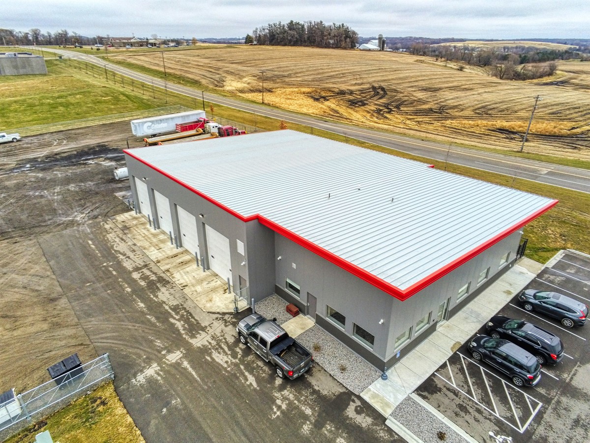
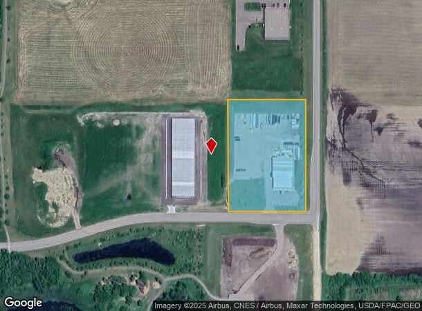
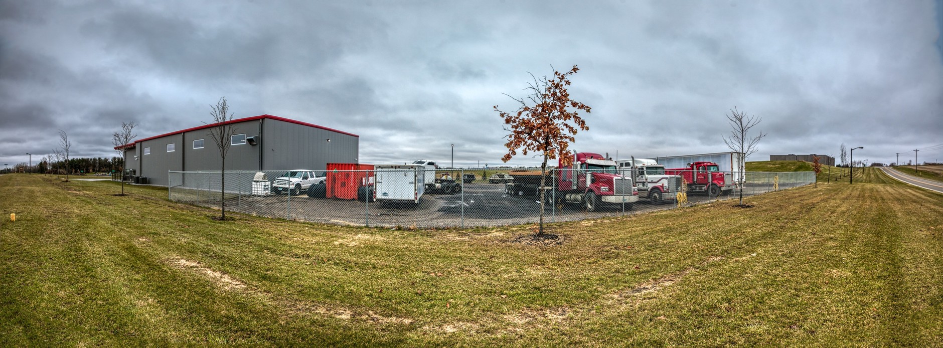
This Property Is For Sale
NEARBY LISTINGS FOR SALE OR LEASE
-
-
View all Lonsdale listings for sale on LoopNet.com
Property Detail
1974 Pond View Dr Se
Faribault-Northfield, MN
Lonsdale Business Park 2Nd Add
19.25.4.76.001
LOT 1 BLOCK 1 OF LONSDALE BUSINESS PARK 2ND ADD
Warehouse
Rice
X
Minnesota
27131C0125D
1
2024
3.25 AC
2024
Minnesota South Area
070102
Other Market Areas
6,400 SF
DEMOGRAPHICS near 1974 Pond View Dr Se
1 Mile
3 Mile
5 Mile
2024 Total Population
1,875
5,718
7,737
2029 Population
1,936
5,855
7,889
Pop Growth 2024-2029
+ 3.25%
+ 2.40%
+ 1.96%
Average Age
33
35
37
2024 Total Households
618
1,943
2,677
HH Growth 2024-2029
+ 3.56%
+ 2.62%
+ 2.13%
Median Household Inc
$89,999
$88,589
$94,471
Avg Household Size
3.00
2.90
2.80
2024 Avg HH Vehicles
2.00
2.00
3.00
Median Home Value
$289,603
$291,908
$318,230
Median Year Built
2005
2001
1996
Nearby Places
- Restaurants
- Banks
- Shops
- Fitness
- Groceries
PUBLIC TRANSPORTATION
AIRPORT
Minneapolis-St Paul International/Wold-Chamberlain
DRIVE
WALK
Distance
Minneapolis-St Paul International/Wold-Chamberlain
51 min
38.6 mi
Freight Ports
Port Milwaukee
DRIVE
WALK
Distance
Port Milwaukee
394 min
343.8 mi
Nearby Properties
Address
Land Use
TOTAL SIZE
Lot Size
Zoning
Address
Land Use
TOTAL SIZE
Lot Size
Zoning
3,783 SF
20 AC
Address
Land Use
TOTAL SIZE
Lot Size
Zoning
18,543 SF
5.14 AC
Address
Land Use
TOTAL SIZE
Lot Size
Zoning
7,795 SF
2.10 AC
Address
Land Use
TOTAL SIZE
Lot Size
Zoning
26,924 SF
7.25 AC
Address
Land Use
TOTAL SIZE
Lot Size
Zoning
2,450 SF
13.10 AC
Address
Land Use
TOTAL SIZE
Lot Size
Zoning
12,187 SF
8.30 AC
Address
Land Use
TOTAL SIZE
Lot Size
Zoning
4,889 SF
3.60 AC
Address
Land Use
TOTAL SIZE
Lot Size
Zoning
177.40 AC
Address
Land Use
TOTAL SIZE
Lot Size
Zoning
6,222 SF
7.89 AC
Address
Land Use
TOTAL SIZE
Lot Size
Zoning
5,732 SF
1.71 AC
Address
Land Use
TOTAL SIZE
Lot Size
Zoning
20,963 SF
0.80 AC
Address
Land Use
TOTAL SIZE
Lot Size
Zoning
2,688 SF
117 AC
Address
Land Use
TOTAL SIZE
Lot Size
Zoning
391 SF
0.25 AC
Address
Land Use
TOTAL SIZE
Lot Size
Zoning
6,720 SF
3.91 AC
Address
Land Use
TOTAL SIZE
Lot Size
Zoning
15,120 SF
7.24 AC
Address
Land Use
TOTAL SIZE
Lot Size
Zoning
Address
Land Use
TOTAL SIZE
Lot Size
Zoning
7,545 SF
0.25 AC
Address
Land Use
TOTAL SIZE
Lot Size
Zoning
9,100 SF
1.29 AC
Address
Land Use
TOTAL SIZE
Lot Size
Zoning
111.41 AC
Address
Land Use
TOTAL SIZE
Lot Size
Zoning
6,448 SF
1 AC
Address
Land Use
TOTAL SIZE
Lot Size
Zoning
7,000 SF
1.50 AC
Address
Land Use
TOTAL SIZE
Lot Size
Zoning
6,112 SF
0.55 AC
Address
Land Use
TOTAL SIZE
Lot Size
Zoning
15,120 SF
2.87 AC
Address
Land Use
TOTAL SIZE
Lot Size
Zoning
2,608 SF
0.69 AC
Address
Land Use
TOTAL SIZE
Lot Size
Zoning
8,000 SF
2.55 AC
Address
Land Use
TOTAL SIZE
Lot Size
Zoning
105.90 AC
Address
Land Use
TOTAL SIZE
Lot Size
Zoning
3.60 AC
Address
Land Use
TOTAL SIZE
Lot Size
Zoning
Address
Land Use
TOTAL SIZE
Lot Size
Zoning
3,600 SF
73.44 AC
The World's #1 Commercial Real Estate Marketplace
Connect with us
© 2025 CoStar Group
The information above has been obtained from sources believed reliable. While we do not doubt its accuracy we have not verified it and make no guarantee, warranty or representation about it. It is your responsibility to independently confirm its accuracy and completeness. Any projections, opinions, assumptions, or estimates used are for example only and do not represent the current or future performance of the property. The value of this transaction to you depends on tax and other factors which should be evaluated by your tax, financial, and legal advisors. You and your advisors should conduct a careful, independent investigation of the property to determine to your satisfaction the suitability of the property for your needs.