Property Record
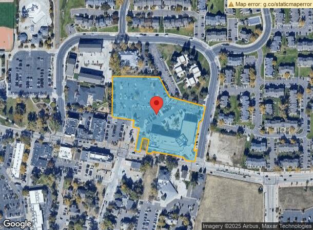
19751 E Mainstreet, Parker, CO 80138


NEARBY LISTINGS FOR SALE OR LEASE
Property Detail
19751 E Mainstreet
Denver-Aurora-Lakewood, CO
Parker Central Area
2233-221-03-020
LOT 3 BLK 1 PARKER CENTRAL AREA FLG 8 4TH AMD 3.996 AM/L
Officebuilding
Douglas
X
Colorado
08005C0500K
3
2023
4 AC
2023
Parker/Castle Rock
013904
Denver
76,482 SF
DEMOGRAPHICS near 19751 E Mainstreet
1 Mile
3 Mile
5 Mile
2024 Total Population
10,184
73,410
124,550
2029 Population
11,567
83,280
140,003
Pop Growth 2024-2029
+ 13.58%
+ 13.45%
+ 12.41%
Average Age
38
38
39
2024 Total Households
4,244
26,099
45,088
HH Growth 2024-2029
+ 13.57%
+ 13.64%
+ 12.42%
Median Household Inc
$81,990
$123,543
$125,128
Avg Household Size
2.30
2.70
2.70
2024 Avg HH Vehicles
2.00
2.00
2.00
Median Home Value
$489,923
$585,759
$628,209
Median Year Built
1996
2001
2003
Nearby Places
- Restaurants
- Banks
- Shops
- Fitness
- Groceries
PUBLIC TRANSPORTATION
AIRPORT
Denver International
DRIVE
WALK
Distance
Denver International
34 min
30.5 mi
Freight Ports
Tulsa Port Of Catoosa
DRIVE
WALK
Distance
Tulsa Port Of Catoosa
727 min
710.4 mi
SALE & LEASE HISTORY
LISTING DATE
SALE/LEASE

Sep 18, 2020
For Lease
Sep 06, 2019
For Lease
May 21, 2018
For Lease
May 01, 2019
For Sale
Jul 20, 2022
For Lease
Jan 23, 2018
For Lease
Apr 10, 2019
For Sale
Nearby Properties
Address
Land Use
TOTAL SIZE
Lot Size
Zoning
Address
Land Use
TOTAL SIZE
Lot Size
Zoning
381,657 SF
33.84 AC
Address
Land Use
TOTAL SIZE
Lot Size
Zoning
234,588 SF
46.71 AC
A1
Address
Land Use
TOTAL SIZE
Lot Size
Zoning
207,872 SF
44.94 AC
PDU
Address
Land Use
TOTAL SIZE
Lot Size
Zoning
132,400 SF
26.15 AC
Address
Land Use
TOTAL SIZE
Lot Size
Zoning
140,080 SF
15.05 AC
Address
Land Use
TOTAL SIZE
Lot Size
Zoning
371,040 SF
11.96 AC
Address
Land Use
TOTAL SIZE
Lot Size
Zoning
344,128 SF
19.06 AC
Address
Land Use
TOTAL SIZE
Lot Size
Zoning
343,018 SF
15.13 AC
Address
Land Use
TOTAL SIZE
Lot Size
Zoning
132,601 SF
16.08 AC
Address
Land Use
TOTAL SIZE
Lot Size
Zoning
93,100 SF
8.78 AC
Address
Land Use
TOTAL SIZE
Lot Size
Zoning
455,049 SF
16.96 AC
Address
Land Use
TOTAL SIZE
Lot Size
Zoning
93,100 SF
8.95 AC
Address
Land Use
TOTAL SIZE
Lot Size
Zoning
453,901 SF
16.34 AC
Address
Land Use
TOTAL SIZE
Lot Size
Zoning
442,567 SF
16.90 AC
Address
Land Use
TOTAL SIZE
Lot Size
Zoning
375,171 SF
12.88 AC
Address
Land Use
TOTAL SIZE
Lot Size
Zoning
445,938 SF
19.85 AC
Address
Land Use
TOTAL SIZE
Lot Size
Zoning
53,500 SF
6 AC
Address
Land Use
TOTAL SIZE
Lot Size
Zoning
514,882 SF
18.62 AC
Address
Land Use
TOTAL SIZE
Lot Size
Zoning
369,624 SF
21.98 AC
Address
Land Use
TOTAL SIZE
Lot Size
Zoning
88,280 SF
34.08 AC
A1
Address
Land Use
TOTAL SIZE
Lot Size
Zoning
389,337 SF
22.01 AC
Address
Land Use
TOTAL SIZE
Lot Size
Zoning
72,346 SF
8.02 AC
Address
Land Use
TOTAL SIZE
Lot Size
Zoning
95,276 SF
13.45 AC
Address
Land Use
TOTAL SIZE
Lot Size
Zoning
138,348 SF
14.96 AC
RR
Address
Land Use
TOTAL SIZE
Lot Size
Zoning
74,804 SF
Address
Land Use
TOTAL SIZE
Lot Size
Zoning
83,001 SF
6.82 AC
Address
Land Use
TOTAL SIZE
Lot Size
Zoning
307,904 SF
15.72 AC
Address
Land Use
TOTAL SIZE
Lot Size
Zoning
122,154 SF
13.90 AC
Address
Land Use
TOTAL SIZE
Lot Size
Zoning
75,651 SF
10.02 AC
PDU
Address
Land Use
TOTAL SIZE
Lot Size
Zoning
119,298 SF
11.10 AC
The World's #1 Commercial Real Estate Marketplace
Connect with us
© 2025 CoStar Group
The information above has been obtained from sources believed reliable. While we do not doubt its accuracy we have not verified it and make no guarantee, warranty or representation about it. It is your responsibility to independently confirm its accuracy and completeness. Any projections, opinions, assumptions, or estimates used are for example only and do not represent the current or future performance of the property. The value of this transaction to you depends on tax and other factors which should be evaluated by your tax, financial, and legal advisors. You and your advisors should conduct a careful, independent investigation of the property to determine to your satisfaction the suitability of the property for your needs.