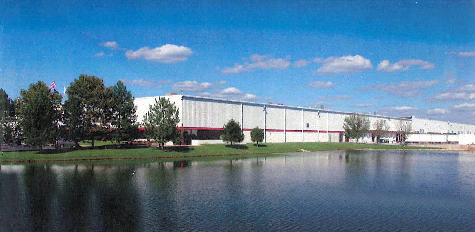
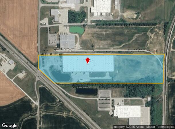
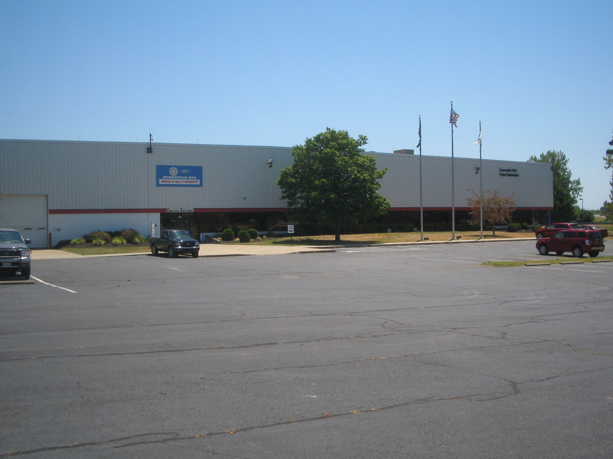
Property Record
1980 S 100 W, Princeton, IN 47670
NEARBY LISTINGS FOR SALE OR LEASE
Property Detail
1980 S 100 W
Warehouse
PT NE 24 2 11 37.626 AC D-10
X
Gibson
18051C0254E
Indiana
2023
37.63 AC
2023
Gibson County
050402
Evansville
367,406 SF
26-11-24-200-000.555-027
DEMOGRAPHICS near 1980 S 100 W
1 Mile
3 Mile
5 Mile
2024 Total Population
332
10,138
12,951
2029 Population
339
10,335
13,161
Pop Growth 2024-2029
+ 2.11%
+ 1.94%
+ 1.62%
Average Age
42
40
41
2024 Total Households
130
4,247
5,356
HH Growth 2024-2029
+ 2.31%
+ 1.93%
+ 1.62%
Median Household Inc
$84,868
$57,102
$58,616
Avg Household Size
2.40
2.30
2.30
2024 Avg HH Vehicles
3.00
2.00
2.00
Median Home Value
$151,162
$125,902
$134,021
Median Year Built
1977
1973
1973
Nearby Places
- Restaurants
- Banks
- Shops
- Fitness
- Groceries
PUBLIC TRANSPORTATION
AIRPORT
Evansville Regional
DRIVE
WALK
Distance
Evansville Regional
32 min
22.6 mi
Freight Ports
Port of Toledo
DRIVE
WALK
Distance
Port of Toledo
447 min
378.4 mi
SALE & LEASE HISTORY
LISTING DATE
SALE/LEASE

Sep 24, 2016
For Sale
Sep 24, 2016
For Sale
Oct 18, 2017
For Lease
May 03, 2017
For Sale
Mar 30, 2017
For Sale
Mar 23, 2017
For Sale
Mar 22, 2017
For Sale
Apr 20, 2017
For Sale
Apr 19, 2017
For Sale
Nearby Properties
Address
Land Use
TOTAL SIZE
Lot Size
Zoning
Address
Land Use
TOTAL SIZE
Lot Size
Zoning
4,362,285 SF
609.34 AC
Address
Land Use
TOTAL SIZE
Lot Size
Zoning
238,585 SF
19.99 AC
Address
Land Use
TOTAL SIZE
Lot Size
Zoning
287,746 SF
Address
Land Use
TOTAL SIZE
Lot Size
Zoning
222,044 SF
80.72 AC
Address
Land Use
TOTAL SIZE
Lot Size
Zoning
69,122 SF
Address
Land Use
TOTAL SIZE
Lot Size
Zoning
2,146 SF
89.21 AC
Address
Land Use
TOTAL SIZE
Lot Size
Zoning
163,990 SF
37.54 AC
Address
Land Use
TOTAL SIZE
Lot Size
Zoning
188,258 SF
25.37 AC
Address
Land Use
TOTAL SIZE
Lot Size
Zoning
280,000 SF
Address
Land Use
TOTAL SIZE
Lot Size
Zoning
127,398 SF
12.92 AC
Address
Land Use
TOTAL SIZE
Lot Size
Zoning
104,912 SF
26.23 AC
Address
Land Use
TOTAL SIZE
Lot Size
Zoning
135,600 SF
Address
Land Use
TOTAL SIZE
Lot Size
Zoning
24,636 SF
2.27 AC
Address
Land Use
TOTAL SIZE
Lot Size
Zoning
91,062 SF
14.08 AC
Address
Land Use
TOTAL SIZE
Lot Size
Zoning
53,241 SF
2.68 AC
Address
Land Use
TOTAL SIZE
Lot Size
Zoning
46,810 SF
7 AC
Address
Land Use
TOTAL SIZE
Lot Size
Zoning
375 SF
12.17 AC
Address
Land Use
TOTAL SIZE
Lot Size
Zoning
656 SF
69.40 AC
Address
Land Use
TOTAL SIZE
Lot Size
Zoning
37,791 SF
1.84 AC
Address
Land Use
TOTAL SIZE
Lot Size
Zoning
16,640 SF
29.66 AC
Address
Land Use
TOTAL SIZE
Lot Size
Zoning
99,372 SF
13.88 AC
Address
Land Use
TOTAL SIZE
Lot Size
Zoning
38,494 SF
4.24 AC
Address
Land Use
TOTAL SIZE
Lot Size
Zoning
14,786 SF
8.37 AC
Address
Land Use
TOTAL SIZE
Lot Size
Zoning
3,840 SF
53.71 AC
Address
Land Use
TOTAL SIZE
Lot Size
Zoning
24,934 SF
Address
Land Use
TOTAL SIZE
Lot Size
Zoning
23,980 SF
1.07 AC
Address
Land Use
TOTAL SIZE
Lot Size
Zoning
116,698 SF
12.52 AC
Address
Land Use
TOTAL SIZE
Lot Size
Zoning
5,198 SF
3.43 AC
Address
Land Use
TOTAL SIZE
Lot Size
Zoning
14,416 SF
3.96 AC
The World's #1 Commercial Real Estate Marketplace
Connect with us
© 2025 CoStar Group
The information above has been obtained from sources believed reliable. While we do not doubt its accuracy we have not verified it and make no guarantee, warranty or representation about it. It is your responsibility to independently confirm its accuracy and completeness. Any projections, opinions, assumptions, or estimates used are for example only and do not represent the current or future performance of the property. The value of this transaction to you depends on tax and other factors which should be evaluated by your tax, financial, and legal advisors. You and your advisors should conduct a careful, independent investigation of the property to determine to your satisfaction the suitability of the property for your needs.