Property Record
19800 S Obrien Rd, Groveland, FL 34736


NEARBY LISTINGS FOR SALE OR LEASE
Property Detail
19800 S Obrien Rd
28-21-25-0001-000-02400
WEST 1/2 OF THE NORTHEAST 1/4 LYING SOUTHEAST OF STATE ROAD 19 AND LYING EASTERLY OF SOUTH O'BRIEN ROAD RIGHT OF WAY OF SECTOIN 28 TOWNSHIP 21 SOUTH RANGE 25 EAST AND BEGIN AT THE SOUTHWEST CORNER OF THE NORTHEAST 1/4 OF THE NORTHEAST 1/4 RUN NORTH 2
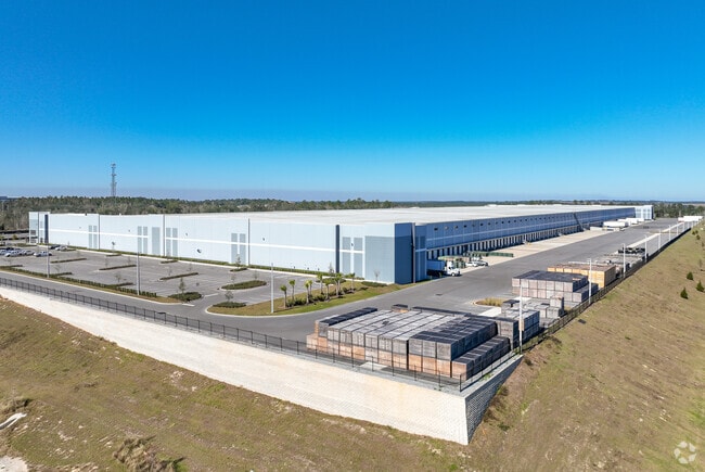
Warehouse
Lake
AE
Florida
12069C0490E
24
0
89.73 AC
2026
Lake County
031206
Orlando
980,381 SF
Orlando-Kissimmee-Sanford, FL
DEMOGRAPHICS near 19800 S Obrien Rd
1 Mile
3 Mile
5 Mile
2024 Total Population
638
8,565
29,238
2029 Population
711
10,085
34,395
Pop Growth 2024-2029
+ 11.44%
+ 17.75%
+ 17.64%
Average Age
54
49
45
2024 Total Households
294
3,220
10,913
HH Growth 2024-2029
+ 10.54%
+ 17.58%
+ 17.36%
Median Household Inc
$65,368
$86,094
$77,184
Avg Household Size
2.20
2.30
2.60
2024 Avg HH Vehicles
2.00
2.00
2.00
Median Home Value
$81,402
$319,822
$291,637
Median Year Built
2011
2010
2006
Nearby Places
Map Layers
Map Styles
 Street
 Aerial
- Restaurants
- Banks
- Shops
- Fitness
- Groceries
SALE & LEASE HISTORY
LISTING DATE
SALE/LEASE

Mar 26, 2025
For Sale
Nearby Properties
Address
Land Use
TOTAL SIZE
Lot Size
Zoning
Address
Land Use
TOTAL SIZE
Lot Size
Zoning
877,798 SF
71.91 AC
PUD
Address
Land Use
TOTAL SIZE
Lot Size
Zoning
570,180 SF
45.30 AC
PUD
Address
Land Use
TOTAL SIZE
Lot Size
Zoning
425,048 SF
29.99 AC
MP
Address
Land Use
TOTAL SIZE
Lot Size
Zoning
707,178 SF
44.54 AC
PUD
Address
Land Use
TOTAL SIZE
Lot Size
Zoning
362,249 SF
100.59 AC
PUD
Address
Land Use
TOTAL SIZE
Lot Size
Zoning
43,769 SF
287.86 AC
C1
Address
Land Use
TOTAL SIZE
Lot Size
Zoning
202,028 SF
47.71 AC
PUD
Address
Land Use
TOTAL SIZE
Lot Size
Zoning
291,197 SF
17.47 AC
PUD
Address
Land Use
TOTAL SIZE
Lot Size
Zoning
250,800 SF
24.02 AC
PUD
Address
Land Use
TOTAL SIZE
Lot Size
Zoning
192,992 SF
20.66 AC
PUD
Address
Land Use
TOTAL SIZE
Lot Size
Zoning
195,697 SF
11.92 AC
PUD
Address
Land Use
TOTAL SIZE
Lot Size
Zoning
125,732 SF
20.19 AC
PUD
Address
Land Use
TOTAL SIZE
Lot Size
Zoning
127,200 SF
10.54 AC
PUD
Address
Land Use
TOTAL SIZE
Lot Size
Zoning
116,737 SF
71.77 AC
MP
Address
Land Use
TOTAL SIZE
Lot Size
Zoning
125,956 SF
31.25 AC
PUD
Address
Land Use
TOTAL SIZE
Lot Size
Zoning
56.54 AC
PUD
Address
Land Use
TOTAL SIZE
Lot Size
Zoning
89,916 SF
10.72 AC
PUD
Address
Land Use
TOTAL SIZE
Lot Size
Zoning
41,283 SF
22.83 AC
MP
Address
Land Use
TOTAL SIZE
Lot Size
Zoning
48,772 SF
51.39 AC
LM
Address
Land Use
TOTAL SIZE
Lot Size
Zoning
46,302 SF
24.06 AC
HM
Address
Land Use
TOTAL SIZE
Lot Size
Zoning
67,562 SF
5.01 AC
Address
Land Use
TOTAL SIZE
Lot Size
Zoning
65,330 SF
3.89 AC
Address
Land Use
TOTAL SIZE
Lot Size
Zoning
59,972 SF
25.12 AC
LM
Address
Land Use
TOTAL SIZE
Lot Size
Zoning
71.86 AC
Address
Land Use
TOTAL SIZE
Lot Size
Zoning
69,000 SF
5.63 AC
PUD
Address
Land Use
TOTAL SIZE
Lot Size
Zoning
64,000 SF
5.31 AC
Address
Land Use
TOTAL SIZE
Lot Size
Zoning
8,030 SF
46.70 AC
C2
Address
Land Use
TOTAL SIZE
Lot Size
Zoning
23.17 AC
A
Address
Land Use
TOTAL SIZE
Lot Size
Zoning
37,600 SF
13.16 AC
The World's #1 Commercial Real Estate Marketplace
Connect with us
© 2026 CoStar Group
The information above has been obtained from sources believed reliable. While we do not doubt its accuracy we have not verified it and make no guarantee, warranty or representation about it. It is your responsibility to independently confirm its accuracy and completeness. Any projections, opinions, assumptions, or estimates used are for example only and do not represent the current or future performance of the property. The value of this transaction to you depends on tax and other factors which should be evaluated by your tax, financial, and legal advisors. You and your advisors should conduct a careful, independent investigation of the property to determine to your satisfaction the suitability of the property for your needs.