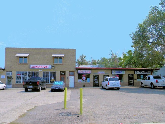
Property Record
1982 Nome St, Aurora, CO 80010


NEARBY LISTINGS FOR SALE OR LEASE
Property Detail
1982 Nome St
Denver-Aurora-Lakewood, CO
Ross Resubd Blk 169 Boston Hts 2Nd Fil
1823-35-4-04-004
SUB:ROSS RESUBD BLK 169 BOSTON HTS 2ND FIL BLK:169 DESC: S 20 FT OF LOTS 1 AND 2
Storebuilding
Adams
X
Colorado
08005C0176K
1,2
2024
0.06 AC
2024
Central
008000
Denver
900 SF
DEMOGRAPHICS near 1982 Nome St
1 Mile
3 Mile
5 Mile
2024 Total Population
23,706
157,221
382,808
2029 Population
24,598
160,008
388,123
Pop Growth 2024-2029
+ 3.76%
+ 1.77%
+ 1.39%
Average Age
35
35
37
2024 Total Households
8,182
55,128
145,206
HH Growth 2024-2029
+ 4.00%
+ 1.82%
+ 1.39%
Median Household Inc
$52,380
$62,233
$69,451
Avg Household Size
2.70
2.70
2.50
2024 Avg HH Vehicles
2.00
2.00
2.00
Median Home Value
$397,052
$394,968
$429,488
Median Year Built
1970
1979
1980
Nearby Places
Map Layers
Map Styles
 Street
 Aerial
- Restaurants
- Banks
- Shops
- Fitness
- Groceries
PUBLIC TRANSPORTATION
COMMUTER RAIL
Peoria Station Track 1 (Union Station to Denver Airport Station - Regional Transportation District)
DRIVE
WALK
Distance
Peoria Station Track 1 (Union Station to Denver Airport Station - Regional Transportation District)
5 min
2.3 mi
Peoria Station Track 2 (Union Station to Denver Airport Station - Regional Transportation District)
DRIVE
WALK
Distance
Peoria Station Track 2 (Union Station to Denver Airport Station - Regional Transportation District)
5 min
2.4 mi
AIRPORT
Denver International
DRIVE
WALK
Distance
Denver International
22 min
16.6 mi
Freight Ports
Tulsa Port Of Catoosa
DRIVE
WALK
Distance
Tulsa Port Of Catoosa
719 min
702.1 mi
SALE & LEASE HISTORY
LISTING DATE
SALE/LEASE

May 17, 2017
For Lease
Dec 04, 2019
For Lease
Nearby Properties
Address
Land Use
TOTAL SIZE
Lot Size
Zoning
Address
Land Use
TOTAL SIZE
Lot Size
Zoning
368,450 SF
48.59 AC
Address
Land Use
TOTAL SIZE
Lot Size
Zoning
353,829 SF
4.51 AC
Address
Land Use
TOTAL SIZE
Lot Size
Zoning
719,357 SF
21.47 AC
M-MX-5
Address
Land Use
TOTAL SIZE
Lot Size
Zoning
880,442 SF
67.95 AC
I-B
Address
Land Use
TOTAL SIZE
Lot Size
Zoning
525,050 SF
105.06 AC
Address
Land Use
TOTAL SIZE
Lot Size
Zoning
161,437 SF
2.22 AC
RCZDC
Address
Land Use
TOTAL SIZE
Lot Size
Zoning
97,001 SF
Address
Land Use
TOTAL SIZE
Lot Size
Zoning
87,346 SF
1.76 AC
RFBAD
Address
Land Use
TOTAL SIZE
Lot Size
Zoning
691,200 SF
38.09 AC
Address
Land Use
TOTAL SIZE
Lot Size
Zoning
273,184 SF
1.89 AC
Address
Land Use
TOTAL SIZE
Lot Size
Zoning
390,822 SF
13.47 AC
O-1
Address
Land Use
TOTAL SIZE
Lot Size
Zoning
57,392 SF
0.72 AC
Address
Land Use
TOTAL SIZE
Lot Size
Zoning
185,206 SF
9.94 AC
C-MX
Address
Land Use
TOTAL SIZE
Lot Size
Zoning
315,058 SF
36.85 AC
RPCZD
Address
Land Use
TOTAL SIZE
Lot Size
Zoning
646,975 SF
32.60 AC
M-IMX-8
Address
Land Use
TOTAL SIZE
Lot Size
Zoning
33.01 AC
M-IMX-12
Address
Land Use
TOTAL SIZE
Lot Size
Zoning
269,622 SF
12.90 AC
Address
Land Use
TOTAL SIZE
Lot Size
Zoning
253,099 SF
7.15 AC
E-SU-DX
Address
Land Use
TOTAL SIZE
Lot Size
Zoning
723,053 SF
32.44 AC
M-IMX-12
Address
Land Use
TOTAL SIZE
Lot Size
Zoning
677,018 SF
5.05 AC
C-MX
Address
Land Use
TOTAL SIZE
Lot Size
Zoning
178,235 SF
1.38 AC
RFBAD
Address
Land Use
TOTAL SIZE
Lot Size
Zoning
51,075 SF
0.72 AC
Address
Land Use
TOTAL SIZE
Lot Size
Zoning
238,845 SF
1.70 AC
Address
Land Use
TOTAL SIZE
Lot Size
Zoning
624,019 SF
4.09 AC
Address
Land Use
TOTAL SIZE
Lot Size
Zoning
672,521 SF
0.61 AC
RB3
Address
Land Use
TOTAL SIZE
Lot Size
Zoning
400,000 SF
22.91 AC
I-0
Address
Land Use
TOTAL SIZE
Lot Size
Zoning
176,751 SF
28.75 AC
Address
Land Use
TOTAL SIZE
Lot Size
Zoning
466,055 SF
24.82 AC
M-IMX-5
Address
Land Use
TOTAL SIZE
Lot Size
Zoning
111,358 SF
1.21 AC
Address
Land Use
TOTAL SIZE
Lot Size
Zoning
277,005 SF
16.37 AC
The World's #1 Commercial Real Estate Marketplace
Connect with us
© 2025 CoStar Group
The information above has been obtained from sources believed reliable. While we do not doubt its accuracy we have not verified it and make no guarantee, warranty or representation about it. It is your responsibility to independently confirm its accuracy and completeness. Any projections, opinions, assumptions, or estimates used are for example only and do not represent the current or future performance of the property. The value of this transaction to you depends on tax and other factors which should be evaluated by your tax, financial, and legal advisors. You and your advisors should conduct a careful, independent investigation of the property to determine to your satisfaction the suitability of the property for your needs.