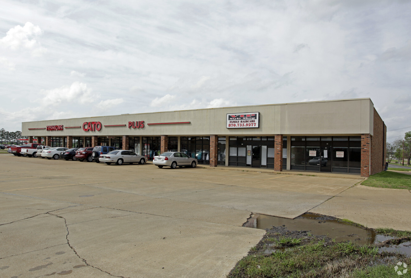
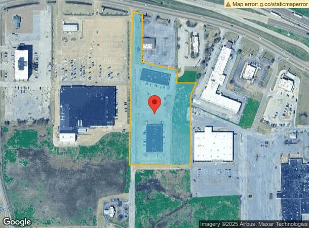
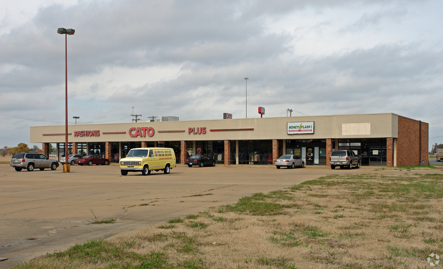
Property Record
1985 Kroger Dr, West Memphis, AR 72301
NEARBY LISTINGS FOR SALE OR LEASE
Property Detail
1985 Kroger Dr
Memphis, TN-MS-AR
Walmart Shopping Ctr Ph I
388-050040-000
PLAT BOOK 3-254,3-399
Stripcommercialcenter
Crittenden
X
Arkansas
05035C0340E
5
2023
6.07 AC
2024
Crittenden County
030201
Memphis
11,041 SF
DEMOGRAPHICS near 1985 Kroger Dr
1 Mile
3 Mile
5 Mile
2024 Total Population
4,421
32,221
37,701
2029 Population
4,275
31,296
36,659
Pop Growth 2024-2029
(3.30%)
(2.87%)
(2.76%)
Average Age
38
38
38
2024 Total Households
1,781
12,671
14,751
HH Growth 2024-2029
(3.37%)
(2.89%)
(2.77%)
Median Household Inc
$45,141
$44,647
$44,907
Avg Household Size
2.30
2.50
2.50
2024 Avg HH Vehicles
2.00
2.00
2.00
Median Home Value
$118,559
$135,101
$141,266
Median Year Built
1965
1980
1982
Nearby Places
- Restaurants
- Banks
- Shops
- Fitness
- Groceries
PUBLIC TRANSPORTATION
COMMUTER RAIL
Central Station (Riverfront Loop - Memphis Area Transit Authority Trolley (MataTrolley))
DRIVE
WALK
Distance
Central Station (Riverfront Loop - Memphis Area Transit Authority Trolley (MataTrolley))
12 min
8.9 mi
AIRPORT
Memphis International
DRIVE
WALK
Distance
Memphis International
26 min
18.0 mi
Freight Ports
Port of Shreveport
DRIVE
WALK
Distance
Port of Shreveport
389 min
360.3 mi
Nearby Properties
Address
Land Use
TOTAL SIZE
Lot Size
Zoning
Address
Land Use
TOTAL SIZE
Lot Size
Zoning
148,005 SF
134.67 AC
Address
Land Use
TOTAL SIZE
Lot Size
Zoning
5,772 SF
20 AC
Address
Land Use
TOTAL SIZE
Lot Size
Zoning
46,927 SF
7.52 AC
Address
Land Use
TOTAL SIZE
Lot Size
Zoning
665,000 SF
46.40 AC
Address
Land Use
TOTAL SIZE
Lot Size
Zoning
844,801 SF
77.14 AC
Address
Land Use
TOTAL SIZE
Lot Size
Zoning
194,110 SF
125.33 AC
Address
Land Use
TOTAL SIZE
Lot Size
Zoning
209,064 SF
26.97 AC
Address
Land Use
TOTAL SIZE
Lot Size
Zoning
79,208 SF
3.98 AC
Address
Land Use
TOTAL SIZE
Lot Size
Zoning
87,608 SF
10.02 AC
Address
Land Use
TOTAL SIZE
Lot Size
Zoning
28,600 SF
7 AC
Address
Land Use
TOTAL SIZE
Lot Size
Zoning
69,600 SF
38.09 AC
Address
Land Use
TOTAL SIZE
Lot Size
Zoning
7,482 SF
7.17 AC
Address
Land Use
TOTAL SIZE
Lot Size
Zoning
3,960 SF
14.54 AC
Address
Land Use
TOTAL SIZE
Lot Size
Zoning
148,342 SF
9.87 AC
Address
Land Use
TOTAL SIZE
Lot Size
Zoning
12,088 SF
98.07 AC
Address
Land Use
TOTAL SIZE
Lot Size
Zoning
58,365 SF
6.11 AC
Address
Land Use
TOTAL SIZE
Lot Size
Zoning
43,570 SF
1.80 AC
Address
Land Use
TOTAL SIZE
Lot Size
Zoning
9,207 SF
2.31 AC
Address
Land Use
TOTAL SIZE
Lot Size
Zoning
2,728 SF
10.54 AC
Address
Land Use
TOTAL SIZE
Lot Size
Zoning
23,900 SF
11.23 AC
Address
Land Use
TOTAL SIZE
Lot Size
Zoning
43,781 SF
1.65 AC
Address
Land Use
TOTAL SIZE
Lot Size
Zoning
3,456 SF
6.09 AC
Address
Land Use
TOTAL SIZE
Lot Size
Zoning
10,220 SF
11.74 AC
Address
Land Use
TOTAL SIZE
Lot Size
Zoning
50,279 SF
2.20 AC
Address
Land Use
TOTAL SIZE
Lot Size
Zoning
168,256 SF
3.06 AC
Address
Land Use
TOTAL SIZE
Lot Size
Zoning
12,000 SF
10.35 AC
Address
Land Use
TOTAL SIZE
Lot Size
Zoning
64,791 SF
3.57 AC
Address
Land Use
TOTAL SIZE
Lot Size
Zoning
28,746 SF
3.11 AC
Address
Land Use
TOTAL SIZE
Lot Size
Zoning
Address
Land Use
TOTAL SIZE
Lot Size
Zoning
67,750 SF
5.24 AC
The World's #1 Commercial Real Estate Marketplace
Connect with us
© 2025 CoStar Group
The information above has been obtained from sources believed reliable. While we do not doubt its accuracy we have not verified it and make no guarantee, warranty or representation about it. It is your responsibility to independently confirm its accuracy and completeness. Any projections, opinions, assumptions, or estimates used are for example only and do not represent the current or future performance of the property. The value of this transaction to you depends on tax and other factors which should be evaluated by your tax, financial, and legal advisors. You and your advisors should conduct a careful, independent investigation of the property to determine to your satisfaction the suitability of the property for your needs.