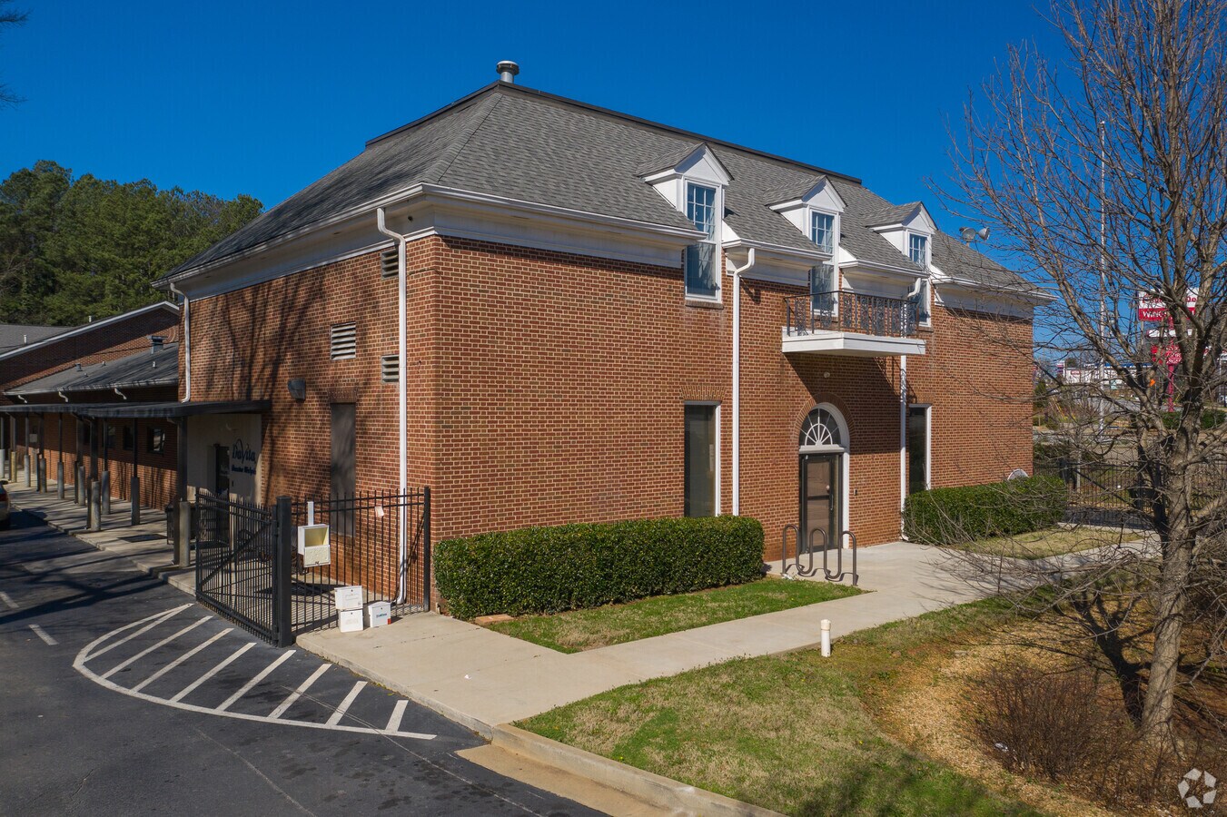
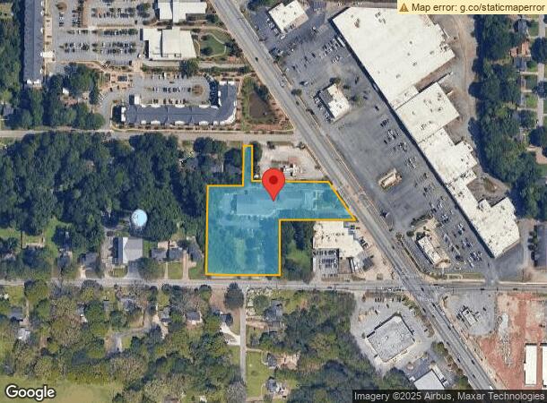
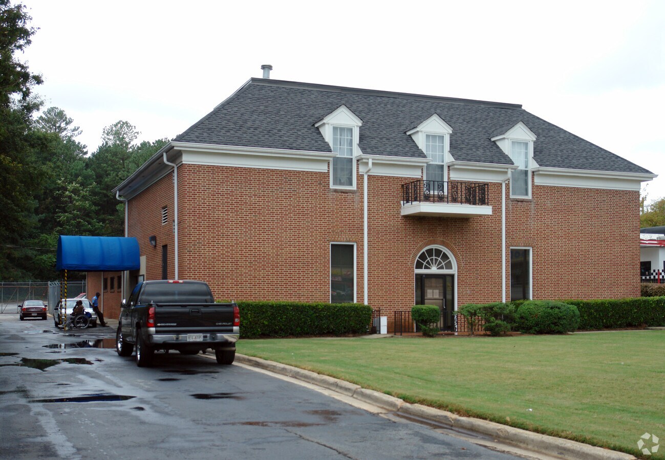
Property Record
1987 Candler Rd, Decatur, GA 30032

Current Lease Availabilities
NEARBY LISTINGS FOR SALE OR LEASE
Property Detail
1987 Candler Rd
15-170-05-021
TRACT 22-MAY-07 2.4AC 125 X 8 X 15 X 8 X 20 X ...
Medicalbuilding
DeKalb
X
Georgia
13089C0131J
21
2023
2.80 AC
2023
I-20 East/Conyers
023601
Atlanta
16,280 SF
Atlanta-Sandy Springs-Roswell, GA
DEMOGRAPHICS near 1987 Candler Rd
1 Mile
3 Mile
5 Mile
2024 Total Population
10,702
100,432
268,787
2029 Population
10,764
100,808
271,221
Pop Growth 2024-2029
+ 0.58%
+ 0.37%
+ 0.91%
Average Age
42
40
39
2024 Total Households
4,529
41,453
112,591
HH Growth 2024-2029
+ 0.57%
+ 0.42%
+ 1.13%
Median Household Inc
$52,302
$64,354
$74,675
Avg Household Size
2.30
2.40
2.30
2024 Avg HH Vehicles
2.00
2.00
2.00
Median Home Value
$303,729
$330,712
$347,386
Median Year Built
1959
1967
1975
Nearby Places
- Restaurants
- Banks
- Shops
- Fitness
- Groceries
PUBLIC TRANSPORTATION
AIRPORT
Hartsfield - Jackson Atlanta International
DRIVE
WALK
Distance
Hartsfield - Jackson Atlanta International
24 min
14.1 mi
Freight Ports
Georgia Ports - Savannah
DRIVE
WALK
Distance
Georgia Ports - Savannah
277 min
246.0 mi
Nearby Properties
Address
Land Use
TOTAL SIZE
Lot Size
Zoning
Address
Land Use
TOTAL SIZE
Lot Size
Zoning
327,098 SF
4.92 AC
X
Address
Land Use
TOTAL SIZE
Lot Size
Zoning
67,882 SF
4.76 AC
X
Address
Land Use
TOTAL SIZE
Lot Size
Zoning
290,130 SF
6 AC
R100
Address
Land Use
TOTAL SIZE
Lot Size
Zoning
123,732 SF
0.50 AC
RM75
Address
Land Use
TOTAL SIZE
Lot Size
Zoning
104,501 SF
2.56 AC
X
Address
Land Use
TOTAL SIZE
Lot Size
Zoning
13,114 SF
18 AC
RM100
Address
Land Use
TOTAL SIZE
Lot Size
Zoning
286,700 SF
0.30 AC
G-C
Address
Land Use
TOTAL SIZE
Lot Size
Zoning
522,850 SF
40.50 AC
RM75
Address
Land Use
TOTAL SIZE
Lot Size
Zoning
81,129 SF
4.29 AC
C1
Address
Land Use
TOTAL SIZE
Lot Size
Zoning
132,604 SF
19.10 AC
RM100
Address
Land Use
TOTAL SIZE
Lot Size
Zoning
64,296 SF
0.40 AC
X
Address
Land Use
TOTAL SIZE
Lot Size
Zoning
137,771 SF
15.30 AC
RM75
Address
Land Use
TOTAL SIZE
Lot Size
Zoning
72,870 SF
12.30 AC
C2
Address
Land Use
TOTAL SIZE
Lot Size
Zoning
259,845 SF
17.40 AC
RM85
Address
Land Use
TOTAL SIZE
Lot Size
Zoning
245,053 SF
22.70 AC
RM85
Address
Land Use
TOTAL SIZE
Lot Size
Zoning
234,053 SF
16.90 AC
RM75
Address
Land Use
TOTAL SIZE
Lot Size
Zoning
554,853 SF
43.10 AC
RM75
Address
Land Use
TOTAL SIZE
Lot Size
Zoning
367,452 SF
31.30 AC
RM100
Address
Land Use
TOTAL SIZE
Lot Size
Zoning
77,605 SF
4.11 AC
RMH
Address
Land Use
TOTAL SIZE
Lot Size
Zoning
29,028 SF
3.70 AC
RMH
Address
Land Use
TOTAL SIZE
Lot Size
Zoning
295,632 SF
18.10 AC
RM75
Address
Land Use
TOTAL SIZE
Lot Size
Zoning
133,052 SF
14.80 AC
RM85
Address
Land Use
TOTAL SIZE
Lot Size
Zoning
35,934 SF
0.49 AC
X
Address
Land Use
TOTAL SIZE
Lot Size
Zoning
2,484 SF
1.97 AC
X
Address
Land Use
TOTAL SIZE
Lot Size
Zoning
207,757 SF
19.20 AC
RM85
Address
Land Use
TOTAL SIZE
Lot Size
Zoning
278,121 SF
20.90 AC
RM85
Address
Land Use
TOTAL SIZE
Lot Size
Zoning
219,652 SF
27 AC
C1
Address
Land Use
TOTAL SIZE
Lot Size
Zoning
419,434 SF
21.20 AC
RM85
Address
Land Use
TOTAL SIZE
Lot Size
Zoning
1,647 SF
30.90 AC
R60
Address
Land Use
TOTAL SIZE
Lot Size
Zoning
83,787 SF
4.50 AC
M1
The World's #1 Commercial Real Estate Marketplace
Connect with us
© 2025 CoStar Group
The information above has been obtained from sources believed reliable. While we do not doubt its accuracy we have not verified it and make no guarantee, warranty or representation about it. It is your responsibility to independently confirm its accuracy and completeness. Any projections, opinions, assumptions, or estimates used are for example only and do not represent the current or future performance of the property. The value of this transaction to you depends on tax and other factors which should be evaluated by your tax, financial, and legal advisors. You and your advisors should conduct a careful, independent investigation of the property to determine to your satisfaction the suitability of the property for your needs.