Property Record
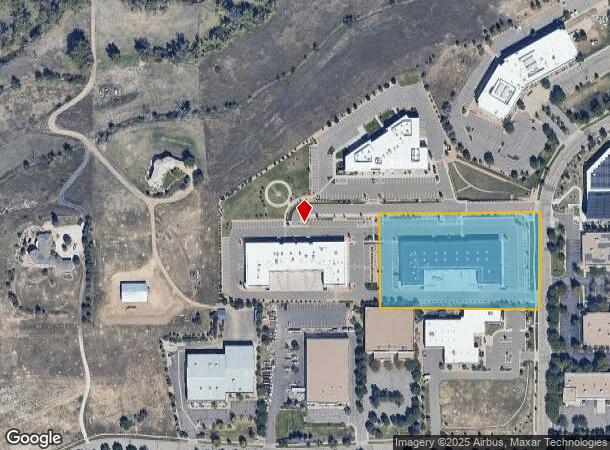
199 S Taylor Ave, Louisville, CO 80027
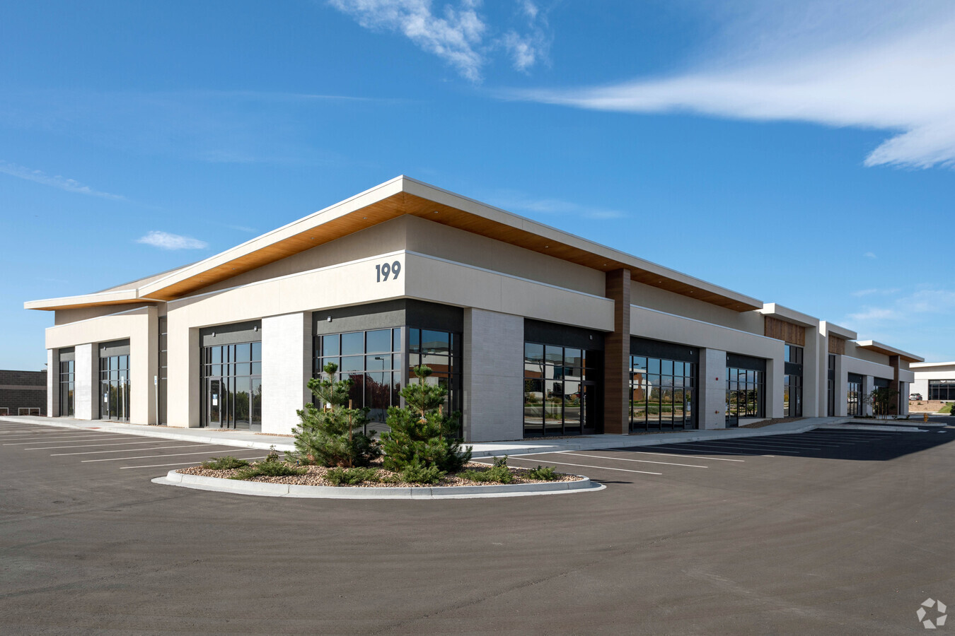
This Property Is For Sale
Current Lease Availabilities
NEARBY LISTINGS FOR SALE OR LEASE
Property Detail
199 S Taylor Ave
Boulder, CO
Business Center At Ctc Replat G
1575160-34-001
LOT 1 BUSINESS CENTER AT CTC REPLAT G
Industrialgeneral
Boulder
X
Colorado
08013C0601K
1
2023
3.17 AC
2024
Boulder County
060700
Denver
36,769 SF
DEMOGRAPHICS near 199 S Taylor Ave
1 Mile
3 Mile
5 Mile
2024 Total Population
3,166
61,777
122,389
2029 Population
3,144
62,156
126,324
Pop Growth 2024-2029
(0.69%)
+ 0.61%
+ 3.22%
Average Age
42
40
41
2024 Total Households
1,305
25,364
49,444
HH Growth 2024-2029
(0.92%)
+ 0.78%
+ 3.42%
Median Household Inc
$105,952
$107,813
$111,877
Avg Household Size
2.40
2.40
2.40
2024 Avg HH Vehicles
2.00
2.00
2.00
Median Home Value
$755,116
$688,632
$685,219
Median Year Built
1982
1992
1995
Nearby Places
- Restaurants
- Banks
- Shops
- Fitness
- Groceries
PUBLIC TRANSPORTATION
AIRPORT
Denver International
DRIVE
WALK
Distance
Denver International
41 min
33.2 mi
Freight Ports
Tulsa Port Of Catoosa
DRIVE
WALK
Distance
Tulsa Port Of Catoosa
747 min
727.4 mi
Nearby Properties
Address
Land Use
TOTAL SIZE
Lot Size
Zoning
Address
Land Use
TOTAL SIZE
Lot Size
Zoning
776,625 SF
43.40 AC
PUD
Address
Land Use
TOTAL SIZE
Lot Size
Zoning
62.60 AC
Address
Land Use
TOTAL SIZE
Lot Size
Zoning
411,485 SF
24.79 AC
Address
Land Use
TOTAL SIZE
Lot Size
Zoning
188,092 SF
2.01 AC
Address
Land Use
TOTAL SIZE
Lot Size
Zoning
279,770 SF
34.13 AC
Address
Land Use
TOTAL SIZE
Lot Size
Zoning
320,771 SF
18.60 AC
PUD
Address
Land Use
TOTAL SIZE
Lot Size
Zoning
154,528 SF
13.96 AC
A
Address
Land Use
TOTAL SIZE
Lot Size
Zoning
453,015 SF
12.10 AC
B-PUD
Address
Land Use
TOTAL SIZE
Lot Size
Zoning
446,461 SF
18.19 AC
B-PUD
Address
Land Use
TOTAL SIZE
Lot Size
Zoning
207,248 SF
15.66 AC
Address
Land Use
TOTAL SIZE
Lot Size
Zoning
120,510 SF
11.02 AC
Address
Land Use
TOTAL SIZE
Lot Size
Zoning
200,000 SF
20.32 AC
Address
Land Use
TOTAL SIZE
Lot Size
Zoning
135,508 SF
9.64 AC
Address
Land Use
TOTAL SIZE
Lot Size
Zoning
42.46 AC
A
Address
Land Use
TOTAL SIZE
Lot Size
Zoning
247,609 SF
14.53 AC
Address
Land Use
TOTAL SIZE
Lot Size
Zoning
153,430 SF
12.16 AC
Address
Land Use
TOTAL SIZE
Lot Size
Zoning
191,727 SF
4 AC
PUD
Address
Land Use
TOTAL SIZE
Lot Size
Zoning
387,684 SF
9.37 AC
PUD
Address
Land Use
TOTAL SIZE
Lot Size
Zoning
165,172 SF
11.12 AC
Address
Land Use
TOTAL SIZE
Lot Size
Zoning
308,482 SF
16.27 AC
B-PUD
Address
Land Use
TOTAL SIZE
Lot Size
Zoning
146,318 SF
10.46 AC
Address
Land Use
TOTAL SIZE
Lot Size
Zoning
164,842 SF
10.97 AC
Address
Land Use
TOTAL SIZE
Lot Size
Zoning
136,448 SF
10.86 AC
Address
Land Use
TOTAL SIZE
Lot Size
Zoning
400,742 SF
24.25 AC
Address
Land Use
TOTAL SIZE
Lot Size
Zoning
160,675 SF
7.24 AC
PUD
Address
Land Use
TOTAL SIZE
Lot Size
Zoning
200,885 SF
17.84 AC
Address
Land Use
TOTAL SIZE
Lot Size
Zoning
88,427 SF
6.98 AC
B-PUD
Address
Land Use
TOTAL SIZE
Lot Size
Zoning
107,468 SF
15.29 AC
Address
Land Use
TOTAL SIZE
Lot Size
Zoning
88,427 SF
7.18 AC
B-PUD
Address
Land Use
TOTAL SIZE
Lot Size
Zoning
109,547 SF
7.91 AC
The World's #1 Commercial Real Estate Marketplace
Connect with us
© 2025 CoStar Group
The information above has been obtained from sources believed reliable. While we do not doubt its accuracy we have not verified it and make no guarantee, warranty or representation about it. It is your responsibility to independently confirm its accuracy and completeness. Any projections, opinions, assumptions, or estimates used are for example only and do not represent the current or future performance of the property. The value of this transaction to you depends on tax and other factors which should be evaluated by your tax, financial, and legal advisors. You and your advisors should conduct a careful, independent investigation of the property to determine to your satisfaction the suitability of the property for your needs.