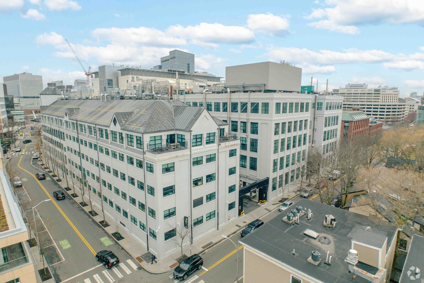
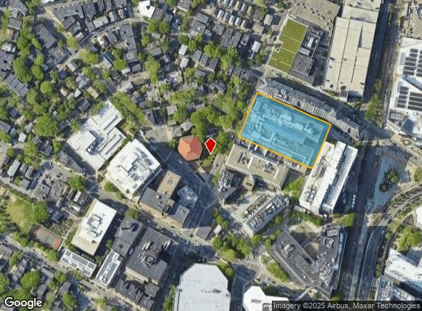
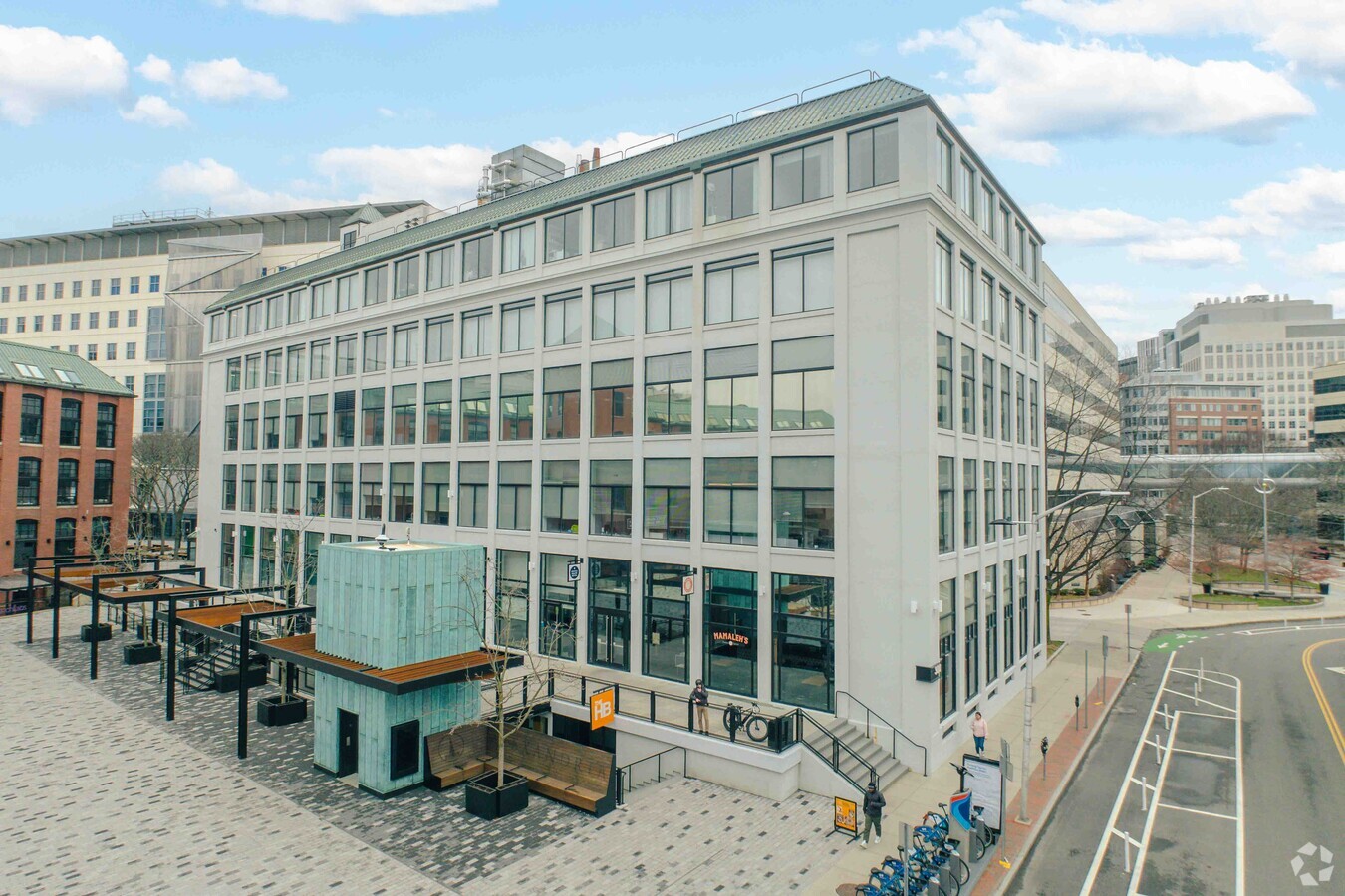
Property Record
1B Kendall Sq, Cambridge, MA 02139
NEARBY LISTINGS FOR SALE OR LEASE
-
-
-
-
-
-
-
-
-
-
-
-
-
-
-
-
-
No Photo
-
-
-
-
-
-
-
View all Cambridge listings for lease on LoopNet.com
Property Detail
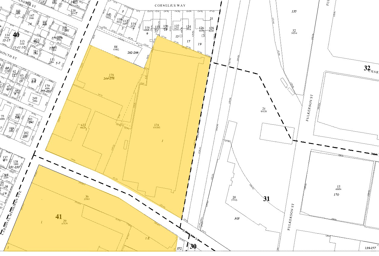
1B Kendall Sq
CAMB-000041-000000-000029
Middlesex
Industrialgeneral
Massachusetts
X
29
25025C0077J
1.55 AC
2020
E Cambridge/Kendall Sq
2024
Boston
352600
Boston-Cambridge-Newton, MA-NH
DEMOGRAPHICS near 1B Kendall Sq
1 Mile
3 Mile
5 Mile
2024 Total Population
54,169
507,075
988,821
2029 Population
53,591
493,718
955,206
Pop Growth 2024-2029
(1.07%)
(2.63%)
(3.40%)
Average Age
35
36
37
2024 Total Households
23,988
223,646
411,257
HH Growth 2024-2029
(1.00%)
(2.82%)
(3.56%)
Median Household Inc
$114,039
$98,226
$93,337
Avg Household Size
2.00
2.00
2.20
2024 Avg HH Vehicles
1.00
1.00
1.00
Median Home Value
$919,029
$906,813
$803,115
Median Year Built
1956
1953
1949
Nearby Places
- Restaurants
- Banks
- Shops
- Fitness
- Groceries
PUBLIC TRANSPORTATION
TRANSIT/SUBWAY
Kendall Station (Red Line - Massachusetts Bay Transportation Authority Subway (The T))
DRIVE
WALK
Distance
Kendall Station (Red Line - Massachusetts Bay Transportation Authority Subway (The T))
1 min
9 min
0.5 mi
Central Square Station (Red Line - Massachusetts Bay Transportation Authority Subway (The T))
DRIVE
WALK
Distance
Central Square Station (Red Line - Massachusetts Bay Transportation Authority Subway (The T))
2 min
15 min
0.8 mi
Union Square (Green Line D - MBTA)
DRIVE
WALK
Distance
Union Square (Green Line D - MBTA)
3 min
18 min
0.9 mi
Lechmere Station (Green Line - E - Massachusetts Bay Transportation Authority Subway (The T))
DRIVE
WALK
Distance
Lechmere Station (Green Line - E - Massachusetts Bay Transportation Authority Subway (The T))
3 min
18 min
1.0 mi
COMMUTER RAIL
North Station (Fitchburg/South Acton Line - Massachusetts Bay Transportation Authority Commuter Rail (Purple Line), Haverhill Line - Massachusetts Bay Transportation Authority Commuter Rail (Purple Line), Lowell Line - Massachusetts Bay Transportation Authority Commuter Rail (Purple Line), Newburyport/Rockport Line - Massachusetts Bay Transportation Authority Commuter Rail (Purple Line))
DRIVE
WALK
Distance
North Station (Fitchburg/South Acton Line - Massachusetts Bay Transportation Authority Commuter Rail (Purple Line), Haverhill Line - Massachusetts Bay Transportation Authority Commuter Rail (Purple Line), Lowell Line - Massachusetts Bay Transportation Authority Commuter Rail (Purple Line), Newburyport/Rockport Line - Massachusetts Bay Transportation Authority Commuter Rail (Purple Line))
6 min
2.1 mi
Yawkey (Framingham/Worcester Line - Massachusetts Bay Transportation Authority Commuter Rail (Purple Line))
DRIVE
WALK
Distance
Yawkey (Framingham/Worcester Line - Massachusetts Bay Transportation Authority Commuter Rail (Purple Line))
7 min
3.5 mi
AIRPORT
General Edward Lawrence Logan International
DRIVE
WALK
Distance
General Edward Lawrence Logan International
11 min
5.2 mi
Freight Ports
Port of Boston
DRIVE
WALK
Distance
Port of Boston
12 min
4.9 mi
SALE & LEASE HISTORY
LISTING DATE
SALE/LEASE

Sep 25, 2016
For Lease
Oct 28, 2019
For Lease
Nov 14, 2019
For Lease
Nov 03, 2022
For Lease
Jan 26, 2018
For Lease
Jan 06, 2022
For Lease
Feb 19, 2018
For Lease
Dec 18, 2020
For Lease
Dec 18, 2019
For Lease
Nearby Properties
Address
Land Use
TOTAL SIZE
Lot Size
Zoning
Address
Land Use
TOTAL SIZE
Lot Size
Zoning
909,764 SF
25.13 AC
E
Address
Land Use
TOTAL SIZE
Lot Size
Zoning
610,560 SF
4 AC
E
Address
Land Use
TOTAL SIZE
Lot Size
Zoning
2.79 AC
Address
Land Use
TOTAL SIZE
Lot Size
Zoning
467,952 SF
0.86 AC
BPA
Address
Land Use
TOTAL SIZE
Lot Size
Zoning
495,000 SF
1.27 AC
Address
Land Use
TOTAL SIZE
Lot Size
Zoning
488,832 SF
1.38 AC
BB
Address
Land Use
TOTAL SIZE
Lot Size
Zoning
469,670 SF
7.60 AC
C
Address
Land Use
TOTAL SIZE
Lot Size
Zoning
142,458 SF
1.67 AC
C-3
Address
Land Use
TOTAL SIZE
Lot Size
Zoning
230,394 SF
0.60 AC
MXD
Address
Land Use
TOTAL SIZE
Lot Size
Zoning
448,796 SF
1.84 AC
C
Address
Land Use
TOTAL SIZE
Lot Size
Zoning
304,349 SF
1.72 AC
Address
Land Use
TOTAL SIZE
Lot Size
Zoning
342,300 SF
1.04 AC
C
Address
Land Use
TOTAL SIZE
Lot Size
Zoning
150,192 SF
10.27 AC
E
Address
Land Use
TOTAL SIZE
Lot Size
Zoning
530,200 SF
62.08 AC
E
Address
Land Use
TOTAL SIZE
Lot Size
Zoning
239,377 SF
0.71 AC
MXD
Address
Land Use
TOTAL SIZE
Lot Size
Zoning
114,000 SF
1.20 AC
RC
Address
Land Use
TOTAL SIZE
Lot Size
Zoning
46,259 SF
1.04 AC
E
Address
Land Use
TOTAL SIZE
Lot Size
Zoning
379,172 SF
1.04 AC
RC
Address
Land Use
TOTAL SIZE
Lot Size
Zoning
4,355 SF
13.12 AC
E
Address
Land Use
TOTAL SIZE
Lot Size
Zoning
1.13 AC
C
Address
Land Use
TOTAL SIZE
Lot Size
Zoning
2.81 AC
O-2
Address
Land Use
TOTAL SIZE
Lot Size
Zoning
387,083 SF
1.92 AC
RC
Address
Land Use
TOTAL SIZE
Lot Size
Zoning
2.25 AC
SD-12
Address
Land Use
TOTAL SIZE
Lot Size
Zoning
157,083 SF
0.41 AC
C
Address
Land Use
TOTAL SIZE
Lot Size
Zoning
435,381 SF
4.22 AC
LB-R
Address
Land Use
TOTAL SIZE
Lot Size
Zoning
227,107 SF
7.70 AC
E
Address
Land Use
TOTAL SIZE
Lot Size
Zoning
334,522 SF
1.26 AC
C
Address
Land Use
TOTAL SIZE
Lot Size
Zoning
47.66 AC
UN
Address
Land Use
TOTAL SIZE
Lot Size
Zoning
419,722 SF
2.02 AC
RC
Address
Land Use
TOTAL SIZE
Lot Size
Zoning
341,500 SF
1.18 AC
RC
The World's #1 Commercial Real Estate Marketplace
Connect with us
© 2025 CoStar Group
The information above has been obtained from sources believed reliable. While we do not doubt its accuracy we have not verified it and make no guarantee, warranty or representation about it. It is your responsibility to independently confirm its accuracy and completeness. Any projections, opinions, assumptions, or estimates used are for example only and do not represent the current or future performance of the property. The value of this transaction to you depends on tax and other factors which should be evaluated by your tax, financial, and legal advisors. You and your advisors should conduct a careful, independent investigation of the property to determine to your satisfaction the suitability of the property for your needs.