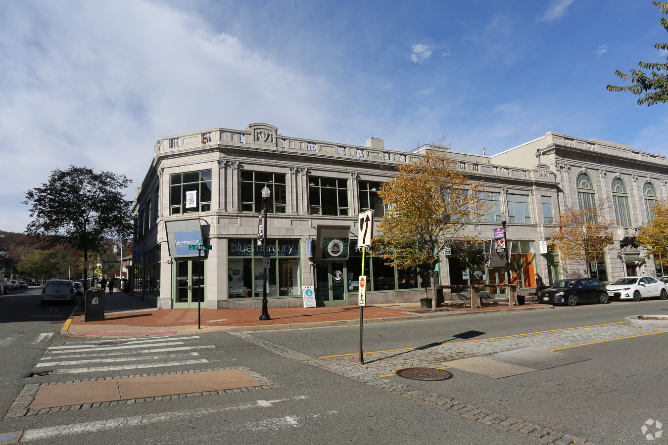
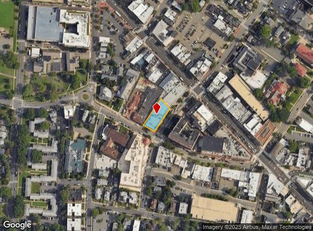
Property Record
22 S Park & 55 Church St, Montclair, NJ 07042
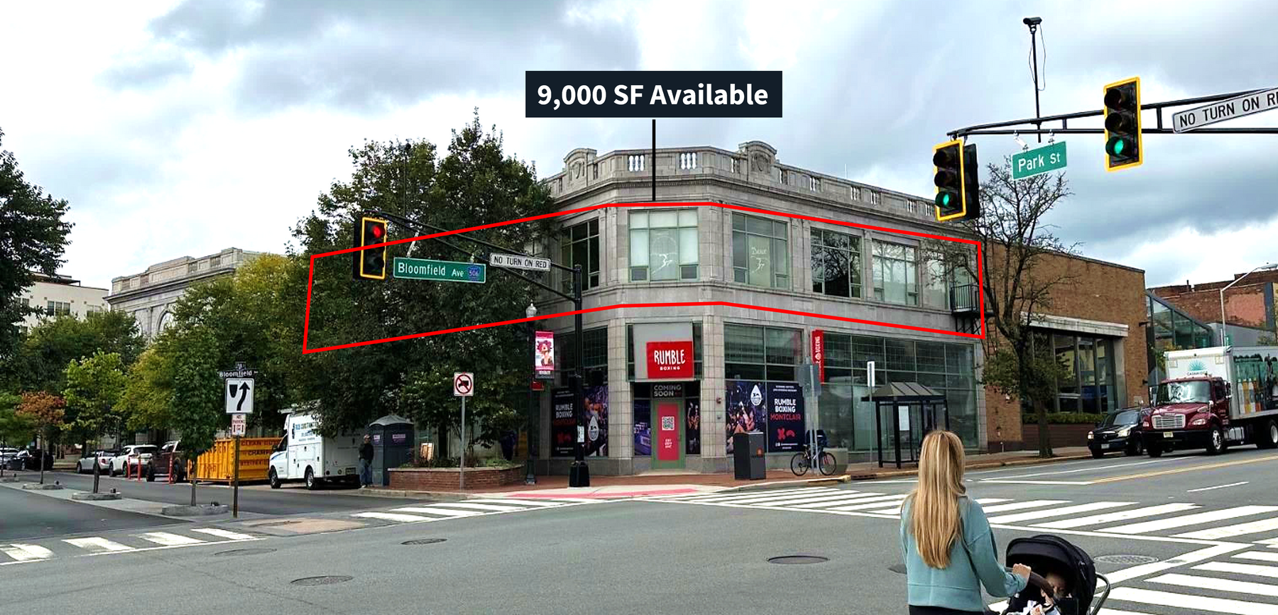
Current Lease Availabilities
NEARBY LISTINGS FOR SALE OR LEASE
Property Detail
22 S Park & 55 Church St
13-02208-0000-00016
168X78 IRR
Storebuilding
Essex
X
New Jersey
34013C0103F
16
2023
0.30 AC
2024
Urban Essex
016800
Northern New Jersey
24,867 SF
Newark, NJ-PA
DEMOGRAPHICS near 22 S Park & 55 Church St
1 Mile
3 Mile
5 Mile
2024 Total Population
23,244
195,247
584,209
2029 Population
22,978
192,193
572,519
Pop Growth 2024-2029
(1.14%)
(1.56%)
(2.00%)
Average Age
40
41
40
2024 Total Households
9,955
75,304
217,620
HH Growth 2024-2029
(1.28%)
(1.72%)
(2.12%)
Median Household Inc
$118,788
$96,569
$80,394
Avg Household Size
2.20
2.50
2.60
2024 Avg HH Vehicles
1.00
2.00
2.00
Median Home Value
$649,923
$470,753
$454,122
Median Year Built
1948
1952
1955
Nearby Places
- Restaurants
- Banks
- Shops
- Fitness
- Groceries
PUBLIC TRANSPORTATION
COMMUTER RAIL
Bay Street (Montclair-Boonton Line - NJ Transit Commuter Rail (NJ Transit))
DRIVE
WALK
Distance
Bay Street (Montclair-Boonton Line - NJ Transit Commuter Rail (NJ Transit))
3 min
16 min
0.9 mi
Walnut Street (Montclair-Boonton Line - NJ Transit Commuter Rail (NJ Transit))
DRIVE
WALK
Distance
Walnut Street (Montclair-Boonton Line - NJ Transit Commuter Rail (NJ Transit))
4 min
18 min
1.0 mi
AIRPORT
Newark Liberty International
DRIVE
WALK
Distance
Newark Liberty International
21 min
16.0 mi
La Guardia
DRIVE
WALK
Distance
La Guardia
44 min
33.3 mi
John F. Kennedy International
DRIVE
WALK
Distance
John F. Kennedy International
56 min
36.6 mi
Freight Ports
Port Newark Container Terminal
DRIVE
WALK
Distance
Port Newark Container Terminal
1 min
9.3 mi
Nearby Properties
Address
Land Use
TOTAL SIZE
Lot Size
Zoning
Address
Land Use
TOTAL SIZE
Lot Size
Zoning
5 AC
H
Address
Land Use
TOTAL SIZE
Lot Size
Zoning
16,084 SF
7.23 AC
Address
Land Use
TOTAL SIZE
Lot Size
Zoning
1,589 SF
R4
Address
Land Use
TOTAL SIZE
Lot Size
Zoning
12.54 AC
OPRP
Address
Land Use
TOTAL SIZE
Lot Size
Zoning
Address
Land Use
TOTAL SIZE
Lot Size
Zoning
5.26 AC
Address
Land Use
TOTAL SIZE
Lot Size
Zoning
33.60 AC
P-C
Address
Land Use
TOTAL SIZE
Lot Size
Zoning
11.49 AC
M-1
Address
Land Use
TOTAL SIZE
Lot Size
Zoning
3.26 AC
PR
Address
Land Use
TOTAL SIZE
Lot Size
Zoning
0.17 AC
BCR1
Address
Land Use
TOTAL SIZE
Lot Size
Zoning
Address
Land Use
TOTAL SIZE
Lot Size
Zoning
1.67 AC
BCR1
Address
Land Use
TOTAL SIZE
Lot Size
Zoning
3.20 AC
BSRD
Address
Land Use
TOTAL SIZE
Lot Size
Zoning
224 SF
0.94 AC
BCR1
Address
Land Use
TOTAL SIZE
Lot Size
Zoning
1.50 AC
RA
Address
Land Use
TOTAL SIZE
Lot Size
Zoning
1.95 AC
RA
Address
Land Use
TOTAL SIZE
Lot Size
Zoning
25.88 AC
Address
Land Use
TOTAL SIZE
Lot Size
Zoning
228,736 SF
48.25 AC
Address
Land Use
TOTAL SIZE
Lot Size
Zoning
31.56 AC
R-3
Address
Land Use
TOTAL SIZE
Lot Size
Zoning
17.90 AC
R-G
Address
Land Use
TOTAL SIZE
Lot Size
Zoning
195,650 SF
3.51 AC
Address
Land Use
TOTAL SIZE
Lot Size
Zoning
5.20 AC
R-H
Address
Land Use
TOTAL SIZE
Lot Size
Zoning
6.30 AC
B
Address
Land Use
TOTAL SIZE
Lot Size
Zoning
1,832 SF
2.18 AC
R3
Address
Land Use
TOTAL SIZE
Lot Size
Zoning
14.27 AC
RO
Address
Land Use
TOTAL SIZE
Lot Size
Zoning
2.22 AC
OB-2
Address
Land Use
TOTAL SIZE
Lot Size
Zoning
14.39 AC
R-G
Address
Land Use
TOTAL SIZE
Lot Size
Zoning
231,312 SF
2.65 AC
Address
Land Use
TOTAL SIZE
Lot Size
Zoning
4.08 AC
Address
Land Use
TOTAL SIZE
Lot Size
Zoning
364.34 AC
R-1
The World's #1 Commercial Real Estate Marketplace
Connect with us
© 2025 CoStar Group
The information above has been obtained from sources believed reliable. While we do not doubt its accuracy we have not verified it and make no guarantee, warranty or representation about it. It is your responsibility to independently confirm its accuracy and completeness. Any projections, opinions, assumptions, or estimates used are for example only and do not represent the current or future performance of the property. The value of this transaction to you depends on tax and other factors which should be evaluated by your tax, financial, and legal advisors. You and your advisors should conduct a careful, independent investigation of the property to determine to your satisfaction the suitability of the property for your needs.