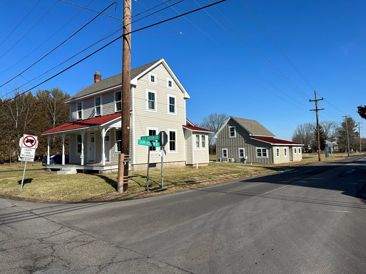
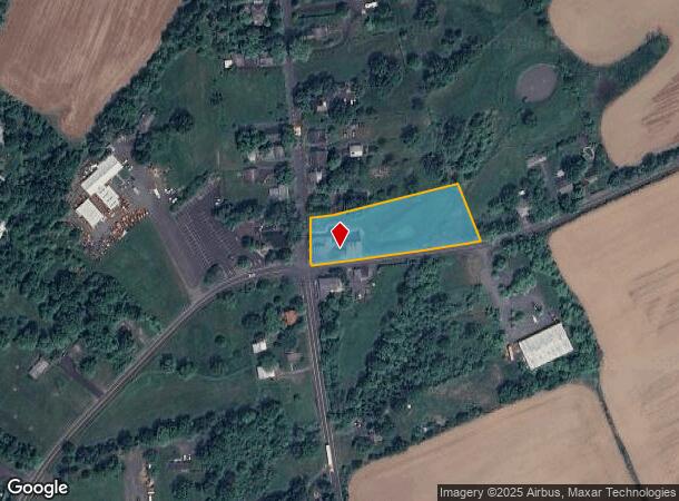
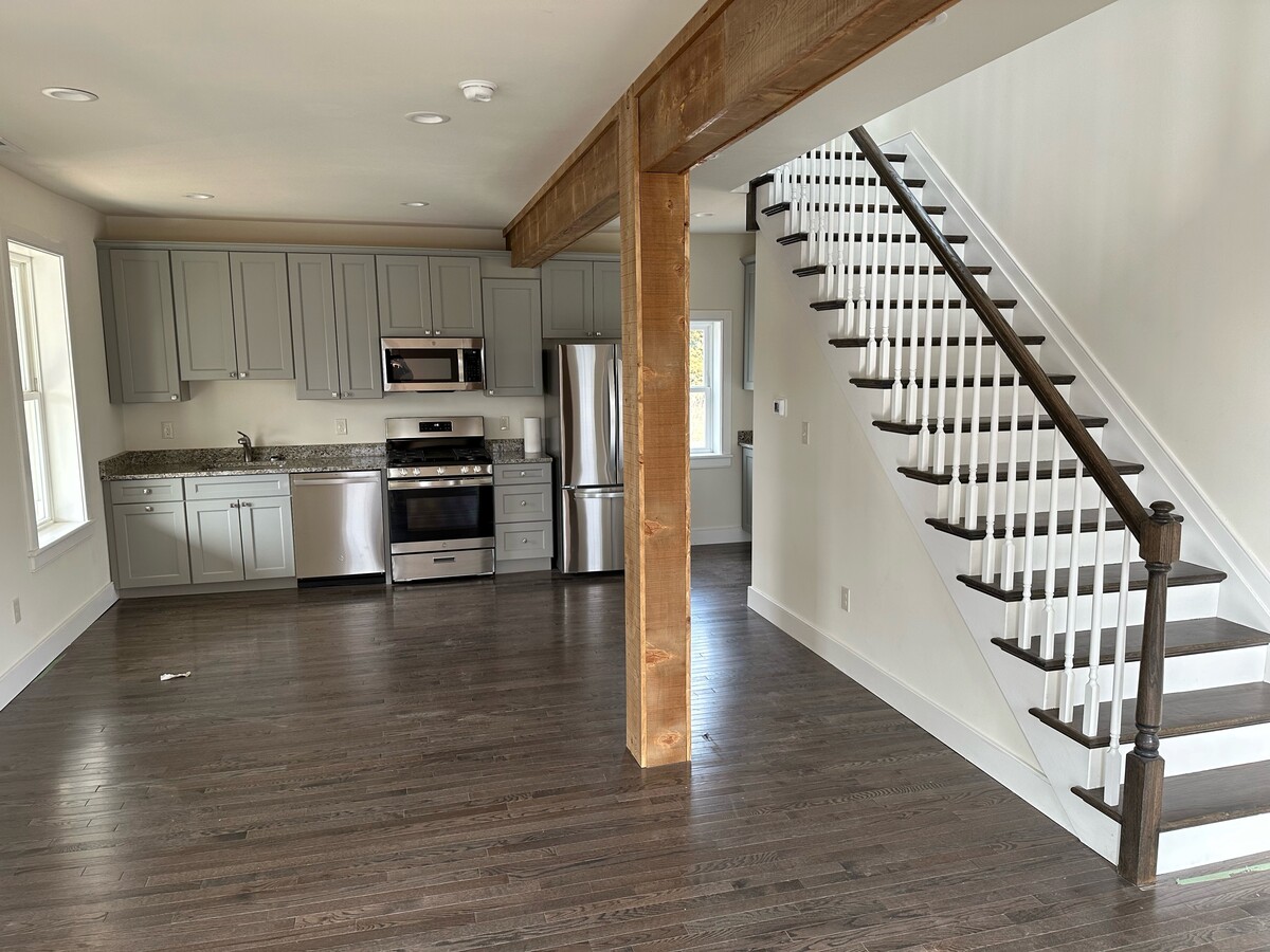
Property Record
2 Dark Hollow Rd, Pipersville, PA 18947
NEARBY LISTINGS FOR SALE OR LEASE
Property Detail
2 Dark Hollow Rd
Philadelphia-Camden-Wilmington, PA-NJ-DE-MD
Bucks
01-016-020
Pennsylvania
Sfr
1.70 AC
X
Upper Bucks County
42017C0167J
Philadelphia
1,183 SF
DEMOGRAPHICS near 2 Dark Hollow Rd
1 Mile
3 Mile
5 Mile
2024 Total Population
427
6,180
19,732
2029 Population
417
6,063
19,468
Pop Growth 2024-2029
(2.34%)
(1.89%)
(1.34%)
Average Age
45
44
43
2024 Total Households
158
2,230
7,246
HH Growth 2024-2029
(2.53%)
(2.11%)
(1.41%)
Median Household Inc
$103,125
$119,770
$122,196
Avg Household Size
2.50
2.70
2.70
2024 Avg HH Vehicles
3.00
3.00
2.00
Median Home Value
$482,926
$492,869
$499,054
Median Year Built
1962
1980
1983
Nearby Places
- Restaurants
- Banks
- Shops
- Fitness
- Groceries
PUBLIC TRANSPORTATION
COMMUTER RAIL
Doylestown (R5 - Southeastern Pennsylvania Transportation Authority Regional Rail (SEPTA Regional Rail))
DRIVE
WALK
Distance
Doylestown (R5 - Southeastern Pennsylvania Transportation Authority Regional Rail (SEPTA Regional Rail))
15 min
9.2 mi
AIRPORT
Trenton Mercer
DRIVE
WALK
Distance
Trenton Mercer
42 min
23.8 mi
Lehigh Valley International
DRIVE
WALK
Distance
Lehigh Valley International
50 min
28.1 mi
Freight Ports
Port of Philadelphia
DRIVE
WALK
Distance
Port of Philadelphia
60 min
34.4 mi
SALE & LEASE HISTORY
LISTING DATE
SALE/LEASE

Feb 06, 2023
For Lease
Nearby Properties
Address
Land Use
TOTAL SIZE
Lot Size
Zoning
Address
Land Use
TOTAL SIZE
Lot Size
Zoning
66,008 SF
13.28 AC
C3
Address
Land Use
TOTAL SIZE
Lot Size
Zoning
72,320 SF
17.82 AC
I
Address
Land Use
TOTAL SIZE
Lot Size
Zoning
2,886 SF
15.46 AC
AP
Address
Land Use
TOTAL SIZE
Lot Size
Zoning
3,343 SF
0.84 AC
R2
Address
Land Use
TOTAL SIZE
Lot Size
Zoning
561,638 SF
36.65 AC
RO
Address
Land Use
TOTAL SIZE
Lot Size
Zoning
61,059 SF
11.43 AC
I
Address
Land Use
TOTAL SIZE
Lot Size
Zoning
25,008 SF
4.05 AC
I
Address
Land Use
TOTAL SIZE
Lot Size
Zoning
78,057 SF
10.50 AC
I
Address
Land Use
TOTAL SIZE
Lot Size
Zoning
36,664 SF
5.10 AC
I
Address
Land Use
TOTAL SIZE
Lot Size
Zoning
49,383 SF
4.44 AC
I
Address
Land Use
TOTAL SIZE
Lot Size
Zoning
1,040 SF
1.15 AC
VR
Address
Land Use
TOTAL SIZE
Lot Size
Zoning
39,541 SF
12.96 AC
I
Address
Land Use
TOTAL SIZE
Lot Size
Zoning
30,295 SF
4.11 AC
I
Address
Land Use
TOTAL SIZE
Lot Size
Zoning
4,980 SF
3.36 AC
C2
Address
Land Use
TOTAL SIZE
Lot Size
Zoning
1,100 SF
0.38 AC
CC
Address
Land Use
TOTAL SIZE
Lot Size
Zoning
35,152 SF
10.54 AC
C2
Address
Land Use
TOTAL SIZE
Lot Size
Zoning
16,288 SF
3.13 AC
C2
Address
Land Use
TOTAL SIZE
Lot Size
Zoning
64,000 SF
8 AC
C2
Address
Land Use
TOTAL SIZE
Lot Size
Zoning
19,120 SF
5.13 AC
C2
Address
Land Use
TOTAL SIZE
Lot Size
Zoning
54,680 SF
4.82 AC
I
Address
Land Use
TOTAL SIZE
Lot Size
Zoning
12,000 SF
28.87 AC
I
Address
Land Use
TOTAL SIZE
Lot Size
Zoning
32,212 SF
24.79 AC
I
Address
Land Use
TOTAL SIZE
Lot Size
Zoning
9,151 SF
5.93 AC
CC
Address
Land Use
TOTAL SIZE
Lot Size
Zoning
19,900 SF
3.19 AC
I
Address
Land Use
TOTAL SIZE
Lot Size
Zoning
25,600 SF
2.87 AC
I
Address
Land Use
TOTAL SIZE
Lot Size
Zoning
8,329 SF
0.69 AC
VC
Address
Land Use
TOTAL SIZE
Lot Size
Zoning
20,400 SF
4.81 AC
C
Address
Land Use
TOTAL SIZE
Lot Size
Zoning
14,000 SF
2.18 AC
Address
Land Use
TOTAL SIZE
Lot Size
Zoning
13,126 SF
21.75 AC
CC
Address
Land Use
TOTAL SIZE
Lot Size
Zoning
3,222 SF
1.08 AC
C2
The World's #1 Commercial Real Estate Marketplace
Connect with us
© 2025 CoStar Group
The information above has been obtained from sources believed reliable. While we do not doubt its accuracy we have not verified it and make no guarantee, warranty or representation about it. It is your responsibility to independently confirm its accuracy and completeness. Any projections, opinions, assumptions, or estimates used are for example only and do not represent the current or future performance of the property. The value of this transaction to you depends on tax and other factors which should be evaluated by your tax, financial, and legal advisors. You and your advisors should conduct a careful, independent investigation of the property to determine to your satisfaction the suitability of the property for your needs.