Property Record
2 Parkside Cir, Punta Gorda, FL 33950
NEARBY LISTINGS FOR SALE OR LEASE
Property Detail
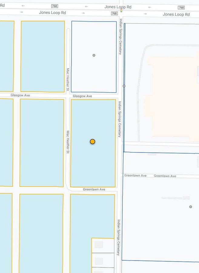
2 Parkside Cir
Punta Gorda, FL
ZZZ 214123 P25 69.79 AC M/L (WHOLE PARCEL) ZZZ 214123 P25 36.07 AC M/L COMMENCE AT THE SW CORNER OF SECTION 21 THENCE E 1300 FEET TO POB; THENCE NORTH 1950 FEET TO SOUTH RIGHT OF WAY OF GLASGOW AVE; THENCE WEST 846.06 FEET; THENCE SOUTHWEST 196.13
412321151006
Charlotte
Commercialacreage
Florida
2023
22.80 AC
2023
Charlotte County
010301
Southwest Florida
DEMOGRAPHICS near 2 Parkside Cir
1 Mile
3 Mile
5 Mile
2024 Total Population
2,790
19,320
38,573
2029 Population
3,342
23,193
46,448
Pop Growth 2024-2029
+ 19.78%
+ 20.05%
+ 20.42%
Average Age
54
56
58
2024 Total Households
1,128
9,219
18,848
HH Growth 2024-2029
+ 20.48%
+ 20.28%
+ 20.66%
Median Household Inc
$82,770
$57,532
$61,970
Avg Household Size
2.10
2.00
2.00
2024 Avg HH Vehicles
2.00
2.00
2.00
Median Home Value
$329,044
$280,378
$338,347
Median Year Built
2002
1997
1993
Nearby Places
- Restaurants
- Banks
- Shops
- Fitness
- Groceries
PUBLIC TRANSPORTATION
AIRPORT
Punta Gorda
DRIVE
WALK
Distance
Punta Gorda
8 min
3.8 mi
Freight Ports
Port Manatee
DRIVE
WALK
Distance
Port Manatee
90 min
74.2 mi
Nearby Properties
Address
Land Use
TOTAL SIZE
Lot Size
Zoning
Address
Land Use
TOTAL SIZE
Lot Size
Zoning
333,027 SF
9.79 AC
CHRW
Address
Land Use
TOTAL SIZE
Lot Size
Zoning
349,844 SF
78.47 AC
P
Address
Land Use
TOTAL SIZE
Lot Size
Zoning
163,527 SF
44.20 AC
ECAP
Address
Land Use
TOTAL SIZE
Lot Size
Zoning
77,154 SF
10.30 AC
PD-P
Address
Land Use
TOTAL SIZE
Lot Size
Zoning
161,439 SF
171 AC
RE1
Address
Land Use
TOTAL SIZE
Lot Size
Zoning
345,043 SF
33.12 AC
ECAP
Address
Land Use
TOTAL SIZE
Lot Size
Zoning
47,443 SF
7.94 AC
CC
Address
Land Use
TOTAL SIZE
Lot Size
Zoning
15,253 SF
13.27 AC
P
Address
Land Use
TOTAL SIZE
Lot Size
Zoning
198,916 SF
25.79 AC
HC
Address
Land Use
TOTAL SIZE
Lot Size
Zoning
142,812 SF
7.89 AC
HC
Address
Land Use
TOTAL SIZE
Lot Size
Zoning
6,313 SF
15.49 AC
P
Address
Land Use
TOTAL SIZE
Lot Size
Zoning
208,560 SF
36.69 AC
PD-GM
Address
Land Use
TOTAL SIZE
Lot Size
Zoning
279,650 SF
374.81 AC
ECAP
Address
Land Use
TOTAL SIZE
Lot Size
Zoning
73,095 SF
5 AC
NC
Address
Land Use
TOTAL SIZE
Lot Size
Zoning
9,118 SF
13.57 AC
P
Address
Land Use
TOTAL SIZE
Lot Size
Zoning
31,608 SF
8.02 AC
NC
Address
Land Use
TOTAL SIZE
Lot Size
Zoning
96,845 SF
17.15 AC
HC
Address
Land Use
TOTAL SIZE
Lot Size
Zoning
30,472 SF
3.19 AC
NR-10
Address
Land Use
TOTAL SIZE
Lot Size
Zoning
24,580 SF
84.50 AC
PKR
Address
Land Use
TOTAL SIZE
Lot Size
Zoning
12,159 SF
0.56 AC
PD-CC
Address
Land Use
TOTAL SIZE
Lot Size
Zoning
43,914 SF
4.06 AC
HC
Address
Land Use
TOTAL SIZE
Lot Size
Zoning
49,958 SF
6.81 AC
CC
Address
Land Use
TOTAL SIZE
Lot Size
Zoning
82,379 SF
0.88 AC
CC
Address
Land Use
TOTAL SIZE
Lot Size
Zoning
30,940 SF
0.41 AC
NC
Address
Land Use
TOTAL SIZE
Lot Size
Zoning
68,492 SF
6.38 AC
HC
Address
Land Use
TOTAL SIZE
Lot Size
Zoning
43,755 SF
8.18 AC
CC
Address
Land Use
TOTAL SIZE
Lot Size
Zoning
25,356 SF
1.40 AC
CC
Address
Land Use
TOTAL SIZE
Lot Size
Zoning
54.25 AC
RMF10
Address
Land Use
TOTAL SIZE
Lot Size
Zoning
63,902 SF
5.87 AC
HC
Address
Land Use
TOTAL SIZE
Lot Size
Zoning
37,155 SF
3.98 AC
NR-10
The World's #1 Commercial Real Estate Marketplace
Connect with us
© 2025 CoStar Group
The information above has been obtained from sources believed reliable. While we do not doubt its accuracy we have not verified it and make no guarantee, warranty or representation about it. It is your responsibility to independently confirm its accuracy and completeness. Any projections, opinions, assumptions, or estimates used are for example only and do not represent the current or future performance of the property. The value of this transaction to you depends on tax and other factors which should be evaluated by your tax, financial, and legal advisors. You and your advisors should conduct a careful, independent investigation of the property to determine to your satisfaction the suitability of the property for your needs.