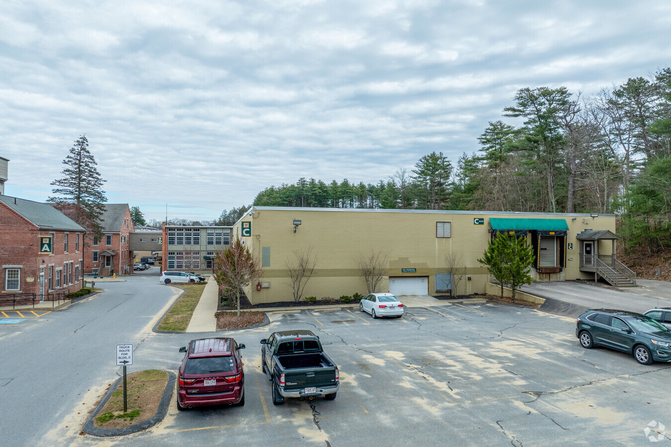
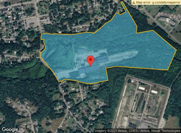
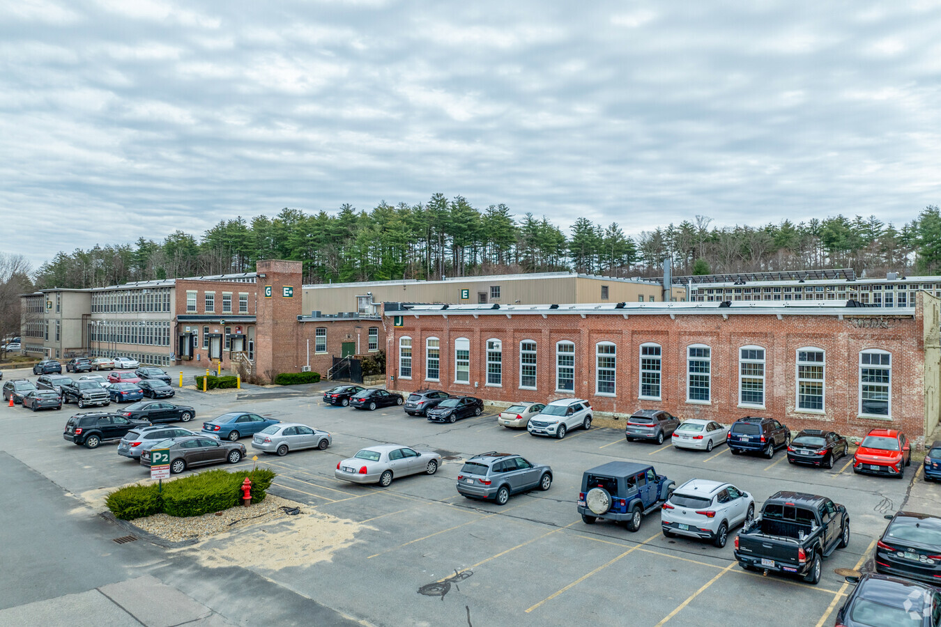
Property Record
2 Shaker Rd, Shirley, MA 01464
Current Lease Availabilities
NEARBY LISTINGS FOR SALE OR LEASE
Property Detail
2 Shaker Rd
SHIR-000015-D000000-000009
Middlesex
Industrialgeneral
Massachusetts
AE
9
25027C0292E
49.80 AC
2025
Groton/Townsend
2025
Boston
388200
Boston-Cambridge-Newton, MA-NH
2,928 SF
DEMOGRAPHICS near 2 Shaker Rd
1 Mile
3 Mile
5 Mile
2024 Total Population
3,679
11,280
32,186
2029 Population
3,649
11,245
32,103
Pop Growth 2024-2029
(0.82%)
(0.31%)
(0.26%)
Average Age
43
43
43
2024 Total Households
1,054
3,267
11,217
HH Growth 2024-2029
(0.47%)
0.00%
(0.22%)
Median Household Inc
$95,178
$115,814
$116,170
Avg Household Size
2.40
2.50
2.50
2024 Avg HH Vehicles
2.00
2.00
2.00
Median Home Value
$341,441
$413,551
$416,365
Median Year Built
1952
1974
1975
Nearby Places
- Restaurants
- Banks
- Shops
- Fitness
- Groceries
PUBLIC TRANSPORTATION
COMMUTER RAIL
Shirley (Fitchburg/South Acton Line - Massachusetts Bay Transportation Authority Commuter Rail (Purple Line))
DRIVE
WALK
Distance
Shirley (Fitchburg/South Acton Line - Massachusetts Bay Transportation Authority Commuter Rail (Purple Line))
1 min
9 min
0.5 mi
Ayer (Fitchburg/South Acton Line - Massachusetts Bay Transportation Authority Commuter Rail (Purple Line))
DRIVE
WALK
Distance
Ayer (Fitchburg/South Acton Line - Massachusetts Bay Transportation Authority Commuter Rail (Purple Line))
10 min
4.3 mi
AIRPORT
Worcester Regional
DRIVE
WALK
Distance
Worcester Regional
47 min
31.8 mi
Manchester Boston Regional
DRIVE
WALK
Distance
Manchester Boston Regional
63 min
35.8 mi
Freight Ports
Port of Boston
DRIVE
WALK
Distance
Port of Boston
67 min
42.8 mi
Nearby Properties
Address
Land Use
TOTAL SIZE
Lot Size
Zoning
Address
Land Use
TOTAL SIZE
Lot Size
Zoning
663,948 SF
516.30 AC
Address
Land Use
TOTAL SIZE
Lot Size
Zoning
97.47 AC
R1
Address
Land Use
TOTAL SIZE
Lot Size
Zoning
337,563 SF
21.31 AC
17
Address
Land Use
TOTAL SIZE
Lot Size
Zoning
832,622 SF
43.78 AC
I
Address
Land Use
TOTAL SIZE
Lot Size
Zoning
2,295.68 AC
Address
Land Use
TOTAL SIZE
Lot Size
Zoning
373.10 AC
O
Address
Land Use
TOTAL SIZE
Lot Size
Zoning
353,742 SF
34.89 AC
C
Address
Land Use
TOTAL SIZE
Lot Size
Zoning
398,800 SF
21.92 AC
I
Address
Land Use
TOTAL SIZE
Lot Size
Zoning
214.69 AC
O
Address
Land Use
TOTAL SIZE
Lot Size
Zoning
214.32 AC
4
Address
Land Use
TOTAL SIZE
Lot Size
Zoning
60,968 SF
Address
Land Use
TOTAL SIZE
Lot Size
Zoning
202.78 AC
14
Address
Land Use
TOTAL SIZE
Lot Size
Zoning
66,966 SF
C
Address
Land Use
TOTAL SIZE
Lot Size
Zoning
342,309 SF
21.60 AC
I
Address
Land Use
TOTAL SIZE
Lot Size
Zoning
164,000 SF
11 AC
4
Address
Land Use
TOTAL SIZE
Lot Size
Zoning
142.59 AC
O
Address
Land Use
TOTAL SIZE
Lot Size
Zoning
216,289 SF
17.54 AC
I
Address
Land Use
TOTAL SIZE
Lot Size
Zoning
85,000 SF
31.56 AC
R1
Address
Land Use
TOTAL SIZE
Lot Size
Zoning
140.95 AC
4
Address
Land Use
TOTAL SIZE
Lot Size
Zoning
372,000 SF
30.33 AC
Address
Land Use
TOTAL SIZE
Lot Size
Zoning
78,344 SF
7.65 AC
O
Address
Land Use
TOTAL SIZE
Lot Size
Zoning
131 AC
2
Address
Land Use
TOTAL SIZE
Lot Size
Zoning
150,372 SF
15.74 AC
21
Address
Land Use
TOTAL SIZE
Lot Size
Zoning
134,920 SF
26.90 AC
I
Address
Land Use
TOTAL SIZE
Lot Size
Zoning
162,932 SF
19.12 AC
C
Address
Land Use
TOTAL SIZE
Lot Size
Zoning
95,148 SF
60.40 AC
16
Address
Land Use
TOTAL SIZE
Lot Size
Zoning
186,000 SF
16.02 AC
C
Address
Land Use
TOTAL SIZE
Lot Size
Zoning
234,465 SF
16.13 AC
I
Address
Land Use
TOTAL SIZE
Lot Size
Zoning
178,900 SF
14.23 AC
14
Address
Land Use
TOTAL SIZE
Lot Size
Zoning
109,921 SF
7.22 AC
21
The World's #1 Commercial Real Estate Marketplace
Connect with us
© 2025 CoStar Group
The information above has been obtained from sources believed reliable. While we do not doubt its accuracy we have not verified it and make no guarantee, warranty or representation about it. It is your responsibility to independently confirm its accuracy and completeness. Any projections, opinions, assumptions, or estimates used are for example only and do not represent the current or future performance of the property. The value of this transaction to you depends on tax and other factors which should be evaluated by your tax, financial, and legal advisors. You and your advisors should conduct a careful, independent investigation of the property to determine to your satisfaction the suitability of the property for your needs.