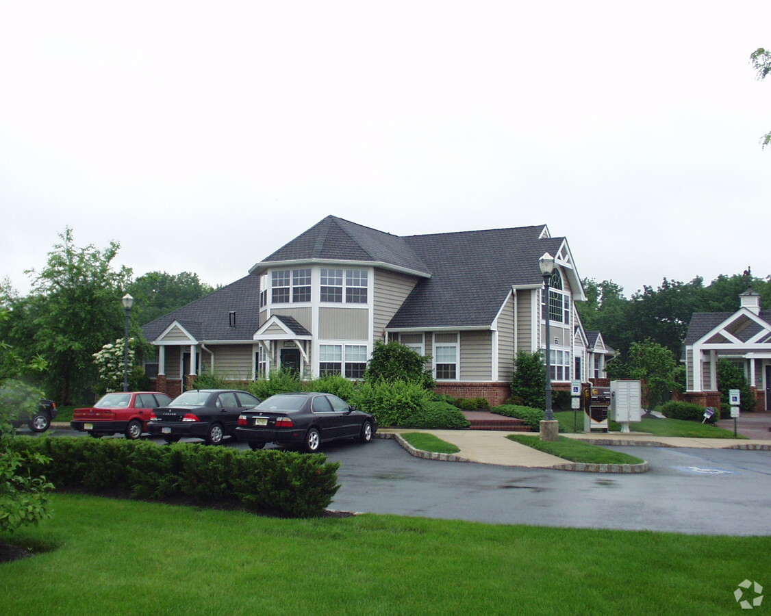
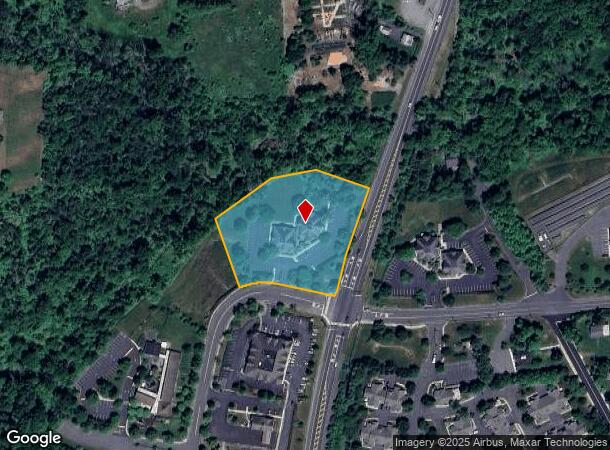
Property Record
2 Tree Farm Rd, Pennington, NJ 08534

NEARBY LISTINGS FOR SALE OR LEASE
Property Detail
2 Tree Farm Rd
06-00048-0000-00008-02
Pennington Point West Sec 1
Commercialnec
Mercer
A
New Jersey
34021C0108F
8.2
2023
2.97 AC
2024
Trenton
003800
Northern New Jersey
16,250 SF
Trenton, NJ
DEMOGRAPHICS near 2 Tree Farm Rd
1 Mile
3 Mile
5 Mile
2024 Total Population
2,483
11,151
43,676
2029 Population
2,463
10,983
43,124
Pop Growth 2024-2029
(0.81%)
(1.51%)
(1.26%)
Average Age
46
44
43
2024 Total Households
986
4,116
16,051
HH Growth 2024-2029
(0.51%)
(1.53%)
(1.41%)
Median Household Inc
$122,871
$140,206
$128,864
Avg Household Size
2.40
2.60
2.50
2024 Avg HH Vehicles
2.00
2.00
2.00
Median Home Value
$543,556
$532,575
$428,809
Median Year Built
1969
1974
1977
Nearby Places
- Restaurants
- Banks
- Shops
- Fitness
- Groceries
PUBLIC TRANSPORTATION
COMMUTER RAIL
West Trenton (R3 - Southeastern Pennsylvania Transportation Authority Regional Rail (SEPTA Regional Rail))
DRIVE
WALK
Distance
West Trenton (R3 - Southeastern Pennsylvania Transportation Authority Regional Rail (SEPTA Regional Rail))
15 min
7.4 mi
Yardley (R3 - Southeastern Pennsylvania Transportation Authority Regional Rail (SEPTA Regional Rail))
DRIVE
WALK
Distance
Yardley (R3 - Southeastern Pennsylvania Transportation Authority Regional Rail (SEPTA Regional Rail))
18 min
9.7 mi
AIRPORT
Trenton Mercer
DRIVE
WALK
Distance
Trenton Mercer
14 min
6.0 mi
Freight Ports
Port of Philadelphia
DRIVE
WALK
Distance
Port of Philadelphia
51 min
34.3 mi
SALE & LEASE HISTORY
LISTING DATE
SALE/LEASE

Sep 24, 2016
For Lease
May 18, 2017
For Lease
Jul 11, 2017
For Lease
Nearby Properties
Address
Land Use
TOTAL SIZE
Lot Size
Zoning
Address
Land Use
TOTAL SIZE
Lot Size
Zoning
42 AC
R03
Address
Land Use
TOTAL SIZE
Lot Size
Zoning
13.86 AC
OP
Address
Land Use
TOTAL SIZE
Lot Size
Zoning
13.36 AC
OP
Address
Land Use
TOTAL SIZE
Lot Size
Zoning
7.85 AC
OP
Address
Land Use
TOTAL SIZE
Lot Size
Zoning
6.09 AC
OP
Address
Land Use
TOTAL SIZE
Lot Size
Zoning
Address
Land Use
TOTAL SIZE
Lot Size
Zoning
8.73 AC
OP
Address
Land Use
TOTAL SIZE
Lot Size
Zoning
6.37 AC
OP
Address
Land Use
TOTAL SIZE
Lot Size
Zoning
6.01 AC
OP
Address
Land Use
TOTAL SIZE
Lot Size
Zoning
8.35 AC
OP
Address
Land Use
TOTAL SIZE
Lot Size
Zoning
20.93 AC
HBO
Address
Land Use
TOTAL SIZE
Lot Size
Zoning
221.99 AC
2ZON
Address
Land Use
TOTAL SIZE
Lot Size
Zoning
17,000 SF
32.87 AC
R-80
Address
Land Use
TOTAL SIZE
Lot Size
Zoning
16.34 AC
SC
Address
Land Use
TOTAL SIZE
Lot Size
Zoning
50.53 AC
2ZON
Address
Land Use
TOTAL SIZE
Lot Size
Zoning
22.37 AC
2ZON
Address
Land Use
TOTAL SIZE
Lot Size
Zoning
7.39 AC
R100
Address
Land Use
TOTAL SIZE
Lot Size
Zoning
43.08 AC
R100
Address
Land Use
TOTAL SIZE
Lot Size
Zoning
327 AC
VRC
Address
Land Use
TOTAL SIZE
Lot Size
Zoning
Address
Land Use
TOTAL SIZE
Lot Size
Zoning
6.28 AC
OP
Address
Land Use
TOTAL SIZE
Lot Size
Zoning
3,101 SF
250.13 AC
VRC
Address
Land Use
TOTAL SIZE
Lot Size
Zoning
5,325 SF
11.17 AC
R-A
Address
Land Use
TOTAL SIZE
Lot Size
Zoning
10.45 AC
C1
Address
Land Use
TOTAL SIZE
Lot Size
Zoning
6,367 SF
8.34 AC
VRC
Address
Land Use
TOTAL SIZE
Lot Size
Zoning
3.40 AC
R-6
Address
Land Use
TOTAL SIZE
Lot Size
Zoning
49,540 SF
15.76 AC
IC
Address
Land Use
TOTAL SIZE
Lot Size
Zoning
3,584 SF
1.85 AC
B-H
Address
Land Use
TOTAL SIZE
Lot Size
Zoning
66.43 AC
VRC
Address
Land Use
TOTAL SIZE
Lot Size
Zoning
5.71 AC
IC
The World's #1 Commercial Real Estate Marketplace
Connect with us
© 2025 CoStar Group
The information above has been obtained from sources believed reliable. While we do not doubt its accuracy we have not verified it and make no guarantee, warranty or representation about it. It is your responsibility to independently confirm its accuracy and completeness. Any projections, opinions, assumptions, or estimates used are for example only and do not represent the current or future performance of the property. The value of this transaction to you depends on tax and other factors which should be evaluated by your tax, financial, and legal advisors. You and your advisors should conduct a careful, independent investigation of the property to determine to your satisfaction the suitability of the property for your needs.