Property Record
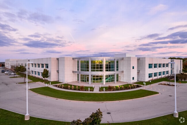
2 W World Packaging Cir, Franklin, WI 53132

NEARBY LISTINGS FOR SALE OR LEASE
Property Detail
2 W World Packaging Cir
Milwaukee-Waukesha-West Allis, WI
Cert Surv 7638
900-0009-019
CERTIFIED SURVEY MAP NO 7638 NE 26-5-21 LOT 2
Industrialgeneral
Milwaukee
X
Wisconsin
55101C0076D
2
2024
17.47 AC
2024
SW Outlying Milwaukee
150304
Milwaukee/Madison
DEMOGRAPHICS near 2 W World Packaging Cir
1 Mile
3 Mile
5 Mile
2024 Total Population
3,248
25,584
77,293
2029 Population
3,147
24,933
75,403
Pop Growth 2024-2029
(3.11%)
(2.54%)
(2.45%)
Average Age
41
42
41
2024 Total Households
1,158
9,730
30,878
HH Growth 2024-2029
(3.11%)
(2.75%)
(2.49%)
Median Household Inc
$138,172
$93,582
$85,420
Avg Household Size
2.70
2.40
2.40
2024 Avg HH Vehicles
2.00
2.00
2.00
Median Home Value
$345,301
$322,353
$284,829
Median Year Built
1987
1992
1984
Nearby Places
Map Layers
Map Styles
 Street
 Aerial
- Restaurants
- Banks
- Shops
- Fitness
- Groceries
PUBLIC TRANSPORTATION
COMMUTER RAIL
General Mitchell Intl. Airport Amtrak Station (Hiawatha Service - Amtrak)
DRIVE
WALK
Distance
General Mitchell Intl. Airport Amtrak Station (Hiawatha Service - Amtrak)
16 min
8.0 mi
AIRPORT
General Mitchell International
DRIVE
WALK
Distance
General Mitchell International
16 min
8.9 mi
Freight Ports
Port Milwaukee
DRIVE
WALK
Distance
Port Milwaukee
20 min
12.8 mi
SALE & LEASE HISTORY
LISTING DATE
SALE/LEASE

Apr 16, 2021
For Lease
Nearby Properties
Address
Land Use
TOTAL SIZE
Lot Size
Zoning
Address
Land Use
TOTAL SIZE
Lot Size
Zoning
75.05 AC
Address
Land Use
TOTAL SIZE
Lot Size
Zoning
Address
Land Use
TOTAL SIZE
Lot Size
Zoning
47.22 AC
RESIDENTIA
Address
Land Use
TOTAL SIZE
Lot Size
Zoning
Address
Land Use
TOTAL SIZE
Lot Size
Zoning
16.06 AC
Address
Land Use
TOTAL SIZE
Lot Size
Zoning
41.93 AC
Address
Land Use
TOTAL SIZE
Lot Size
Zoning
8.79 AC
RESIDENTIA
Address
Land Use
TOTAL SIZE
Lot Size
Zoning
18.39 AC
RESIDENTIA
Address
Land Use
TOTAL SIZE
Lot Size
Zoning
64,800 SF
28.17 AC
Address
Land Use
TOTAL SIZE
Lot Size
Zoning
48.65 AC
Address
Land Use
TOTAL SIZE
Lot Size
Zoning
17.37 AC
Address
Land Use
TOTAL SIZE
Lot Size
Zoning
16.48 AC
Address
Land Use
TOTAL SIZE
Lot Size
Zoning
14.24 AC
RESIDENTIA
Address
Land Use
TOTAL SIZE
Lot Size
Zoning
7.36 AC
RESIDENTIA
Address
Land Use
TOTAL SIZE
Lot Size
Zoning
10.78 AC
Address
Land Use
TOTAL SIZE
Lot Size
Zoning
Address
Land Use
TOTAL SIZE
Lot Size
Zoning
19.25 AC
Address
Land Use
TOTAL SIZE
Lot Size
Zoning
26.03 AC
Address
Land Use
TOTAL SIZE
Lot Size
Zoning
17.95 AC
RESIDENTIA
Address
Land Use
TOTAL SIZE
Lot Size
Zoning
Address
Land Use
TOTAL SIZE
Lot Size
Zoning
42,253 SF
6.93 AC
Address
Land Use
TOTAL SIZE
Lot Size
Zoning
57,474 SF
5.07 AC
Address
Land Use
TOTAL SIZE
Lot Size
Zoning
21.21 AC
Address
Land Use
TOTAL SIZE
Lot Size
Zoning
12.45 AC
Address
Land Use
TOTAL SIZE
Lot Size
Zoning
Address
Land Use
TOTAL SIZE
Lot Size
Zoning
Address
Land Use
TOTAL SIZE
Lot Size
Zoning
6.09 AC
RESIDENTIA
Address
Land Use
TOTAL SIZE
Lot Size
Zoning
12.31 AC
Address
Land Use
TOTAL SIZE
Lot Size
Zoning
13.16 AC
The World's #1 Commercial Real Estate Marketplace
Connect with us
© 2026 CoStar Group
The information above has been obtained from sources believed reliable. While we do not doubt its accuracy we have not verified it and make no guarantee, warranty or representation about it. It is your responsibility to independently confirm its accuracy and completeness. Any projections, opinions, assumptions, or estimates used are for example only and do not represent the current or future performance of the property. The value of this transaction to you depends on tax and other factors which should be evaluated by your tax, financial, and legal advisors. You and your advisors should conduct a careful, independent investigation of the property to determine to your satisfaction the suitability of the property for your needs.