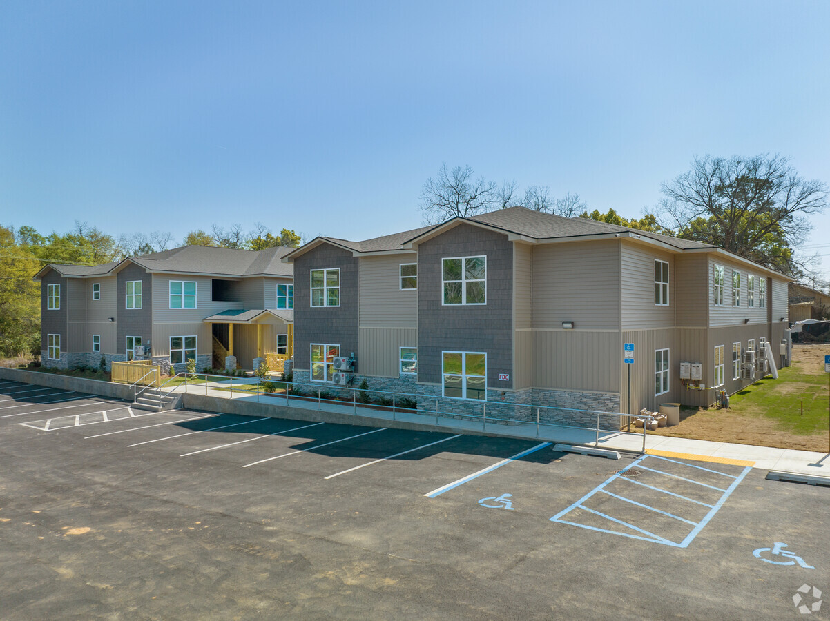
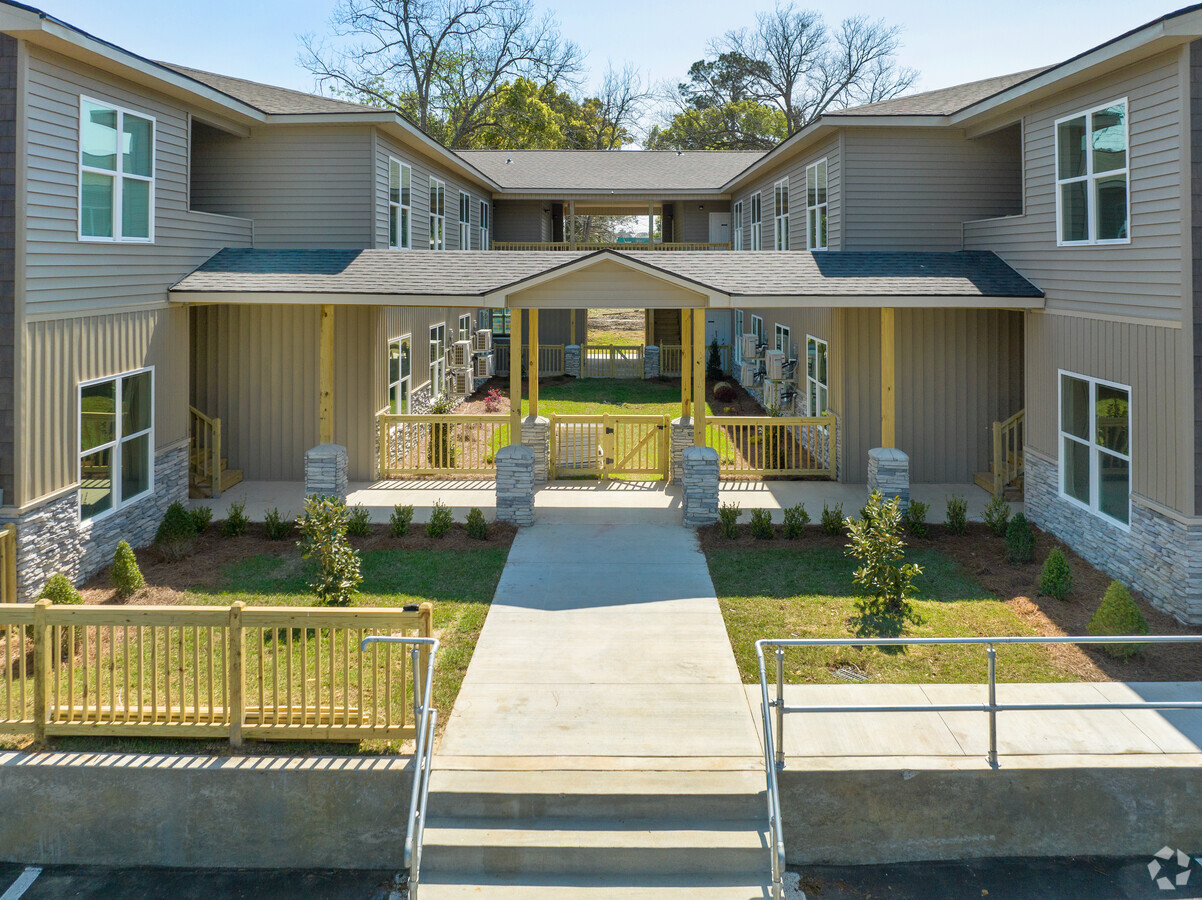
Property Record
20 7Th St Ne, Moultrie, GA 31768
NEARBY LISTINGS FOR SALE OR LEASE
-
-
View all Moultrie listings for sale on LoopNet.com
Property Detail
20 7Th St Ne
Moultrie, GA
Shady Grove
M034-103
LOT 2 BLK 7 8TH LD
Commercialnec
Colquitt
X
Georgia
13071C0192E
2
2024
0.52 AC
2024
Albany/Southwest
970400
Other Market Areas
21,346 SF
DEMOGRAPHICS near 20 7Th St Ne
1 Mile
3 Mile
5 Mile
2024 Total Population
5,666
18,751
26,804
2029 Population
5,806
18,869
26,882
Pop Growth 2024-2029
+ 2.47%
+ 0.63%
+ 0.29%
Average Age
38
38
39
2024 Total Households
2,189
7,178
10,150
HH Growth 2024-2029
+ 2.51%
+ 0.61%
+ 0.29%
Median Household Inc
$23,788
$34,409
$38,514
Avg Household Size
2.50
2.50
2.50
2024 Avg HH Vehicles
1.00
2.00
2.00
Median Home Value
$63,162
$93,059
$119,134
Median Year Built
1971
1974
1980
Nearby Places
- Restaurants
- Banks
- Shops
- Fitness
- Groceries
Nearby Properties
Address
Land Use
TOTAL SIZE
Lot Size
Zoning
Address
Land Use
TOTAL SIZE
Lot Size
Zoning
200,104 SF
186.32 AC
Address
Land Use
TOTAL SIZE
Lot Size
Zoning
38,268 SF
2.07 AC
Address
Land Use
TOTAL SIZE
Lot Size
Zoning
73.72 AC
Address
Land Use
TOTAL SIZE
Lot Size
Zoning
24.25 AC
Address
Land Use
TOTAL SIZE
Lot Size
Zoning
21,678 SF
5.75 AC
Address
Land Use
TOTAL SIZE
Lot Size
Zoning
115.93 AC
COMMERCIAL
Address
Land Use
TOTAL SIZE
Lot Size
Zoning
21,866 SF
1.44 AC
Address
Land Use
TOTAL SIZE
Lot Size
Zoning
11.45 AC
Address
Land Use
TOTAL SIZE
Lot Size
Zoning
15.56 AC
Address
Land Use
TOTAL SIZE
Lot Size
Zoning
2,606 SF
15 AC
Address
Land Use
TOTAL SIZE
Lot Size
Zoning
17,574 SF
1.59 AC
Address
Land Use
TOTAL SIZE
Lot Size
Zoning
149,407 SF
15.29 AC
Address
Land Use
TOTAL SIZE
Lot Size
Zoning
27,504 SF
1.98 AC
Address
Land Use
TOTAL SIZE
Lot Size
Zoning
64,000 SF
13.98 AC
Address
Land Use
TOTAL SIZE
Lot Size
Zoning
18,096 SF
12.13 AC
Address
Land Use
TOTAL SIZE
Lot Size
Zoning
111,860 SF
13.50 AC
002
Address
Land Use
TOTAL SIZE
Lot Size
Zoning
105,612 SF
13.19 AC
002
Address
Land Use
TOTAL SIZE
Lot Size
Zoning
61,200 SF
9.50 AC
Address
Land Use
TOTAL SIZE
Lot Size
Zoning
189,470 SF
12.68 AC
Address
Land Use
TOTAL SIZE
Lot Size
Zoning
90,694 SF
19.17 AC
Address
Land Use
TOTAL SIZE
Lot Size
Zoning
48,965 SF
5.24 AC
Address
Land Use
TOTAL SIZE
Lot Size
Zoning
27,217 SF
20.32 AC
Address
Land Use
TOTAL SIZE
Lot Size
Zoning
9,916 SF
6.24 AC
002
Address
Land Use
TOTAL SIZE
Lot Size
Zoning
21,574 SF
1.11 AC
Address
Land Use
TOTAL SIZE
Lot Size
Zoning
64,840 SF
9 AC
Address
Land Use
TOTAL SIZE
Lot Size
Zoning
2,614 SF
8.30 AC
Address
Land Use
TOTAL SIZE
Lot Size
Zoning
41,170 SF
1.63 AC
Address
Land Use
TOTAL SIZE
Lot Size
Zoning
37,295 SF
8.30 AC
Address
Land Use
TOTAL SIZE
Lot Size
Zoning
841 SF
8.15 AC
Address
Land Use
TOTAL SIZE
Lot Size
Zoning
1,070 SF
6.07 AC
The World's #1 Commercial Real Estate Marketplace
Connect with us
© 2025 CoStar Group
The information above has been obtained from sources believed reliable. While we do not doubt its accuracy we have not verified it and make no guarantee, warranty or representation about it. It is your responsibility to independently confirm its accuracy and completeness. Any projections, opinions, assumptions, or estimates used are for example only and do not represent the current or future performance of the property. The value of this transaction to you depends on tax and other factors which should be evaluated by your tax, financial, and legal advisors. You and your advisors should conduct a careful, independent investigation of the property to determine to your satisfaction the suitability of the property for your needs.