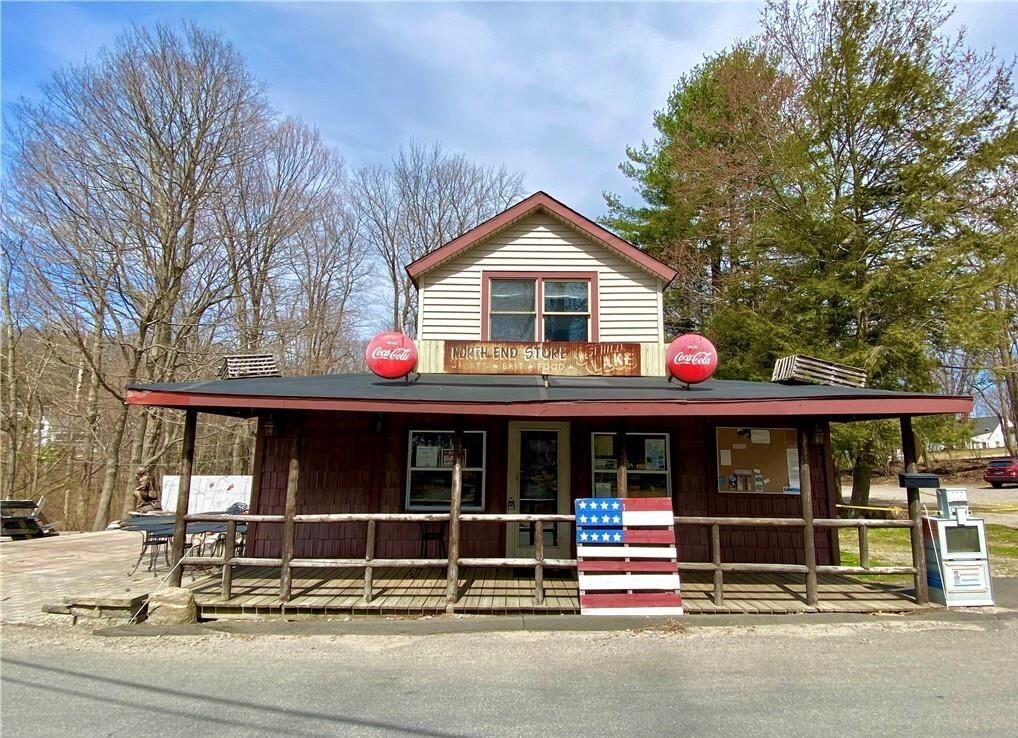
Property Record
20 Perkins Rd, Barkhamsted, CT 06063


NEARBY LISTINGS FOR SALE OR LEASE
Property Detail
20 Perkins Rd
Torrington, CT
Litchfield
BARK-000047A-000014A-000002A
Connecticut
Commercialbuilding
2a
2024
0.16 AC
2024
Rt 8/Winsted
290100
Hartford
1,565 SF
DEMOGRAPHICS near 20 Perkins Rd
1 Mile
3 Mile
5 Mile
2024 Total Population
603
11,191
22,709
2029 Population
606
11,277
22,850
Pop Growth 2024-2029
+ 0.50%
+ 0.77%
+ 0.62%
Average Age
46
44
45
2024 Total Households
239
4,759
9,698
HH Growth 2024-2029
+ 0.42%
+ 0.71%
+ 0.56%
Median Household Inc
$99,715
$77,274
$80,698
Avg Household Size
2.50
2.30
2.30
2024 Avg HH Vehicles
3.00
2.00
2.00
Median Home Value
$332,894
$238,310
$250,477
Median Year Built
1978
1963
1970
Nearby Places
- Restaurants
- Banks
- Shops
- Fitness
- Groceries
PUBLIC TRANSPORTATION
AIRPORT
Bradley International
DRIVE
WALK
Distance
Bradley International
52 min
23.4 mi
Freight Ports
Port of New Haven
DRIVE
WALK
Distance
Port of New Haven
75 min
54.3 mi
SALE & LEASE HISTORY
LISTING DATE
SALE/LEASE

Sep 23, 2022
For Sale
Sep 17, 2019
For Sale
Nearby Properties
Address
Land Use
TOTAL SIZE
Lot Size
Zoning
Address
Land Use
TOTAL SIZE
Lot Size
Zoning
224,385 SF
26.20 AC
RR
Address
Land Use
TOTAL SIZE
Lot Size
Zoning
13.79 AC
TG
Address
Land Use
TOTAL SIZE
Lot Size
Zoning
95,810 SF
5.60 AC
TCR
Address
Land Use
TOTAL SIZE
Lot Size
Zoning
20,544 SF
2.42 AC
TG
Address
Land Use
TOTAL SIZE
Lot Size
Zoning
9.50 AC
8
Address
Land Use
TOTAL SIZE
Lot Size
Zoning
24,618 SF
3.63 AC
TG
Address
Land Use
TOTAL SIZE
Lot Size
Zoning
5.11 AC
TC
Address
Land Use
TOTAL SIZE
Lot Size
Zoning
2.32 AC
TG
Address
Land Use
TOTAL SIZE
Lot Size
Zoning
53,252 SF
32.19 AC
TSF
Address
Land Use
TOTAL SIZE
Lot Size
Zoning
33,268 SF
5.27 AC
RA-2
Address
Land Use
TOTAL SIZE
Lot Size
Zoning
50,068 SF
1.97 AC
TC
Address
Land Use
TOTAL SIZE
Lot Size
Zoning
338.20 AC
R2
Address
Land Use
TOTAL SIZE
Lot Size
Zoning
24,000 SF
0.44 AC
TG
Address
Land Use
TOTAL SIZE
Lot Size
Zoning
93,750 SF
9.19 AC
IP
Address
Land Use
TOTAL SIZE
Lot Size
Zoning
42,850 SF
0.36 AC
TC
Address
Land Use
TOTAL SIZE
Lot Size
Zoning
30,243 SF
4 AC
Address
Land Use
TOTAL SIZE
Lot Size
Zoning
3.17 AC
TCR
Address
Land Use
TOTAL SIZE
Lot Size
Zoning
10,125 SF
1.34 AC
TG
Address
Land Use
TOTAL SIZE
Lot Size
Zoning
432.91 AC
R
Address
Land Use
TOTAL SIZE
Lot Size
Zoning
7,225 SF
4.90 AC
4
Address
Land Use
TOTAL SIZE
Lot Size
Zoning
28,226 SF
0.96 AC
TCR
Address
Land Use
TOTAL SIZE
Lot Size
Zoning
48.54 AC
I
Address
Land Use
TOTAL SIZE
Lot Size
Zoning
7.20 AC
I
Address
Land Use
TOTAL SIZE
Lot Size
Zoning
38,896 SF
0.96 AC
TG
Address
Land Use
TOTAL SIZE
Lot Size
Zoning
29,968 SF
3.72 AC
TCR
Address
Land Use
TOTAL SIZE
Lot Size
Zoning
16.78 AC
5
Address
Land Use
TOTAL SIZE
Lot Size
Zoning
63,394 SF
6.64 AC
IP
Address
Land Use
TOTAL SIZE
Lot Size
Zoning
14.77 AC
B-2
Address
Land Use
TOTAL SIZE
Lot Size
Zoning
14 AC
CZ
Address
Land Use
TOTAL SIZE
Lot Size
Zoning
53.47 AC
I-1
The World's #1 Commercial Real Estate Marketplace
Connect with us
© 2025 CoStar Group
The information above has been obtained from sources believed reliable. While we do not doubt its accuracy we have not verified it and make no guarantee, warranty or representation about it. It is your responsibility to independently confirm its accuracy and completeness. Any projections, opinions, assumptions, or estimates used are for example only and do not represent the current or future performance of the property. The value of this transaction to you depends on tax and other factors which should be evaluated by your tax, financial, and legal advisors. You and your advisors should conduct a careful, independent investigation of the property to determine to your satisfaction the suitability of the property for your needs.