Property Record
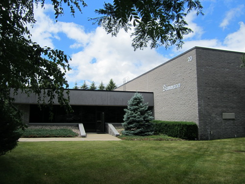
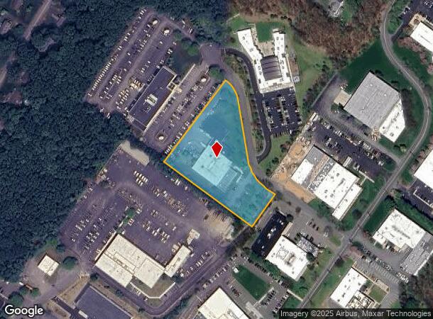
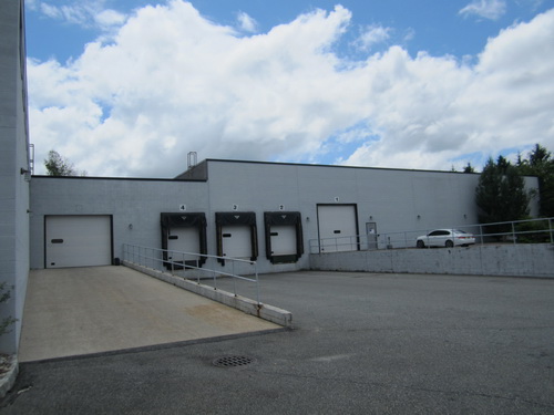
20 Potash Rd, Oakland, NJ 07436
NEARBY LISTINGS FOR SALE OR LEASE
Property Detail
20 Potash Rd
New York-Jersey City-White Plains, NY-NJ
Industrial I-P Oakland Indl P
42-03601-0000-00037
2.880 AC
Industrialgeneral
Bergen
X
New Jersey
34003C0063H
37
2023
2.88 AC
2024
Northwest Bergen
039300
Northern New Jersey
DEMOGRAPHICS near 20 Potash Rd
1 Mile
3 Mile
5 Mile
2024 Total Population
4,579
45,897
144,186
2029 Population
4,578
45,922
143,640
Pop Growth 2024-2029
(0.02%)
+ 0.05%
(0.38%)
Average Age
44
43
43
2024 Total Households
1,558
16,125
51,752
HH Growth 2024-2029
(0.06%)
(0.07%)
(0.55%)
Median Household Inc
$152,689
$140,606
$129,284
Avg Household Size
2.80
2.80
2.70
2024 Avg HH Vehicles
2.00
2.00
2.00
Median Home Value
$698,227
$582,745
$545,379
Median Year Built
1964
1967
1967
Nearby Places
- Restaurants
- Banks
- Shops
- Fitness
- Groceries
PUBLIC TRANSPORTATION
COMMUTER RAIL
Allendale (Bergen County/Port Jervis Line - NJ Transit Commuter Rail (NJ Transit), Main/Port Jervis Line - NJ Transit Commuter Rail (NJ Transit))
DRIVE
WALK
Distance
Allendale (Bergen County/Port Jervis Line - NJ Transit Commuter Rail (NJ Transit), Main/Port Jervis Line - NJ Transit Commuter Rail (NJ Transit))
18 min
9.5 mi
AIRPORT
Newark Liberty International
DRIVE
WALK
Distance
Newark Liberty International
42 min
29.8 mi
Laguardia
DRIVE
WALK
Distance
Laguardia
49 min
31.6 mi
Westchester County
DRIVE
WALK
Distance
Westchester County
60 min
43.4 mi
Freight Ports
Port Newark Container Terminal
DRIVE
WALK
Distance
Port Newark Container Terminal
47 min
28.3 mi
Nearby Properties
Address
Land Use
TOTAL SIZE
Lot Size
Zoning
Address
Land Use
TOTAL SIZE
Lot Size
Zoning
128.12 AC
HOBR
Address
Land Use
TOTAL SIZE
Lot Size
Zoning
50.16 AC
CO
Address
Land Use
TOTAL SIZE
Lot Size
Zoning
10.55 AC
IP
Address
Land Use
TOTAL SIZE
Lot Size
Zoning
12.69 AC
A40
Address
Land Use
TOTAL SIZE
Lot Size
Zoning
5.01 AC
IP
Address
Land Use
TOTAL SIZE
Lot Size
Zoning
231.26 AC
PRC
Address
Land Use
TOTAL SIZE
Lot Size
Zoning
334,755 SF
107.89 AC
Address
Land Use
TOTAL SIZE
Lot Size
Zoning
14.04 AC
B2
Address
Land Use
TOTAL SIZE
Lot Size
Zoning
8.07 AC
IP
Address
Land Use
TOTAL SIZE
Lot Size
Zoning
79,562 SF
10.32 AC
RB
Address
Land Use
TOTAL SIZE
Lot Size
Zoning
10.42 AC
B2
Address
Land Use
TOTAL SIZE
Lot Size
Zoning
12.45 AC
A225
Address
Land Use
TOTAL SIZE
Lot Size
Zoning
12.49 AC
RB
Address
Land Use
TOTAL SIZE
Lot Size
Zoning
98.41 AC
A130
Address
Land Use
TOTAL SIZE
Lot Size
Zoning
13.39 AC
MFAH
Address
Land Use
TOTAL SIZE
Lot Size
Zoning
8.07 AC
SR
Address
Land Use
TOTAL SIZE
Lot Size
Zoning
259,919 SF
48.14 AC
Address
Land Use
TOTAL SIZE
Lot Size
Zoning
2,005 SF
4.62 AC
A225
Address
Land Use
TOTAL SIZE
Lot Size
Zoning
2,738 SF
1.77 AC
RB
Address
Land Use
TOTAL SIZE
Lot Size
Zoning
7.58 AC
R-4
Address
Land Use
TOTAL SIZE
Lot Size
Zoning
40.30 AC
RA-2
Address
Land Use
TOTAL SIZE
Lot Size
Zoning
6.98 AC
IP
Address
Land Use
TOTAL SIZE
Lot Size
Zoning
6 AC
IP
Address
Land Use
TOTAL SIZE
Lot Size
Zoning
8.87 AC
RA1
Address
Land Use
TOTAL SIZE
Lot Size
Zoning
2,372 SF
5 AC
IP
Address
Land Use
TOTAL SIZE
Lot Size
Zoning
36.30 AC
A40
Address
Land Use
TOTAL SIZE
Lot Size
Zoning
4.96 AC
I3
Address
Land Use
TOTAL SIZE
Lot Size
Zoning
2.50 AC
B2
Address
Land Use
TOTAL SIZE
Lot Size
Zoning
22 AC
A40
Address
Land Use
TOTAL SIZE
Lot Size
Zoning
3.06 AC
IP
The World's #1 Commercial Real Estate Marketplace
Connect with us
© 2025 CoStar Group
The information above has been obtained from sources believed reliable. While we do not doubt its accuracy we have not verified it and make no guarantee, warranty or representation about it. It is your responsibility to independently confirm its accuracy and completeness. Any projections, opinions, assumptions, or estimates used are for example only and do not represent the current or future performance of the property. The value of this transaction to you depends on tax and other factors which should be evaluated by your tax, financial, and legal advisors. You and your advisors should conduct a careful, independent investigation of the property to determine to your satisfaction the suitability of the property for your needs.